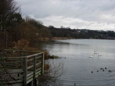
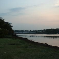
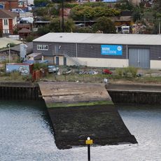
Chessel Bay, Nature reserve on River Itchen in Southampton, United Kingdom
Chessel Bay is a nature reserve on the eastern bank of the River Itchen, featuring flat mudflats, salt marshes, and wooded areas that create different habitats. The landscape changes dramatically with the tides, exposing new areas to explore and observe at different times of the day.
The area gained official protection status as a Local Nature Reserve in 1989, starting formal conservation efforts along this stretch of the river. This designation came as part of broader initiatives to safeguard important wildlife habitats in the Southampton region.
Local volunteers known as Friends of Chessel Bay gather twice per year to collect litter and maintain the natural conditions of this marine environment.
Low tide is the best time to visit, as exposed mudflats allow for better wildlife viewing and easier exploration of the shoreline. Visitors should wear appropriate footwear for wet ground and plan visits around tidal times to make the most of the experience.
The reserve is part of the internationally designated Solent and Southampton Water Ramsar site, making it crucial for migratory waterfowl populations. This international status reflects its importance as a refuge for birds traveling between distant breeding and wintering grounds.
The community of curious travelers
AroundUs brings together thousands of curated places, local tips, and hidden gems, enriched daily by 60,000 contributors worldwide.