Castleshaw Roman fort

Log in to your account

AroundUs is a community-driven map of interesting places, built by curious explorers like you. It grows with every review, story, and photo you share.
Connect to save your favorite spots, contribute locations, and create personalized routes.
Continue with Google
Continue with Apple
Continue with X
Continue with Facebook
Continue with email
By continuing, you accept our Terms and Conditions and our Privacy Policy
Create an account
Add to collection
Map
Suggest a change
Share

Castleshaw Roman fort, Archaeological site in Saddleworth, United Kingdom.

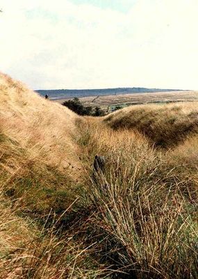
Castleshaw Roman fort is an archaeological site in a valley in the Pennines where the remains of two successive Roman forts lie exposed. The ruins show foundation walls of defensive structures, barracks, and storage buildings spread across the level ground.

The first fort was built around AD 79 as an outpost during Roman expansion into northern Britain. Roughly 26 years later it was replaced by a smaller fort that remained in use for decades afterward.

The Friends of Castleshaw Roman Forts organization conducts research, excavations, and educational programs to preserve and study the archaeological remains in Castleshaw Valley.

The site is freely accessible and can be visited at any time, with information panels at various points explaining the Roman structures. Comfortable footwear is advisable as the ground has uneven grass and dips throughout.

Pottery stamps found at the location show that a Roman military unit from the Iberian Peninsula was stationed here. These finds reveal a direct connection to troops from distant parts of the Roman Empire.
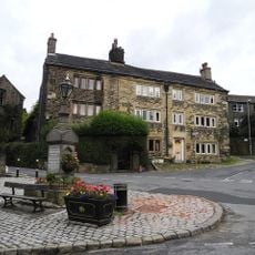
Location: Castleshaw

Location: Saddleworth

Part of: Castleshaw Roman forts, 250m west of Castle Shaw Farm

GPS coordinates: 53.58300,-2.00300

Latest update: December 12, 2025 09:08

Photos
Around this place
St Thomas' Church, Friarmere
United Kingdom

St Thomas' Church, Friarmere

1.8 km
White Lion Public House
United Kingdom

White Lion Public House

2.1 km
Thieves Clough Bridge
United Kingdom

Thieves Clough Bridge

2.2 km
Delph Bridge
United Kingdom

Delph Bridge

2.1 km
Denshaw Oddfellows Lodge
United Kingdom

Denshaw Oddfellows Lodge

2.6 km
Huddersfield Narrow Canal Lock adjacent to Ward Road Bridge
United Kingdom

Huddersfield Narrow Canal Lock adjacent to Ward Road Bridge

2.1 km
Bont
United Kingdom

Bont

2.9 km
37, Huddersfield Road
United Kingdom

37, Huddersfield Road

2.3 km
Railway tunnel portals MVL3/41, west end of Standedge Tunnel
United Kingdom

Railway tunnel portals MVL3/41, west end of Standedge Tunnel

1.7 km
9 and 11, High Street
United Kingdom

9 and 11, High Street

2.1 km
Engine House, Engine Pit And Bye Pit, Red Brook
United Kingdom

Engine House, Engine Pit And Bye Pit, Red Brook

2.7 km
Milestone, ExYW Denshaw Moor
United Kingdom

Milestone, ExYW Denshaw Moor

2.5 km
Milestone, ExYW Denshaw
United Kingdom

Milestone, ExYW Denshaw

2.8 km
Fairbanks Farmhouse and Cottages
United Kingdom

Fairbanks Farmhouse and Cottages

2.3 km
45, Huddersfield Road
United Kingdom

45, Huddersfield Road

2.3 km
Nos. 2 (Lane Ends) 4 and 8
United Kingdom

Nos. 2 (Lane Ends) 4 and 8

3 km
Wood Barn Farmhouse and adjoining barn
United Kingdom

Wood Barn Farmhouse and adjoining barn

726 m
Milestone, ExYW Standedge Road
United Kingdom

Milestone, ExYW Standedge Road

1.4 km
1, Woods Lane
United Kingdom

1, Woods Lane

3 km
Milestone, ExYW down hill of sharp bend, opp SLOW on road
United Kingdom

Milestone, ExYW down hill of sharp bend, opp SLOW on road

970 m
Milestone, ExYW on bridge crossing reservoirs
United Kingdom

Milestone, ExYW on bridge crossing reservoirs

2.1 km
Milestone, ExYW W of jct A6052
United Kingdom

Milestone, ExYW W of jct A6052

2.5 km
Milestone, ExYW Dobcross, nr Navigation Inn and canal bridge
United Kingdom

Milestone, ExYW Dobcross, nr Navigation Inn and canal bridge

2.9 km
Milestone, ExYW N of Uppermill
United Kingdom

Milestone, ExYW N of Uppermill

1.8 km
Milestone, ExYW Dobcross
United Kingdom

Milestone, ExYW Dobcross

2.1 km
Milestone, ExYW Harrop Dale N of Uppermill
United Kingdom

Milestone, ExYW Harrop Dale N of Uppermill

1.2 km
Milestone, ExYW N of Delph and house(exPH) on opp side of road
United Kingdom

Milestone, ExYW N of Delph and house(exPH) on opp side of road

2.5 km
Milestone, ExYW N of Delph
United Kingdom

Milestone, ExYW N of Delph

2.3 km
Show the full map
Reviews

Visited this place? Tap the stars to rate it and share your experience / photos with the community! Try now! You can cancel it anytime.

« Castleshaw Roman fort - Archaeological site in Saddleworth, United Kingdom » is provided by Around Us (aroundus.com). Images and texts are derived from Wikimedia project under a Creative Commons license. You are allowed to copy, distribute, and modify copies of this page, under the conditions set by the license, as long as this note is clearly visible.

Discover hidden gems everywhere you go!

From secret cafés to breathtaking viewpoints, skip the crowded tourist spots and find places that match your style. Our app makes it easy with voice search, smart filtering, route optimization, and insider tips from travelers worldwide. Download now for the complete mobile experience.

Around Us App Screenshot

A unique approach to discovering new places

Le Figaro

All the places worth exploring

France Info

A tailor-made excursion in just a few clicks

20 Minutes