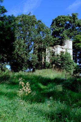
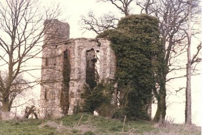
Dinton Castle, Grade II listed folly in Dinton, United Kingdom.
Dinton Castle is an octagonal folly in Dinton featuring circular towers positioned on its east and west sides. The limestone walls display embedded fossils and ammonites collected as decorative elements within the structure.
Sir John Vanhattern constructed this structure in 1769 as a decorative eyecatcher for the Dinton Hall estate. It was designed to display his fossil collection and enhance the visual appearance of the surrounding countryside.
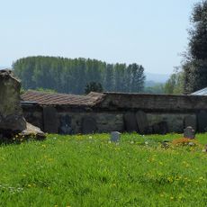
The castle stands near a Saxon burial ground where multiple archaeological discoveries occurred throughout the twentieth century.
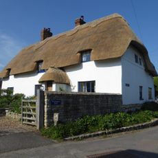
The site is now a private residence and can be viewed from outside but sits on private land. Visitors should respect the private property and photograph only from public viewpoints nearby.
After decades of deterioration, the ruin underwent major restoration in 2018 when a Spanish architect converted it into a modern dwelling. The renovation revealed that the underlying structure had remained sound beneath layers of decay and neglect.
Location: Dinton-with-Ford and Upton
GPS coordinates: 51.79730,-0.89150
Latest update: December 8, 2025 19:46
Hartwell House
3.2 km
Nether Winchendon House
3.1 km
St Mary's Church, Hartwell
3.1 km
Strict and Particular Baptist Chapel, Waddesdon
3.7 km
Stone SSSI, Buckinghamshire
1.7 km
Church of St John the Baptist, Stone
2 km
Parish Church of Saints Peter and Paul
498 m
Parish Church of St Nicholas
2.8 km
Parish Church of St Nicholas
3.3 km
Parish Church of St Michael
3.8 km
Parish Church of St Mary Magdalene
3.5 km
Bridge Lodge
2 km
The Seven Stars Public House
877 m
Bridge 40 Metres South East Of Bridge Lodge
2 km
Lavender Cottage Rose Cottage
1 km
Dinton Hall
509 m
The Bottle And Glass Public House
966 m
Weir Lodge
2.3 km
Ostler's Cottage
1.2 km
Tyringham Hall
2.9 km
The Elms
1.2 km
Wootton's Farmhouse
1.1 km
Westlington Farmhouse And Pump In Yard
849 m
Milepost, Oxford Road; outside the Bugle Horn PH, at Sedrup Lane jct.
3 km
Milestone, Eythrope Lane; bridleway on a private road down to Eythrope Park from Stone
1.6 km
Base Of Churchyard Cross 7 Metres South Of Porch Of Parish Church Of Saints Peter And Paul
511 m
Milepost, Aylesbury Road; Haddenham Low, opp. Horridge Meadow bungalow, 100m past Westlington House
1.5 km
Milepost, Aylesbury Road; Roundhill Farm, W of Dadbrook Mill
3 kmVisited this place? Tap the stars to rate it and share your experience / photos with the community! Try now! You can cancel it anytime.
Discover hidden gems everywhere you go!
From secret cafés to breathtaking viewpoints, skip the crowded tourist spots and find places that match your style. Our app makes it easy with voice search, smart filtering, route optimization, and insider tips from travelers worldwide. Download now for the complete mobile experience.
A unique approach to discovering new places❞
— Le Figaro
All the places worth exploring❞
— France Info
A tailor-made excursion in just a few clicks❞
— 20 Minutes