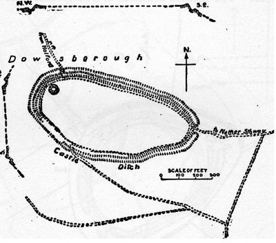
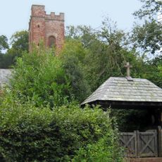
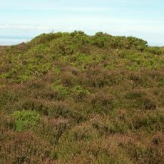
Dowsborough, Iron Age hillfort near Nether Stowey, England
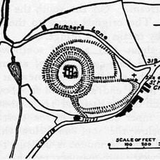
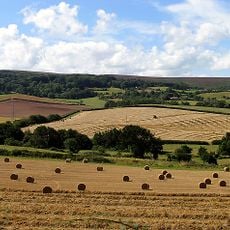
Dowsborough is an oval-shaped fortification near Nether Stowey with a single rampart and ditch enclosing roughly 2.7 hectares of land at 340 meters elevation. The structure shows how Iron Age people used hillsides as defensive positions.
The site dates to the first millennium BC and originally served as a lookout point for Iron Age communities. It may have been reused or monitored later during King Alfred's era when threats came from the sea.
The site connects to the Great Bear Path, a walking route that links to an ancient road once used by King Alfred's forces.
The site sits on a hillside and is best visited in dry weather, as the ground can become waterlogged. A marked walking path exists, but sturdy footwear and time to explore the uneven terrain are essential.
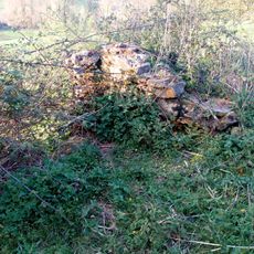
An adjacent earthwork called Dead Woman's Ditch may have provided extra defenses on the western side but is often overlooked. Visitors typically focus on the main rampart and miss this mysteriously named feature.
Location: Nether Stowey
GPS coordinates: 51.14532,-3.20255
Latest update: December 12, 2025 16:42
Alfoxton House
2.5 km
Coleridge Cottage
3.2 km
Crowcombe Court
3 km
Quantock Lodge
3.2 km
Halsway Manor
3.3 km
Stowey Castle
2.7 km
Church of the Holy Ghost, Crowcombe
3.1 km
Dodington Hall
1.9 km
Chapel E of Adscombe Farm
2.8 km
Church of St Mary the Virgin
3.7 km
Church of St Peter and St Paul, Over Stowey
2.7 km
All Saints Church
1.9 km
Ge-mare Farm Fields
3.3 km
St Mary's Church, Stringston
3.7 km
Church of St Mary
2 km
Crowcombe War Memorial, 10 Metres South East of Church House
3.1 km
The Carew Arms And Attached Outbuilding
3.2 km
Stringston churchyard cross
3.7 km
Castle Hill House
2.9 km
Church House And Pound Adjoining To North West
3.1 km
Gazebo And Attached Walling Bounding Grounds Of Stowey Court
3.6 km
Stowey Court
3.7 km
Kidners Cottage
2.4 km
Nether and Over Stowey War Memorial
3.3 km
Crowcombe village cross
3.1 km
Churchyard cross immediately south of Holy Ghost Church
3.1 km
Bowl barrow on Longstone Hill, 270m north east of Bicknoller Post
3.2 km
Clock Tower
3.3 kmVisited this place? Tap the stars to rate it and share your experience / photos with the community! Try now! You can cancel it anytime.
Discover hidden gems everywhere you go!
From secret cafés to breathtaking viewpoints, skip the crowded tourist spots and find places that match your style. Our app makes it easy with voice search, smart filtering, route optimization, and insider tips from travelers worldwide. Download now for the complete mobile experience.
A unique approach to discovering new places❞
— Le Figaro
All the places worth exploring❞
— France Info
A tailor-made excursion in just a few clicks❞
— 20 Minutes