Dolebury Warren, Archaeological site and scheduled monument in Churchill, England.
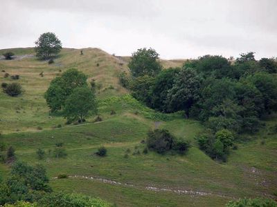
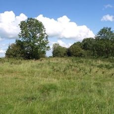
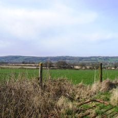
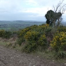
Dolebury Warren is an archaeological site and scheduled monument featuring substantial earthworks on a limestone ridge. The site spans about 91 hectares and offers sweeping views over the Bristol Channel and surrounding countryside.
Iron Age people built this hillfort with double ramparts on three sides and a simpler rampart on the south. The site later served as a medieval rabbit warren before becoming a protected monument.
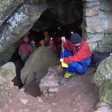
The site holds meaning as a protected landscape maintained by the National Trust, where evidence of occupation spans from prehistoric hunters to later medieval communities. The layered history visible here shows how different people valued this prominent location for thousands of years.
Marked paths connect the site to Churchill village and are accessible via the A38 road. The area is walkable on foot and serves as a trailhead for the Limestone Link, a longer walking route through the region.
The interior preserves pillow mounds, low earthen ridges from when the site functioned as a rabbit warren in medieval times. These distinctive features remain clearly visible and tell a lesser-studied chapter of its use.
Location: Churchill
Operator: National Trust
GPS coordinates: 51.32700,-2.79070
Latest update: December 11, 2025 11:07
Aveline's Hole
2.6 km
Burrington Combe
2.9 km
Goatchurch Cavern
2.7 km
Jubilee Clock Tower
997 m
Sidney Hill Cottage Homes
1.3 km
Callow Rock quarry
3.2 km
Churchill Methodist Church
1 km
Burrington Camp
2.8 km
Over Langford Manor
1 km
Church of St John the Baptist, Churchill
1.8 km
Church of St Michael and All Angels
339 m
Church of Holy Trinity, Burrington
2.9 km
Bourne SSSI, Avon
3.5 km
Church of All Saints
2.9 km
Church of St Leonard
1.7 km
Sandford Station Railway Heritage Centre
3.4 km
Shipham War Memorial
1.5 km
Turnpike Cottage
1.3 km
Turnpike Trust Mile Marker
1.4 km
K6 Telephone Kiosk
1.4 km
Victoria Jubilee Langford Homes
2.2 km
Medieval estate boundary earthwork on Shute Shelve Hill
3.6 km
Milestone At Ngr St 4356 5814
1.7 km
Main block with entrance elevation to Sidcot School
2.6 km
Milepost, near Winscombe & Sidcot, near entrance to Fullers Lane
3.2 km
Sidcot Farmhouse
2.7 km
Milepost, N of Langford Court
2.4 km
Rose Cottage
2.6 kmVisited this place? Tap the stars to rate it and share your experience / photos with the community! Try now! You can cancel it anytime.
Discover hidden gems everywhere you go!
From secret cafés to breathtaking viewpoints, skip the crowded tourist spots and find places that match your style. Our app makes it easy with voice search, smart filtering, route optimization, and insider tips from travelers worldwide. Download now for the complete mobile experience.
A unique approach to discovering new places❞
— Le Figaro
All the places worth exploring❞
— France Info
A tailor-made excursion in just a few clicks❞
— 20 Minutes