Burrington Camp, Iron Age hillfort in Burrington, England
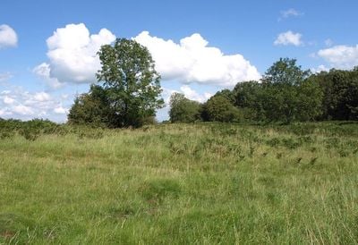
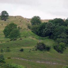
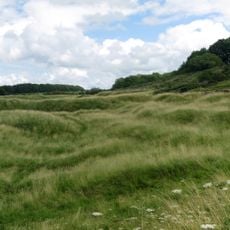
Burrington Camp is an Iron Age fortified settlement on a hillside in North Somerset with a rectangular layout. The structure consists of raised earthen banks and ditches that surround the interior, creating a clear defensive boundary from that period.
The settlement was built in two separate construction phases during the Iron Age, as revealed by archaeological investigations. Early inhabitants first constructed a structure that was later modified or expanded to meet the needs of that era.
The site takes its name from the nearby settlement of Burrington and shows through its layout how people of that era organized their community. The visible banks suggest that it served purposes beyond simple defense against attack.
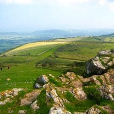
The entrance to the fort is in the northeast section, making it the natural starting point for exploration. The site sits on a hillside, so visitors should expect slopes and wear sturdy footwear.
Inside the enclosure run several parallel earthen banks that puzzle archaeologists about their purpose. These internal structures suggest the site served multiple functions beyond just military defense.
Location: Burrington
GPS coordinates: 51.32570,-2.75020
Latest update: December 14, 2025 14:22
Mendip Hills
3.1 km
Blagdon Lake
3.8 km
Aveline's Hole
245 m
Burrington Combe
479 m
Dolebury Warren
2.8 km
Goatchurch Cavern
593 m
Jubilee Clock Tower
3.6 km
GB Cave
2.6 km
Charterhouse Roman Town
3.6 km
Churchill Methodist Church
3.6 km
Over Langford Manor
2.1 km
Church of St Andrew
2.6 km
Church of St Michael and All Angels
2.9 km
Church of Holy Trinity, Burrington
558 m
Bourne SSSI, Avon
1.3 km
Church of St Leonard
3.8 km
Waterworks At Blagdon: Pumping Station With Receiving Tanks
2.8 km
Shipham War Memorial
3.6 km
Turnpike Cottage
3.5 km
Manor Farmhouse
3.7 km
Masonic Lodge
1 km
Turnpike Trust Mile Marker
2.8 km
Waterworks At Blagdon: Road Bridge Over The By-Wash
3 km
Victoria Jubilee Langford Homes
2.4 km
Butcombe Farmhouse
3.2 km
Lodge To North West Of Alwick Court
3 km
Packhorse Bridge On Roadside At Ngr St 4983 5571
3.7 km
Milepost, N of Langford Court
1.9 kmVisited this place? Tap the stars to rate it and share your experience / photos with the community! Try now! You can cancel it anytime.
Discover hidden gems everywhere you go!
From secret cafés to breathtaking viewpoints, skip the crowded tourist spots and find places that match your style. Our app makes it easy with voice search, smart filtering, route optimization, and insider tips from travelers worldwide. Download now for the complete mobile experience.
A unique approach to discovering new places❞
— Le Figaro
All the places worth exploring❞
— France Info
A tailor-made excursion in just a few clicks❞
— 20 Minutes