Enable Location

We need your location to show you interesting places around you

Discover nearby places

Find interesting locations and hidden gems around you

Precise directions

Get accurate directions and distances to places

Your location is never shared with other users. It's only used when you tap the location button.

Fairy Toot

Log in to your account

Start exploring — it's free

Trusted by 63,018 travelers worldwide

Continue with Google
Continue with Apple
or

We will send you a code to connect

By continuing, you accept our Terms and Conditions and our Privacy Policy

Check your inbox

We've sent a pincode in your inbox. Please enter the code below.

Discussion Reviews 1 Photos
2k Popularity

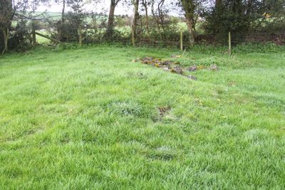
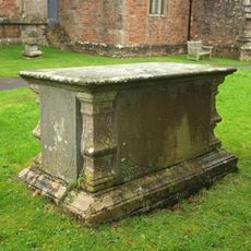
Fairy Toot, Neolithic long barrow in Nempnett Thrubwell, England.

Fairy Toot is a Neolithic long barrow consisting of an elongated earth mound reinforced with stone walls running the length of the site. Inside are multiple burial chambers formed by large stones arranged edgeways to create a chambered passageway.

This mound was built during the Neolithic period when farming communities first settled in southwest England. Investigations in the 1700s and 1800s uncovered the internal structure and revealed details about burial practices from that distant era.

This burial mound shows how early farming communities organized their ceremonies for the dead and reflects beliefs about shared burial spaces. The way chambers were arranged reveals something about how these people valued community and ritual.

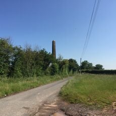
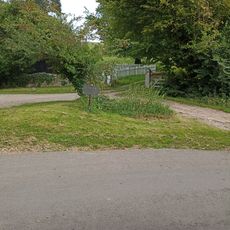
The site sits in open countryside and requires walking across rural paths to reach it, with no visitor facilities at the location. Checking local conditions before visiting is wise since the terrain can change with seasons and weather.

A human skull discovered during early excavations was removed and is now kept at the Bristol Museum. This find offers researchers a direct link to the people who used this burial place thousands of years ago.

The community of curious travelers

AroundUs brings together thousands of curated places, local tips, and hidden gems, enriched daily by 60,000 contributors worldwide.

Start exploring
Location
GPS coordinates
51.35330,-2.68986
Latest update
December 14, 2025 09:43
Around this place
Blagdon Lake
United Kingdom

Blagdon Lake

2.1 km
Roman Temple in Pagans Hill
United Kingdom

Roman Temple in Pagans Hill

3.7 km
St Andrew's Church, Chew Stoke
United Kingdom

St Andrew's Church, Chew Stoke

3.6 km
Church of St Mary and St Peter, Winford
United Kingdom

Church of St Mary and St Peter, Winford

3.9 km
Church of St Andrew
United Kingdom

Church of St Andrew

3.3 km
Church of St Bartholomew, Ubley
United Kingdom

Church of St Bartholomew, Ubley

3.7 km
Plaster's Green Meadows
United Kingdom

Plaster's Green Meadows

1.3 km
Church of St Mary, Nempnett Thrubwell
United Kingdom

Church of St Mary, Nempnett Thrubwell

1.9 km
Church of St Michael and All Angels
United Kingdom

Church of St Michael and All Angels

522 m
Littleton gunpowder works
United Kingdom

Littleton gunpowder works

3.9 km
The Rectory, Chew Stoke
United Kingdom

The Rectory, Chew Stoke

3.8 km
Christ Church
United Kingdom

Christ Church

2.8 km
The George And Dragon Public House
United Kingdom

The George And Dragon Public House

3.7 km
Waterworks At Blagdon: Pumping Station With Receiving Tanks
United Kingdom

Waterworks At Blagdon: Pumping Station With Receiving Tanks

2.5 km
Webb Monument In The Churchyard About 10 Metres South West Of Church Of St Andrew
United Kingdom

Webb Monument In The Churchyard About 10 Metres South West Of Church Of St Andrew

3.6 km
Church Farmhouse
United Kingdom

Church Farmhouse

3.6 km
Obelisk
United Kingdom

Obelisk

3.2 km
Waterworks At Blagdon: Road Bridge Over The By-Wash
United Kingdom

Waterworks At Blagdon: Road Bridge Over The By-Wash

2.2 km
Barn To South West Of Powdermill Farmhouse
United Kingdom

Barn To South West Of Powdermill Farmhouse

3.9 km
Court Farmhouse
United Kingdom

Court Farmhouse

3.9 km
Churchyard Cross In Churchyard, South Of Church Of St Michael And All Angels
United Kingdom

Churchyard Cross In Churchyard, South Of Church Of St Michael And All Angels

519 m
Butcombe Farmhouse
United Kingdom

Butcombe Farmhouse

2 km
The Parsonage
United Kingdom

The Parsonage

2.6 km
Lodge To North West Of Alwick Court
United Kingdom

Lodge To North West Of Alwick Court

3 km
Powdermill Farmhouse
United Kingdom

Powdermill Farmhouse

3.9 km
Milestone About 100 Metres South West Of Stoke Villice, At Ngr 558606
United Kingdom

Milestone About 100 Metres South West Of Stoke Villice, At Ngr 558606

3.9 km
Milepost, top of Red Hill, nr jct with row of Ashes Lane
United Kingdom

Milepost, top of Red Hill, nr jct with row of Ashes Lane

2.6 km
Milestone, Lye Cross
United Kingdom

Milestone, Lye Cross

3 km
Show the full map
Reviews
Share your experience

No review yet

Discussions
Start a discussion...

No discussion yet

« Fairy Toot - Neolithic long barrow in Nempnett Thrubwell, England » is provided by Around Us (aroundus.com). Images and texts are derived from Wikimedia project under a Creative Commons license. You are allowed to copy, distribute, and modify copies of this page, under the conditions set by the license, as long as this note is clearly visible.

Discover hidden gems everywhere you go!

From secret cafés to breathtaking viewpoints, skip the crowded tourist spots and find places that match your style. Our app makes it easy with voice search, smart filtering, route optimization, and insider tips from travelers worldwide. Download now for the complete mobile experience.

Around Us App Screenshot

A unique approach to discovering new places

Le Figaro

All the places worth exploring

France Info

A tailor-made excursion in just a few clicks

20 Minutes

Around Us
Travel Guide & Maps
Download

Send to your phone

QR Code
1

Open the camera app on your mobile.

2

Point at the QR code with your camera. A notification will appear.

3

Tap the notification to open the link.