Falling Foss

Log in to your account

AroundUs is a community-driven map of interesting places, built by curious explorers like you. It grows with every review, story, and photo you share.
Connect to save your favorite spots, contribute locations, and create personalized routes.
By continuing, you accept our Terms and Conditions and our Privacy Policy
Add to collection
Map
Suggest a change
Share

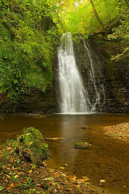
Falling Foss, Waterfall and tourist site in Sneaton, United Kingdom

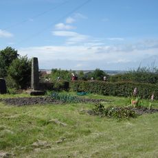
Falling Foss is a waterfall in Littlebeck Wood where water drops over a natural step into a pool below, surrounded by woodland. The site also includes a cave shelter carved into a boulder and a restored cottage that now serves as a small tea establishment.

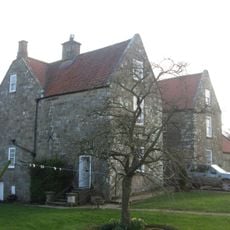
The area became a popular destination during the Victorian era when travelers discovered its natural attractions. A cottage from the 1700s that once housed a gamekeeper was later converted into a tea room, reflecting how rural buildings adapted to serve visitors over time.

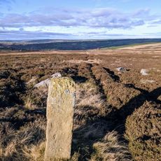
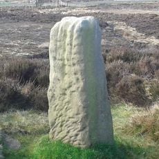
The falls are linked to an 18th-century hermit whose story shapes how locals and visitors perceive this woodland location. Walking through the area, you can sense the human connection to this isolated spot that stretches back centuries.

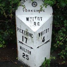
The walk to the waterfall starts from a car park and follows clearly marked woodland trails that are straightforward to navigate. The journey takes about 15 minutes and is accessible for most visitors, though the path can be muddy after rain.

The site's name may be linked to a 18th-century local figure whose connection to the falls is less commonly known among visitors. This layer of local heritage adds depth to what seems at first like a simple natural attraction.

Location: Sneaton

GPS coordinates: 54.41892,-0.63305

Latest update: December 8, 2025 21:02

Photos
Around this place
Lilla Cross
United Kingdom

Lilla Cross

4.8 km
Old St Stephen's Church, Fylingdales
United Kingdom

Old St Stephen's Church, Fylingdales

5.9 km
The Pigsty
United Kingdom

The Pigsty

4.9 km
Church of St John the Evangelist
United Kingdom

Church of St John the Evangelist

4 km
Church of All Saints
United Kingdom

Church of All Saints

3.8 km
St Bartholomew's Church, Ruswarp
United Kingdom

St Bartholomew's Church, Ruswarp

5.7 km
Church of St Hilda
United Kingdom

Church of St Hilda

4.4 km
Fyling Hall
United Kingdom

Fyling Hall

4.9 km
Line Of Boundary Stones Between Civil Parishes Of Sneaton And Eskdaleside Cum Ugglebarnby
United Kingdom

Line Of Boundary Stones Between Civil Parishes Of Sneaton And Eskdaleside Cum Ugglebarnby

2.7 km
Boundary Stone
United Kingdom

Boundary Stone

1.7 km
North York Moors Railway Footbridge Linking Plaforms At Goathland Station
United Kingdom

North York Moors Railway Footbridge Linking Plaforms At Goathland Station

5.5 km
Ruswarp Mill
United Kingdom

Ruswarp Mill

5.6 km
John Cross
United Kingdom

John Cross

1.4 km
Ruswarp railway bridge
United Kingdom

Ruswarp railway bridge

5.6 km
North York Moors Railway Goathland Station
United Kingdom

North York Moors Railway Goathland Station

5.5 km
North York Moors Railway Water Column At Goathland Station
United Kingdom

North York Moors Railway Water Column At Goathland Station

5.5 km
Newbiggin Hall
United Kingdom

Newbiggin Hall

5.8 km
Hawsker Cross wayside cross, 100m east of Hawsker Hall Farm
United Kingdom

Hawsker Cross wayside cross, 100m east of Hawsker Hall Farm

5.3 km
Milepost Approximately 10 Metres West Of Number 137
United Kingdom

Milepost Approximately 10 Metres West Of Number 137

4.3 km
'Breckon Howe' round barrow, Sleights Moor
United Kingdom

'Breckon Howe' round barrow, Sleights Moor

3.4 km
Breckon Howe Boundary Stone Between Parishes Od Eskdaleside Cum Ugglebarnsby And Goathland
United Kingdom

Breckon Howe Boundary Stone Between Parishes Od Eskdaleside Cum Ugglebarnsby And Goathland

3.4 km
Ann's Cross
United Kingdom

Ann's Cross

3.5 km
Boundary Stone
United Kingdom

Boundary Stone

3 km
North York Moors Railway Workshop And Water Tank At Goathland Station
United Kingdom

North York Moors Railway Workshop And Water Tank At Goathland Station

5.5 km
Wayside cross called Postgate Cross on Graystone Hills 700m NNE of Sneaton Corner
United Kingdom

Wayside cross called Postgate Cross on Graystone Hills 700m NNE of Sneaton Corner

3.1 km
York Cross wayside cross, 700m north east of Foster Howes on Sneaton High Moor
United Kingdom

York Cross wayside cross, 700m north east of Foster Howes on Sneaton High Moor

2.2 km
Milestone, Briggswath by bus stop
United Kingdom

Milestone, Briggswath by bus stop

5.1 km
Milestone, Long Lease N of High Hawsker
United Kingdom

Milestone, Long Lease N of High Hawsker

5.8 km
Show the full map
Reviews

Visited this place? Tap the stars to rate it and share your experience / photos with the community! Try now! You can cancel it anytime.

« Falling Foss - Waterfall and tourist site in Sneaton, United Kingdom » is provided by Around Us (aroundus.com). Images and texts are derived from Wikimedia project under a Creative Commons license. You are allowed to copy, distribute, and modify copies of this page, under the conditions set by the license, as long as this note is clearly visible.

Discover hidden gems everywhere you go!

From secret cafés to breathtaking viewpoints, skip the crowded tourist spots and find places that match your style. Our app makes it easy with voice search, smart filtering, route optimization, and insider tips from travelers worldwide. Download now for the complete mobile experience.

Around Us App Screenshot

A unique approach to discovering new places

Le Figaro

All the places worth exploring

France Info

A tailor-made excursion in just a few clicks

20 Minutes