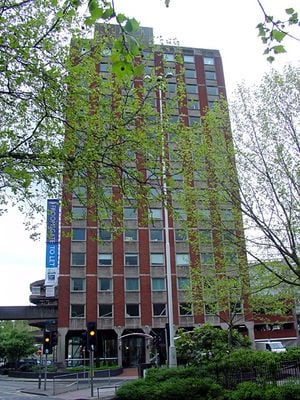
Froomsgate House, Bristol, Commercial tower in central Bristol, England
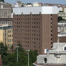
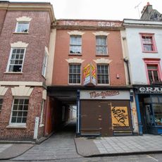
Froomsgate House is a 15-story commercial structure in central Bristol located at the junction of Rupert Street, featuring distinctive brick cladding and significant height within the city center. The building houses commercial space and includes dedicated parking levels for vehicles.
The structure was completed in 1971, representing a major development in Bristol's modern era and standing where the Frome River flows underground beneath the city. Its name preserves memory of a medieval gate that once marked an important point in Bristol's urban layout.
The name comes from an ancient gate that once controlled access to Bristol, reflecting how the building sits on a site with deep connections to the city's past boundaries and growth.
The building can be accessed by multiple elevators that connect the various floors for convenient movement through the structure. Access to certain areas may vary depending on current use, so it's helpful to inquire in advance about which parts are open to visitors.
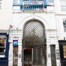
The building originally featured a mosaic mural map showing the surrounding area as it appeared in 1673, based on historical records of Bristol from that period. This artistic element connected the modern structure to older layers of the city's past.
Location: City of Bristol
Inception: 1971
Floors above the ground: 17
Elevators: 3
GPS coordinates: 51.45700,-2.59500
Latest update: December 14, 2025 14:20
Christmas Steps
160 m
Everard's Printing Works
136 m
Church of St John the Baptist, Bristol
135 m
Chapel of the Three Kings of Cologne
180 m
Central Police Station, Bristol
180 m
The Crown, Bristol
169 m
St Bartholomew's Hospital, Bristol
112 m
Lewin's Mead Unitarian meeting house
184 m
Greyfriars, Bristol
43 m
Palestine Museum and Cultural Centre Bristol
151 m
Statue of Samuel Morley
42 m
Bank Public House
116 m
44, Broad Street
167 m
36, Broad Street
132 m
Merchant Tailors' Hall
148 m
1, John Street
125 m
Bristol Police Headquarters Fire Station
139 m
54 And 56, Colston Street
182 m
68 And 70, Colston Street
175 m
28, Broad Street
151 m
51, Broad Street
182 m
White Hart Inn And Attached Wall
190 m
49 And 50, Broad Street
172 m
43, Broad Street
164 m
Number 35 And Attached Railings
128 m
Walls, Piers, Gates And Railings To South West, North West And North East Of St John's Burial Ground
142 m
12-17, John Street
139 m
Employment Exchange
126 mVisited this place? Tap the stars to rate it and share your experience / photos with the community! Try now! You can cancel it anytime.
Discover hidden gems everywhere you go!
From secret cafés to breathtaking viewpoints, skip the crowded tourist spots and find places that match your style. Our app makes it easy with voice search, smart filtering, route optimization, and insider tips from travelers worldwide. Download now for the complete mobile experience.
A unique approach to discovering new places❞
— Le Figaro
All the places worth exploring❞
— France Info
A tailor-made excursion in just a few clicks❞
— 20 Minutes