Furtho, Deserted medieval village in Potterspury, Great Britain
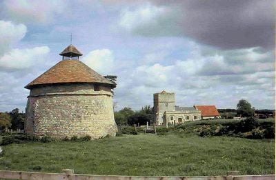
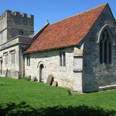
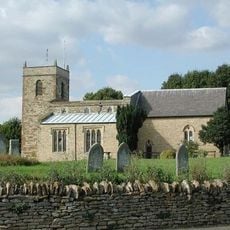
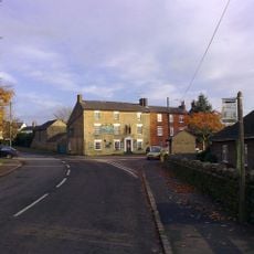
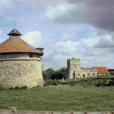
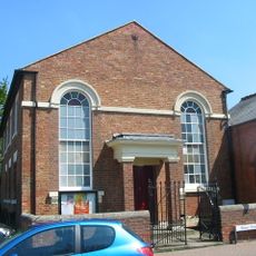
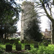
Furtho is an abandoned medieval settlement located east of Potterspury and west of Cosgrove, roughly 2 miles northwest of Stony Stratford. The Church of St Bartholomew, built in the 12th and 14th centuries and rebuilt in 1620, stands as the main surviving structure at this location.
The Domesday Book of 1086 recorded three estates in Furtho held by Robert, Count of Mortain, with the largest manor covering two hides. The settlement declined during the late 16th and early 17th centuries when the local family enclosed the land for agricultural restructuring.
The settlement was named after the Furtho family, who held influence over the area from medieval times through the early modern period. The place reflects how one family's decisions about land use shaped the community and its eventual fate.
The site is difficult to access and often requires permission to enter, as it sits on private land. Visitors should check ahead and wear appropriate clothing for walking across open fields.
The name comes from the Furtho family, but few visitors realize this location may have been occupied long before the Norman conquest. Ancient field patterns and earthworks beneath the surface suggest much earlier settlements in the same area.
Location: Potterspury
Website: https://sites.google.com/site/potterspuryparishcouncil/about-the-parish-council
GPS coordinates: 52.07980,-0.87389
Latest update: December 14, 2025 16:40
Cosgrove aqueduct
3 km
Parish Church of St Mary and St Giles
2.9 km
St Bartholomew's Church, Furtho
134 m
Church of St Simon and St Jude
3 km
Church of St Peter and St Paul
1.9 km
Church of St Nicholas
1.1 km
Former St Anthonys Franciscan Preparatory School
2.6 km
The Carrington Arms Public House
2.9 km
The Cock Hotel
2.8 km
The Bull Hotel
2.9 km
The Old George
3 km
The Old Talbot Public House
2.1 km
The Barley Mow Public House
2 km
31-45, High Street
1.4 km
Bridge Number 65
2 km
Castlethorpe War Memorial
3.1 km
The Crown Public House
3 km
The Horse Tunnel
2.1 km
Bridge Over River Ouse (That Part In Old Stratford Civil Parish)
2.2 km
Dovecote At Manor Farm
54 m
Old Wolverton Mill
2.9 km
Grand Union Canal Bridge Number 63 At Sp 781 445
1.8 km
Barn And Coach House To East Of Old Wolverton Mill
2.9 km
Methodist Church And Church Hall
3.1 km
Stratford House
2.9 km
Tower House
2.7 km
Remains of the church and churchyard of St Mary Magdalen
2.7 km
8, Market Square
3 kmVisited this place? Tap the stars to rate it and share your experience / photos with the community! Try now! You can cancel it anytime.
Discover hidden gems everywhere you go!
From secret cafés to breathtaking viewpoints, skip the crowded tourist spots and find places that match your style. Our app makes it easy with voice search, smart filtering, route optimization, and insider tips from travelers worldwide. Download now for the complete mobile experience.
A unique approach to discovering new places❞
— Le Figaro
All the places worth exploring❞
— France Info
A tailor-made excursion in just a few clicks❞
— 20 Minutes