Gidleigh Castle

Log in to your account

AroundUs is a community-driven map of interesting places, built by curious explorers like you. It grows with every review, story, and photo you share.
Connect to save your favorite spots, contribute locations, and create personalized routes.
By continuing, you accept our Terms and Conditions and our Privacy Policy
Add to collection
Map
Suggest a change
Share

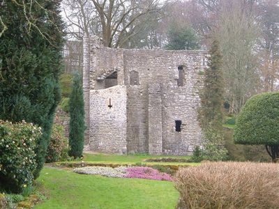
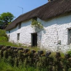
Gidleigh Castle, Medieval ruins in Gidleigh, England

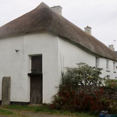
Gidleigh Castle is a stone tower standing three stories high at the edge of Dartmoor with heavily buttressed walls. An undercroft with stone chambers lies beneath the main chamber, creating a structure designed for both residence and defense.

Sir William Prouz built this fortified manor house in the early 14th century as the main residence for Gidleigh manor. The structure endured through the centuries before eventually falling into ruin while retaining its distinctive architectural features.

The building shows how wealthy families in the Middle Ages fortified their homes for protection and status. It reflects the practical building style of the era, when strong walls served both defensive and social purposes.

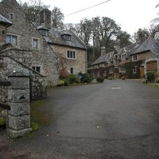
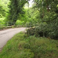
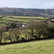
The ruins can be reached from the village of Gidleigh, located about 2 miles northwest of Chagford in Devon. Access requires sturdy footwear and basic navigation skills, as the site sits in open countryside away from main roads.

The thick walls were built from sandy dolomite rock sourced from Hatherleigh quarry, making them resistant to weathering. This particular stone selection shows how builders sourced materials from specific local quarries for important construction projects.

Location: Gidleigh

GPS coordinates: 50.68030,-3.88319

Latest update: December 8, 2025 21:07

Photos
Around this place
Scorhill
United Kingdom

Scorhill

1.9 km
Church of the Holy Trinity
United Kingdom

Church of the Holy Trinity

47 m
Church of St Mary the Virgin
United Kingdom

Church of St Mary the Virgin

2.4 km
Holystreet Manor
United Kingdom

Holystreet Manor

1.9 km
Forder Bridge
United Kingdom

Forder Bridge

1.2 km
Providence Methodist Chapel
United Kingdom

Providence Methodist Chapel

996 m
Church House
United Kingdom

Church House

2.4 km
South Forder Farmhouse
United Kingdom

South Forder Farmhouse

1.1 km
Haycroft Cottage
United Kingdom

Haycroft Cottage

1.6 km
Footbridge At Sx 664 895
United Kingdom

Footbridge At Sx 664 895

1.3 km
Chagford Bridge
United Kingdom

Chagford Bridge

2.4 km
Water Tower, Stables, Coach House And Cottages Approximately 4 Metres North-East Of Outer Down
United Kingdom

Water Tower, Stables, Coach House And Cottages Approximately 4 Metres North-East Of Outer Down

2.2 km
East Ash Manor Including Garden Wall Adjoining To South East
United Kingdom

East Ash Manor Including Garden Wall Adjoining To South East

2.8 km
Thorn Cottage
United Kingdom

Thorn Cottage

2.3 km
Langston Farmhouse North Including Garden Wall Adjoining To Front
United Kingdom

Langston Farmhouse North Including Garden Wall Adjoining To Front

1.7 km
Village Cross
United Kingdom

Village Cross

2.3 km
North Forder Farmhouse
United Kingdom

North Forder Farmhouse

1.1 km
Thorn Farmhouse And Thorn Farm Cottage
United Kingdom

Thorn Farmhouse And Thorn Farm Cottage

2.3 km
Langston Farmhouse (South) Including Garden Walls Adjoining To Front
United Kingdom

Langston Farmhouse (South) Including Garden Walls Adjoining To Front

1.7 km
Gidleigh Mill
United Kingdom

Gidleigh Mill

472 m
Coaxial field system, associated and later remains at Throwleigh Common and Kennon Hill
United Kingdom

Coaxial field system, associated and later remains at Throwleigh Common and Kennon Hill

2.6 km
Cross Fragment At Sx 678891
United Kingdom

Cross Fragment At Sx 678891

939 m
Sampson Headstone Approximately 2 Metres South-East Of Vestry Of Church Of The Holy Trinity
United Kingdom

Sampson Headstone Approximately 2 Metres South-East Of Vestry Of Church Of The Holy Trinity

59 m
Scorhill stone circle, three cairns and a length of reave
United Kingdom

Scorhill stone circle, three cairns and a length of reave

1.9 km
Fragment Of Cross Shaft Approximately 4 Metres East Of Chancel Of Church Of St Mary
United Kingdom

Fragment Of Cross Shaft Approximately 4 Metres East Of Chancel Of Church Of St Mary

2.4 km
Stone circle 400m south west of Buttern Hill
United Kingdom

Stone circle 400m south west of Buttern Hill

2.1 km
Throwleigh Barton
United Kingdom

Throwleigh Barton

2.4 km
Hole Farmhouse
United Kingdom

Hole Farmhouse

2.8 km
Show the full map
Reviews

Visited this place? Tap the stars to rate it and share your experience / photos with the community! Try now! You can cancel it anytime.

« Gidleigh Castle - Medieval ruins in Gidleigh, England » is provided by Around Us (aroundus.com). Images and texts are derived from Wikimedia project under a Creative Commons license. You are allowed to copy, distribute, and modify copies of this page, under the conditions set by the license, as long as this note is clearly visible.

Discover hidden gems everywhere you go!

From secret cafés to breathtaking viewpoints, skip the crowded tourist spots and find places that match your style. Our app makes it easy with voice search, smart filtering, route optimization, and insider tips from travelers worldwide. Download now for the complete mobile experience.

Around Us App Screenshot

A unique approach to discovering new places

Le Figaro

All the places worth exploring

France Info

A tailor-made excursion in just a few clicks

20 Minutes