Gisborough Moor

Log in to your account

AroundUs is a community-driven map of interesting places, built by curious explorers like you. It grows with every review, story, and photo you share.
Connect to save your favorite spots, contribute locations, and create personalized routes.
Continue with Google
Continue with Apple
Continue with X
Continue with Facebook
Continue with email
By continuing, you accept our Terms and Conditions and our Privacy Policy
Create an account

Gisborough Moor

Add to collection
Map
Suggest a change
Share

Gisborough Moor, Moorland between Guisborough and Commondale, England

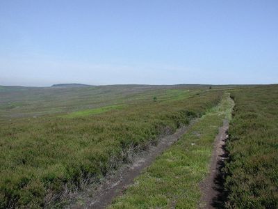
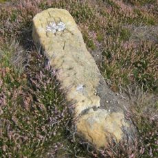
Gisborough Moor is an open moorland between Guisborough and Commondale with expansive terrain that rises above 300 meters in elevation. The landscape consists of rolling open ground that forms part of the wider North York Moors region.

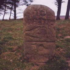
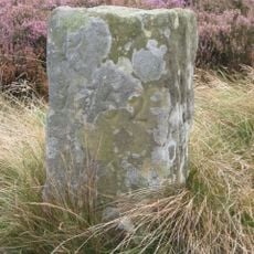
This moorland served as passage between local communities and became strategically important during the World Wars. A memorial on nearby ground honors residents who died in military service during these conflicts.

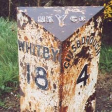
The footpaths crossing this moorland connect nearby villages and show how communities have moved through this landscape for generations. These walking routes remain central to how people experience and use the open land today.

The moorland can be explored on foot using marked paths that take anywhere from a couple of hours to half a day depending on your chosen route. Weather changes quickly here, so bring clothing that protects against wind and rain.

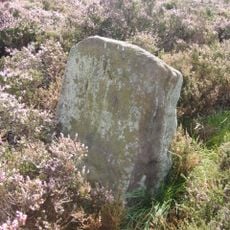
During World War II, a decoy site operated nearby using burning liquids to create false targets for enemy bombers at night. This deception tactic was designed to protect industrial areas from aerial bombardment in the region.

Location: Guisborough

Location: Commondale

Elevation above the sea: 328 m

GPS coordinates: 54.50207,-1.02250

Latest update: December 14, 2025 12:20

Photos
Around this place
Commondale War Memorial
United Kingdom

Commondale War Memorial

3.4 km
Boundary Stone, Circa 475 Metres East Of Aysdalegate Farmhouse
United Kingdom

Boundary Stone, Circa 475 Metres East Of Aysdalegate Farmhouse

3.4 km
Slapewath Viaduct
United Kingdom

Slapewath Viaduct

3.5 km
Boundary Stone, Circa 990 Metres North East Of Skelderskew Farmhouse
United Kingdom

Boundary Stone, Circa 990 Metres North East Of Skelderskew Farmhouse

3.1 km
Pair Of Boundary Stones, Approximately 2025 Metres To South Of Home Lowcross At Ngr Nz599 123
United Kingdom

Pair Of Boundary Stones, Approximately 2025 Metres To South Of Home Lowcross At Ngr Nz599 123

3.5 km
Hob Cross Approximately 875 Metres To South Of Tidkinhow Farmhouse At Ngr Nz645 133
United Kingdom

Hob Cross Approximately 875 Metres To South Of Tidkinhow Farmhouse At Ngr Nz645 133

1.6 km
Boundary Stone, Circa 600 Metres South East Of Aysdalegate Farmhouse
United Kingdom

Boundary Stone, Circa 600 Metres South East Of Aysdalegate Farmhouse

3 km
Guide Stone On North Side Of Road From Stokesley
United Kingdom

Guide Stone On North Side Of Road From Stokesley

2.9 km
Percy Rigg Cross
United Kingdom

Percy Rigg Cross

2.8 km
Commondale Shepherds' Memorial
United Kingdom

Commondale Shepherds' Memorial

1.4 km
Boundary Stone, Circa 1,020 Metres North Of Skelderskew Farmhouse
United Kingdom

Boundary Stone, Circa 1,020 Metres North Of Skelderskew Farmhouse

2.9 km
Boundary Stone Approximately 1225 Metres To South Of Highcliff Farmhouse At Ngr Nz605 121
United Kingdom

Boundary Stone Approximately 1225 Metres To South Of Highcliff Farmhouse At Ngr Nz605 121

2.8 km
Boundary Stone Approximately 1260 Metres To South Of Highcliff Farmhouse At Ngr Nz605 121
United Kingdom

Boundary Stone Approximately 1260 Metres To South Of Highcliff Farmhouse At Ngr Nz605 121

2.8 km
Boundary Stone Approximately 1300 Metres To South Of Highcliff Farmhouse At Ngr Nz603 121
United Kingdom

Boundary Stone Approximately 1300 Metres To South Of Highcliff Farmhouse At Ngr Nz603 121

3 km
Boundary Stone, Approximately 1310 Metres To South Of Highcliff Farmhouse At Ngr Nz605 121
United Kingdom

Boundary Stone, Approximately 1310 Metres To South Of Highcliff Farmhouse At Ngr Nz605 121

2.9 km
Boundary Stone, Approximately 1300 Metres To South West Of Highcliff Farmhouse At Ngr Nz600 123
United Kingdom

Boundary Stone, Approximately 1300 Metres To South West Of Highcliff Farmhouse At Ngr Nz600 123

3.3 km
Boundary Stone, Approximately 1350 Metres To South Of Highcliff Farmhouse At Ngr Nz604 120
United Kingdom

Boundary Stone, Approximately 1350 Metres To South Of Highcliff Farmhouse At Ngr Nz604 120

2.9 km
Boundary Stone, Approximately 1430 Metres To South Of Highcliff Farmhouse At Ngr Nz605 119
United Kingdom

Boundary Stone, Approximately 1430 Metres To South Of Highcliff Farmhouse At Ngr Nz605 119

2.8 km
Boundary Stone Approximately 550 Metres South West Of Tidkinhow Farmhouse At Ngr Nz643 137
United Kingdom

Boundary Stone Approximately 550 Metres South West Of Tidkinhow Farmhouse At Ngr Nz643 137

1.7 km
Boundary Stone Approximately 400 Metres To South Of Highcliff Farmhouse At Ngr Nz606 119
United Kingdom

Boundary Stone Approximately 400 Metres To South Of Highcliff Farmhouse At Ngr Nz606 119

2.8 km
Boundary Stone Approximately 1940 Metres To South Of Home Farmhouse Hutton Lowcross At Ngr Nz595 124
United Kingdom

Boundary Stone Approximately 1940 Metres To South Of Home Farmhouse Hutton Lowcross At Ngr Nz595 124

3.8 km
Boundary Stone, Circa 350 Metres South East Of Aysdalegate Farmhouse
United Kingdom

Boundary Stone, Circa 350 Metres South East Of Aysdalegate Farmhouse

3 km
Boundary Stone, Circa 1,150 Metres North East Of Skelderskew Farmhouse
United Kingdom

Boundary Stone, Circa 1,150 Metres North East Of Skelderskew Farmhouse

3.7 km
Boundary Stone, Circa 1,400 Metres South Of Tidkinhow Farmhouse
United Kingdom

Boundary Stone, Circa 1,400 Metres South Of Tidkinhow Farmhouse

1.5 km
Milestone, Birk Brow Road (top)
United Kingdom

Milestone, Birk Brow Road (top)

3.5 km
Milestone, Birk Brow Road(bottom)
United Kingdom

Milestone, Birk Brow Road(bottom)

3.3 km
Guidestone, boundary N Yorks/Richmond & Cleveland
United Kingdom

Guidestone, boundary N Yorks/Richmond & Cleveland

1.2 km
Milestone, Whitby Road
United Kingdom

Milestone, Whitby Road

3.9 km
Show the full map
Reviews

Visited this place? Tap the stars to rate it and share your experience / photos with the community! Try now! You can cancel it anytime.

« Gisborough Moor - Moorland between Guisborough and Commondale, England » is provided by Around Us (aroundus.com). Images and texts are derived from Wikimedia project under a Creative Commons license. You are allowed to copy, distribute, and modify copies of this page, under the conditions set by the license, as long as this note is clearly visible.

Discover hidden gems everywhere you go!

From secret cafés to breathtaking viewpoints, skip the crowded tourist spots and find places that match your style. Our app makes it easy with voice search, smart filtering, route optimization, and insider tips from travelers worldwide. Download now for the complete mobile experience.

Around Us App Screenshot

A unique approach to discovering new places

Le Figaro

All the places worth exploring

France Info

A tailor-made excursion in just a few clicks

20 Minutes