Enable Location

We need your location to show you interesting places around you

Discover nearby places

Find interesting locations and hidden gems around you

Precise directions

Get accurate directions and distances to places

Your location is never shared with other users. It's only used when you tap the location button.

Fontburn

Log in to your account

Start exploring — it's free

Trusted by 68,138 travelers worldwide

Continue with Google
Continue with Apple
or

We will send you a code to connect

By continuing, you accept our Terms and Conditions and our Privacy Policy

Check your inbox

We've sent a pincode in your inbox. Please enter the code below.

Fontburn
Discussion Reviews 1 Photos
1.8k Popularity

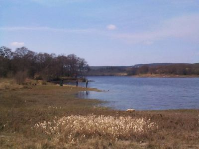
Fontburn, reservoir in the United Kingdom

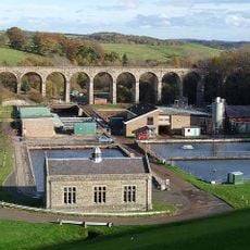
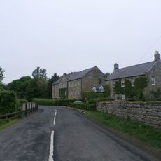
Fontburn is a reservoir near Rothbury in Northumberland with calm water and green trees and fields surrounding it. It is mainly used to supply drinking water to local towns and villages and features a valve tower for water management, with a marked circular walking trail about 5.5 kilometers long that offers easy access for most visitors.

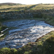
The reservoir was built in 1905, making it over 100 years old and part of local efforts to provide safe water to the community. The structure includes a shaft spillway that helps control water levels and prevent flooding by releasing excess water into the nearby river.

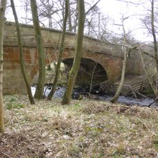
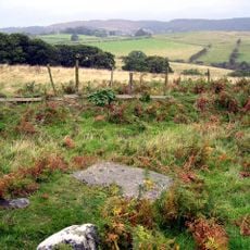
The name Fontburn comes from the stream that feeds the reservoir. Today the site is used by locals and visitors alike, with anglers fishing quietly by the water while walkers explore the trails and birdwatchers search for migrating songbirds, especially in spring and summer.

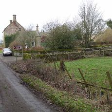
The site has parking on the north shore operated by Northumbrian Water, from which you get the best views. The northern paths are level and well-maintained, while the southern shoreline has rougher ground that can be muddy, so visitors should wear suitable walking shoes and check weather conditions before visiting.

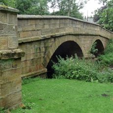
An old stone railway viaduct is still visible across the water and shapes the landscape, though it is now closed to walking. This historic remnant adds nostalgic charm to the scene and offers a glimpse into the area's railway past.

The community of curious travelers

AroundUs brings together thousands of curated places, local tips, and hidden gems, enriched daily by 60,000 contributors worldwide.

Start exploring
Location
GPS coordinates
55.23600,-1.93100
Latest update
February 9, 2026 08:20
Around this place
Netherwitton Hall
United Kingdom

Netherwitton Hall

6.5 km
Rothley Castle
United Kingdom

Rothley Castle

4.8 km
Nunnykirk Hall
United Kingdom

Nunnykirk Hall

3.9 km
Church of St Giles
United Kingdom

Church of St Giles

6.5 km
Milestone Circa A Quarter Of A Mile West Of Coltpark
United Kingdom

Milestone Circa A Quarter Of A Mile West Of Coltpark

2.2 km
Netherwitton War Memorial
United Kingdom

Netherwitton War Memorial

6.4 km
Crossford Bridge Over River Font
United Kingdom

Crossford Bridge Over River Font

5.4 km
Hartington Hall
United Kingdom

Hartington Hall

5.9 km
Netherwitton Bridge Over River Font
United Kingdom

Netherwitton Bridge Over River Font

6.5 km
Fontburn Viaduct
United Kingdom

Fontburn Viaduct

701 m
Milestone At Ewesley Station
United Kingdom

Milestone At Ewesley Station

1.7 km
Milestone Circa 1 Mile South Of Rothbury
United Kingdom

Milestone Circa 1 Mile South Of Rothbury

6.6 km
Milestone Circa A Quarter Of A Mile East Of Lordenshaw
United Kingdom

Milestone Circa A Quarter Of A Mile East Of Lordenshaw

5.1 km
Milestone Circa A Quarter Of A Mile West Of Holling Hill
United Kingdom

Milestone Circa A Quarter Of A Mile West Of Holling Hill

3.8 km
Milestone At Rothley Crossyards
United Kingdom

Milestone At Rothley Crossyards

5 km
Netherwitton Village Cross In Garden Of Font House
United Kingdom

Netherwitton Village Cross In Garden Of Font House

6.3 km
Round cairn on Garleigh Hill, 790m north east of Lordenshaw
United Kingdom

Round cairn on Garleigh Hill, 790m north east of Lordenshaw

5.8 km
Milestone At Donkin Rigg Road End
United Kingdom

Milestone At Donkin Rigg Road End

4 km
Netherwitton Mill
United Kingdom

Netherwitton Mill

6.5 km
Milestone Circa 200 Yards South West Of Coldside
United Kingdom

Milestone Circa 200 Yards South West Of Coldside

2.7 km
Manside defended settlement and medieval cross
United Kingdom

Manside defended settlement and medieval cross

6.2 km
Milestone Circa A Quarter Of A Mile South Of Hartington Road End
United Kingdom

Milestone Circa A Quarter Of A Mile South Of Hartington Road End

6.4 km
Cup and ring marked rock and adjacent stone setting, 820m east of Whittondean Farm
United Kingdom

Cup and ring marked rock and adjacent stone setting, 820m east of Whittondean Farm

6.8 km
Netherwitton Farmhouse
United Kingdom

Netherwitton Farmhouse

6.5 km
Cup and ring marked rock, 940m south-west of Wagtail Farm
United Kingdom

Cup and ring marked rock, 940m south-west of Wagtail Farm

6.9 km
Gate Piers And Screen Walls To South-East Of Netherwitton Hall
United Kingdom

Gate Piers And Screen Walls To South-East Of Netherwitton Hall

6.6 km
Milestone, Codger Fort
United Kingdom

Milestone, Codger Fort

3.4 km
Milestone, Ewesley Fell
United Kingdom

Milestone, Ewesley Fell

2 km
Show the full map
Reviews
Share your experience

No review yet

Discussions
Start a discussion...

No discussion yet

« Fontburn - reservoir in the United Kingdom » is provided by Around Us (aroundus.com). Images and texts are derived from Wikimedia project under a Creative Commons license. You are allowed to copy, distribute, and modify copies of this page, under the conditions set by the license, as long as this note is clearly visible.

Discover hidden gems everywhere you go!

From secret cafés to breathtaking viewpoints, skip the crowded tourist spots and find places that match your style. Our app makes it easy with voice search, smart filtering, route optimization, and insider tips from travelers worldwide. Download now for the complete mobile experience.

Around Us App Screenshot

A unique approach to discovering new places

Le Figaro

All the places worth exploring

France Info

A tailor-made excursion in just a few clicks

20 Minutes

Around Us
Travel Guide & Maps
Download

Send to your phone

QR Code
1

Open the camera app on your mobile.

2

Point at the QR code with your camera. A notification will appear.

3

Tap the notification to open the link.