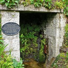
Great County Adit, Mining tunnel system in Cornwall, England
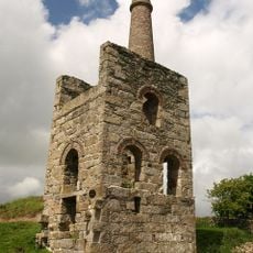
The Great County Adit is an extensive underground tunnel network beneath Cornwall that served as a drainage system for dozens of mining operations. This intricate web of passages connected multiple mines and channeled water that accumulated during their daily work.
The system began in 1748 as a solution to a major problem facing mines: water seeping into underground workings. Over time, more mine owners connected their operations to it, transforming it into a massive infrastructure undertaking.
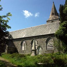
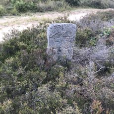
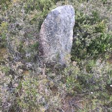
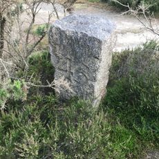
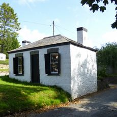
The tunnel system reflects how mining communities in Cornwall worked together to solve a shared problem through engineering innovation. Visitors walking through the region can still see remnants of this collective effort in the landscape and architecture.
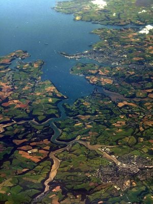
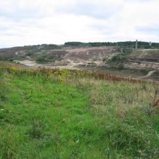
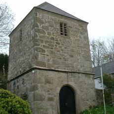
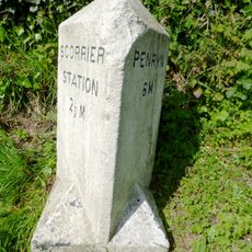
Water still flows through the old passages today and exits the system near Twelveheads, where it discharges into a river. Visitors can observe the lasting impact of this ancient drainage system by visiting the portal and surrounding landscape.
The system achieved its massive capacity not through one central installation but through hundreds of steam engines scattered across the region. This distributed approach allowed smaller mines to also benefit from the drainage technology.
Location: Cornwall
GPS coordinates: 50.23440,-5.14000
Latest update: December 12, 2025 09:01
Carnon viaduct
2.7 km
Church of Saint Piran
3.4 km
Church of Saint Paul
2.5 km
Church of Saint Wenappa
2.9 km
Former Church of All Saints
3 km
St Michael's Church
1.7 km
The Rambling Miner
2.8 km
Gwennap Mining District with Devoran and Perran and Kennall Vale
722 m
Tower of Church of Saint Wenappa
2.9 km
Milestone At Sw 764450 Ne
3.2 km
Clock Tower And Boundary Wall
3.2 km
Milestone C. 300M North Of Sunny Corner Farm
3.5 km
Milepost On West Side Of B 3298 At Sw 733 427
2.9 km
Milestone Adjoining Garden Wall Of No 21
2.8 km
Milepost On West Side Of B3298 At Sw 730 412
3.2 km
Unity Wood Mine Magor's Pumping Engine House
3 km
Parish Boundary Stone At Sw 744429 Sw (Between Original Chacewater And Gwennap Parishes)
2 km
Milestone At Sw 766 386 Ne
3.3 km
Holy Well Of Saint Piran At Sw 778 387 Ne
3.6 km
Parish Boundary Stone At Sw 742429 Sw (Between Original Chacewater And Gwennap Parishes)
2.2 km
Parish Boundary Stone At Sw 747429 Sw (Between Original Chacewater And Gwennap Parishes)
1.7 km
Parish Boundary Stone At Sw 748429 Sw (Between Original Chacewater And Gwennap Parishes) (number 56)
1.7 km
Parish Boundary Stone At Sw 747429 Sw (Between Original Chacewater And Gwennap Parishes)
1.8 km
Parish Boundary Stone At Sw 744429 Sw (Between Original Chacewater And Gwennap Parishes)
2 km
Unity Wood Mine Winding Engine House
3.1 km
Toll House At Sw 781 398 Ne
2.9 km
Milestone, Pengreep, by entrance to Pengrean, just before bend
3.3 km
Milestone, Comford, on the fast narrow climb heading S, 10m NW of the public footpath
3.3 kmVisited this place? Tap the stars to rate it and share your experience / photos with the community! Try now! You can cancel it anytime.
Discover hidden gems everywhere you go!
From secret cafés to breathtaking viewpoints, skip the crowded tourist spots and find places that match your style. Our app makes it easy with voice search, smart filtering, route optimization, and insider tips from travelers worldwide. Download now for the complete mobile experience.
A unique approach to discovering new places❞
— Le Figaro
All the places worth exploring❞
— France Info
A tailor-made excursion in just a few clicks❞
— 20 Minutes