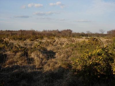
Hamble Common Camp, Iron Age hillfort in Hampshire, England
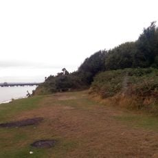
Hamble Common Camp is an Iron Age hillfort and fortification site spread across a large expanse of land. The area is bounded by coastal waters and two rivers and preserves earthen banks and ditches from that early period.
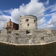
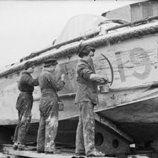
The fortification began as a defensive structure for early British communities during the Iron Age. Later, in the 1500s, an additional castle was added to this defensive line to protect the coast.
The place shows how early inhabitants fortified their settlements, with banks and ditches still visible today. These structures tell of everyday challenges and defensive strategies from past generations.
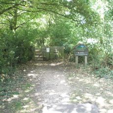
The site features maintained paths that run throughout the area and connect to riverside trails. Access is open, and visitors can explore the terrain on their own, though the ground and slopes change across different sections.
A replica gun was installed on one of the historic gun platforms in the 1980s. The replica was later moved because of coastal erosion, showing how the landscape continues to change.
Location: Hampshire
GPS coordinates: 50.85150,-1.31720
Latest update: December 14, 2025 16:41
Royal Victoria Country Park
2.6 km
Calshot Castle
3.6 km
Jolly Sailor Public House
3.5 km
St Andrew's Castle
109 m
HMS Tormentor
1.2 km
Hamble Rail Trail
1.5 km
Church of All Saints
3.4 km
Swanwick Shore Strict Baptist Chapel
3.6 km
The Brickworks Museum
4.1 km
Church of St Edward the Confessor
4 km
Church of St Mary
2.9 km
The Bugle Inn
797 m
The Victory Inn
838 m
Church of St Leonard
3.8 km
Church of St Mary
1.9 km
Church of St Paul
3.4 km
Sarisbury War Memorial
3.4 km
Church of St Andrew
748 m
Chapel Of Our Lady Of The Rosary
3.4 km
Chapel In The Grounds Of The Royal Victoria Hospital
2.4 km
Prince Consort Public House
3.4 km
Ye Old White Harte Public House
809 m
The King And Queen Public House
828 m
Main Hangar (calshot Former Rnas Station Immediately South Of Castle)
3.7 km
Lodge To The Royal Victoria Hospital Lodge To The Royal Victoria Hospital Fronting To Victoria Road
3.1 km
D-day Memorial Tablet, Hamble-le-Rice
788 m
Watersports Hangar (calshot Former Rnas Station Circa 250 Metres West Of Castle)
3.6 km
Milestone, Sarisbury; by No. 98 Sarisbury Road - house name Jeanette
3.7 kmVisited this place? Tap the stars to rate it and share your experience / photos with the community! Try now! You can cancel it anytime.
Discover hidden gems everywhere you go!
From secret cafés to breathtaking viewpoints, skip the crowded tourist spots and find places that match your style. Our app makes it easy with voice search, smart filtering, route optimization, and insider tips from travelers worldwide. Download now for the complete mobile experience.
A unique approach to discovering new places❞
— Le Figaro
All the places worth exploring❞
— France Info
A tailor-made excursion in just a few clicks❞
— 20 Minutes