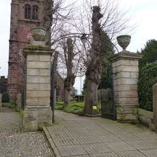
Hockenhull Platts, Nature reserve along River Gowy in Cheshire, England
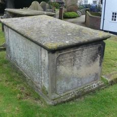
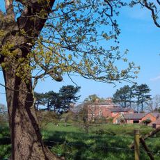
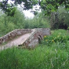
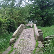
Hockenhull Platts is a nature reserve alongside the River Gowy featuring ponds, reedbeds, mature hedgerows, woodlands, and wet meadows across roughly 5 hectares. Three Grade II listed red sandstone bridges with iron ties connect sections across the river via built causeways.
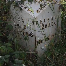
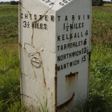
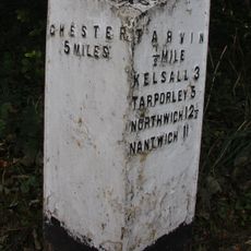
The site developed as part of a medieval route connecting London to Holyhead, with significance dating back to the 14th century. The bridges were constructed to enable this important trade and travel passage across the river.
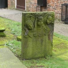
The place name blends English and Welsh origins, with 'platt' meaning bridge in Old English and reflecting the historical ties between the two regions. These linguistic layers remain visible in the landscape today.
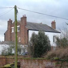
Access is via a public footpath from Platts Lane in Christleton, where parking spaces are provided. The terrain is relatively flat and manageable on foot, though sturdy shoes are advisable due to wet areas.
The three red sandstone bridges date from different periods and show varying construction details reflecting their distinct building methods and repair histories. These differences are plainly visible on the structures and speak to centuries of practical use.
Location: Christleton
Location: Tarvin
GPS coordinates: 53.18620,-2.78490
Latest update: December 14, 2025 09:41
St Andrew's Church, Tarvin
2 km
Hockenhull Hall
832 m
Red Lion
1.9 km
Church House
1.9 km
Tombchest of John Minshull and daughter, south-west corner of churchyard of St. Andrew
1.9 km
Number 86 and attached outbuilding
2.1 km
Stapleford Hall
1.8 km
Tarvin War Memorial
1.9 km
Westernmost of the 3 "Packhorse Bridges"
68 m
Central and easternmost "Packhorse Bridges" and adjoining causeway
14 m
Tombstone of Beatrix Hollinsworth 12 metres west door of Church of St Andrew
1.9 km
Church Hall, Grammar School House and the Hearse House
2 km
Laurel House
2.1 km
Roade House
1.8 km
The Flaggs and Hamilton House, and front garden walls and gates
1.9 km
Sundial in St. Bartholomew's Churchyard
2.7 km
Great Barrow War Memorial
2.7 km
Sundial in the churchyard of St Andrew
1.9 km
Gates and gatepiers to the churchyard of St. Andrew
1.9 km
76, High Street
2.1 km
51, High Street
1.8 km
Tarvin Hall
1.8 km
Tombchest of William Sandbach and others, 5m south-east of sundial in churchyard of St Andrew
1.9 km
78 and 80, High Street
2.1 km
The Vicarage
1.9 km
Milepost, Tarvin Sands
2.7 km
Milepost, S of Stamford Bridge
1.8 km
Milepost, E of on roundabout jct of A54 & A51
1.1 kmVisited this place? Tap the stars to rate it and share your experience / photos with the community! Try now! You can cancel it anytime.
Discover hidden gems everywhere you go!
From secret cafés to breathtaking viewpoints, skip the crowded tourist spots and find places that match your style. Our app makes it easy with voice search, smart filtering, route optimization, and insider tips from travelers worldwide. Download now for the complete mobile experience.
A unique approach to discovering new places❞
— Le Figaro
All the places worth exploring❞
— France Info
A tailor-made excursion in just a few clicks❞
— 20 Minutes