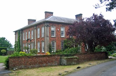
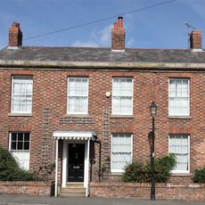
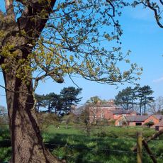
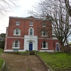
Hockenhull Hall, English country house and Grade II* listed building in Tarvin, England.
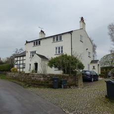
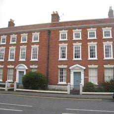
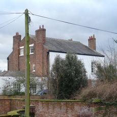
Hockenhull Hall is a country house in Tarvin that was completely rebuilt around 1715 after its original 17th-century construction. The two-storey structure features brick walls with sandstone accents and a Welsh slate hipped roof covering its square-shaped plan.
The hall was originally built in the 17th century and underwent its major transformation around 1715 under architect Francis Smith's direction. This redesign for Hugh Wishaw of Chester turned it into a notable example of Georgian-era updating of an older estate.
The building displays Georgian characteristics that reflect how wealthy English landowners built their country estates in the early 1700s. This architectural style still shapes how the property looks today.
The estate sits in rural Cheshire countryside and functions as a lived-in mansion with active farming operations on the grounds. As a listed building, the exterior is visible but check locally before visiting to understand access rules or visiting possibilities.
The roof uses Welsh slate rather than materials more common in England, reflecting the owner's geographical connections of that era. This choice of material was a subtle mark of wealth and refined taste at the time.
Location: Tarvin
GPS coordinates: 53.18960,-2.77380
Latest update: December 14, 2025 13:04
Hockenhull Platts
832 m
St Andrew's Church, Tarvin
1.2 km
Red Lion
1.1 km
Church House
1.1 km
Tombchest of John Minshull and daughter, south-west corner of churchyard of St. Andrew
1.1 km
Number 86 and attached outbuilding
1.3 km
The White House
2.6 km
Tarvin War Memorial
1.1 km
Westernmost of the 3 "Packhorse Bridges"
891 m
Central and easternmost "Packhorse Bridges" and adjoining causeway
827 m
Tombstone of Beatrix Hollinsworth 12 metres west door of Church of St Andrew
1.1 km
Church Hall, Grammar School House and the Hearse House
1.2 km
Laurel House
1.3 km
Roade House
1.1 km
The Flaggs and Hamilton House, and front garden walls and gates
1.1 km
Stapleford Hall
1.7 km
Great Barrow War Memorial
2.6 km
Sundial in the churchyard of St Andrew
1.1 km
Gates and gatepiers to the churchyard of St. Andrew
1.1 km
76, High Street
1.3 km
51, High Street
1 km
Tarvin Hall
1 km
Tombchest of William Sandbach and others, 5m south-east of sundial in churchyard of St Andrew
1.1 km
78 and 80, High Street
1.3 km
The Vicarage
1.1 km
Milepost, Tarvin Sands
1.9 km
Milepost, S of Stamford Bridge
2 km
Milepost, E of on roundabout jct of A54 & A51
617 mVisited this place? Tap the stars to rate it and share your experience / photos with the community! Try now! You can cancel it anytime.
Discover hidden gems everywhere you go!
From secret cafés to breathtaking viewpoints, skip the crowded tourist spots and find places that match your style. Our app makes it easy with voice search, smart filtering, route optimization, and insider tips from travelers worldwide. Download now for the complete mobile experience.
A unique approach to discovering new places❞
— Le Figaro
All the places worth exploring❞
— France Info
A tailor-made excursion in just a few clicks❞
— 20 Minutes