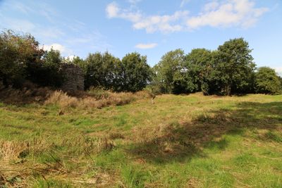
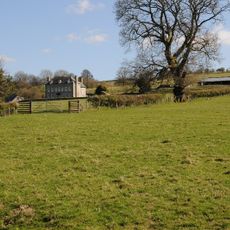
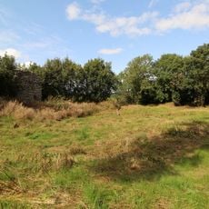
Huntington Castle, Medieval castle ruins in Gladestry, Wales.
Huntington Castle is a medieval fortified site near Gladestry that survives today as earthwork remains positioned on elevated terrain. The fortification sits strategically to command views across the surrounding Welsh countryside from its hilltop location.
The fortress was built during the Norman period as part of a defensive network controlling the border region between England and Wales. This system of fortifications was crucial in establishing Norman dominance over Welsh territories during medieval times.
The castle served as a power center for Norman lords seeking to control Welsh territory and establish their authority in the region. It stands as a physical reminder of how occupying forces used fortified positions to dominate the surrounding landscape.
The site sits on private farmland and visitors should seek permission from local authorities before exploring the grounds. Wear sturdy footwear as the uneven earthworks and natural terrain can be challenging to walk across.
The site displays an unusual oval shape that distinctly differs from the typical motte-and-bailey designs found at other Welsh castles. This rare earthwork form makes it a notable example of an alternative fortification design in the region.
Location: Gladestry
GPS coordinates: 52.17820,-3.09971
Latest update: December 9, 2025 12:27
Parish Church of St Stephen
5.2 km
Church of St Mary
5.1 km
Hergest Court
3.6 km
St Mary's Church
2.2 km
Church Of St Michael
3.2 km
Bollingham Chapel
5.4 km
Church of St. Thomas of Canterbury
515 m
Church of St Mary, Newchurch
4.6 km
Church of St.mary
4.8 km
Church Of St David, Colva
5 km
21 and 22, Church Street
5.4 km
The Royal Oak Public House Including Rubblestone Wing To East
5.4 km
Parkstile Mill
1.9 km
Great House including former barn range attached to right, Newchurch
4.6 km
Huntington Post Office And Outbuilding Adjoining South
265 m
Church House And Attached Wall
5.1 km
K6 Telephone Kiosk Adjacent To The Old Post Office
253 m
Lychgate, Churchyard Of Church Of St Mary
5.2 km
Cwmmau Farmhouse And Adjoining Cowhouse
3.9 km
Apostles Farmhouse
3.9 km
Stone House, Gladestry
1.4 km
The Porch House
5.3 km
Churchyard cross in St Mary the Virgin's churchyard
5.1 km
Empton Farmhouse
2.5 km
Remains Of Huntington Castle
112 m
Lower House Farmhouse
274 m
Corner House, A4594 (N Side) Gladestry
2.1 km
The Wych Wych House
5.1 kmVisited this place? Tap the stars to rate it and share your experience / photos with the community! Try now! You can cancel it anytime.
Discover hidden gems everywhere you go!
From secret cafés to breathtaking viewpoints, skip the crowded tourist spots and find places that match your style. Our app makes it easy with voice search, smart filtering, route optimization, and insider tips from travelers worldwide. Download now for the complete mobile experience.
A unique approach to discovering new places❞
— Le Figaro
All the places worth exploring❞
— France Info
A tailor-made excursion in just a few clicks❞
— 20 Minutes