Enable Location

We need your location to show you interesting places around you

Discover nearby places

Find interesting locations and hidden gems around you

Precise directions

Get accurate directions and distances to places

Your location is never shared with other users. It's only used when you tap the location button.

Kingsweston Hill

Log in to your account

Start exploring — it's free

Trusted by 62,102 travelers worldwide

Continue with Google
Continue with Apple
or

We will send you a code to connect

By continuing, you accept our Terms and Conditions and our Privacy Policy

Check your inbox

We've sent a pincode in your inbox. Please enter the code below.

Kingsweston Hill, Archaeological site in Henbury, England

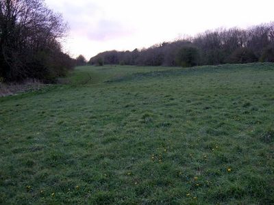
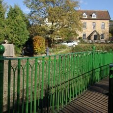
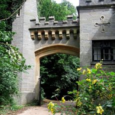
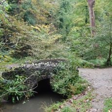
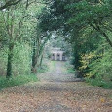
Kingsweston Hill is a partial contour fort situated on elevated ground in Henbury, featuring earthen ramparts that follow the natural slope of the hill. The site offers views across the Bristol area and reveals the layout of an ancient defensive settlement.

The fortification dates to the Iron Age and demonstrates early settlement patterns in the region. The site gained scheduled monument status to preserve its archaeological significance for research.

The scheduled monument status of Kingsweston Hill reflects its importance in preserving British archaeological heritage for future generations to study.

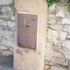
You can walk around the site on foot and enjoy views from the top across the surrounding countryside. Wear sturdy shoes as the ground is uneven and can become muddy depending on the weather.

The earthen ramparts follow the natural contours of the hill rather than being constructed on flat ground, showing skilled use of the terrain. This adaptation to the slope makes it difficult to take in the entire layout from any single viewpoint.

The community of curious travelers

AroundUs brings together thousands of curated places, local tips, and hidden gems, enriched daily by 60,000 contributors worldwide.

Start exploring
Location
GPS coordinates
51.50067,-2.64123
Latest update
December 13, 2025 17:05
Around this place
Kings Weston House
United Kingdom

Kings Weston House

1.6 km
Holy Trinity Church, Westbury on Trym
United Kingdom

Holy Trinity Church, Westbury on Trym

1.4 km
St Mary's Church, Henbury
United Kingdom

St Mary's Church, Henbury

965 m
Henbury Village Hall
United Kingdom

Henbury Village Hall

988 m
Iron Footbridge Over Kings Weston Road
United Kingdom

Iron Footbridge Over Kings Weston Road

1.4 km
Blaise Castle House
United Kingdom

Blaise Castle House

829 m
Museum
United Kingdom

Museum

836 m
Blaise Castle
United Kingdom

Blaise Castle

343 m
Milestone At St 5418 7712 Approximately 400 Metres West Of Park Lodge
United Kingdom

Milestone At St 5418 7712 Approximately 400 Metres West Of Park Lodge

1.7 km
Scipio Africanus memorial
United Kingdom

Scipio Africanus memorial

965 m
Milestone At St 5718 7756 Approximately 10 Metres North East Of Trym Lodge
United Kingdom

Milestone At St 5718 7756 Approximately 10 Metres North East Of Trym Lodge

1.7 km
Bridge At Giant's Soap Dish, Blaise Castle Estate
United Kingdom

Bridge At Giant's Soap Dish, Blaise Castle Estate

314 m
Mill bridge, Blaise Castle Estate
United Kingdom

Mill bridge, Blaise Castle Estate

572 m
Bridge Over Hazel Brook
United Kingdom

Bridge Over Hazel Brook

895 m
Tunnel From Churchyard Of St Mary To South Under Rear Area Of The Old Vicarage
United Kingdom

Tunnel From Churchyard Of St Mary To South Under Rear Area Of The Old Vicarage

965 m
Henbury Hill Lodge, Blaise Castle Estate
United Kingdom

Henbury Hill Lodge, Blaise Castle Estate

1.1 km
Stoke Lodge
United Kingdom

Stoke Lodge

1.7 km
Kings Weston House
United Kingdom

Kings Weston House

1.6 km
Rustic Lodge, Blaise Castle Estate
United Kingdom

Rustic Lodge, Blaise Castle Estate

773 m
Stratford Mill, Blaise Castle Estate
United Kingdom

Stratford Mill, Blaise Castle Estate

598 m
Bridge Over Hazel Brook At St 3557 1778
United Kingdom

Bridge Over Hazel Brook At St 3557 1778

345 m
Cambell's Farm And Attached Garden Wall And Railings
United Kingdom

Cambell's Farm And Attached Garden Wall And Railings

1.7 km
Holly House And Attached Outbuildings
United Kingdom

Holly House And Attached Outbuildings

940 m
Dairy at Blaise Castle House
United Kingdom

Dairy at Blaise Castle House

880 m
The Brewhouse, Kings Weston House
United Kingdom

The Brewhouse, Kings Weston House

1.5 km
The Echo, Approximately 300 Metres South East Of Kings Weston House
United Kingdom

The Echo, Approximately 300 Metres South East Of Kings Weston House

1.5 km
Sundial To The Middle Of The Green At Blaise Hamlet
United Kingdom

Sundial To The Middle Of The Green At Blaise Hamlet

833 m
Milestone, Westbury on Trym, outside No. 9 Passage Road
United Kingdom

Milestone, Westbury on Trym, outside No. 9 Passage Road

1.8 km
Show the full map
« Kingsweston Hill - Archaeological site in Henbury, England » is provided by Around Us (aroundus.com). Images and texts are derived from Wikimedia project under a Creative Commons license. You are allowed to copy, distribute, and modify copies of this page, under the conditions set by the license, as long as this note is clearly visible.

Discover hidden gems everywhere you go!

From secret cafés to breathtaking viewpoints, skip the crowded tourist spots and find places that match your style. Our app makes it easy with voice search, smart filtering, route optimization, and insider tips from travelers worldwide. Download now for the complete mobile experience.

Around Us App Screenshot

A unique approach to discovering new places

Le Figaro

All the places worth exploring

France Info

A tailor-made excursion in just a few clicks

20 Minutes

Around Us
Travel Guide & Maps
Download

Send to your phone

QR Code
1

Open the camera app on your mobile.

2

Point at the QR code with your camera. A notification will appear.

3

Tap the notification to open the link.