Chest opened
+${chestReward.xp} XP
Explorer
NOUVEAU ×${chestReward.collectible.quantity}
tapez pour fermer
Chest locked

Open chests in the app

Around Us is built for your phone — chests unlock when you walk, explore and capture nearby places.

Enable Location

We need your location to show you interesting places around you

Discover nearby places

Find interesting locations and hidden gems around you

Precise directions

Get accurate directions and distances to places

Your location is never shared with other users. It's only used when you tap the location button.

Leeds Country Way

Log in to your account

Start exploring — it's free

Trusted by 73,002 travelers worldwide

Continue with Google
Continue with Apple
or

We will send you a code to connect

By continuing, you accept our Terms and Conditions and our Privacy Policy

Check your inbox

We've sent a pincode in your inbox. Please enter the code below.

Leeds Country Way
Discussion Reviews 1 Photos
4.1k Popularity

Leeds Country Way, long-distance footpath in West Yorkshire, United Kingdom

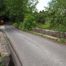
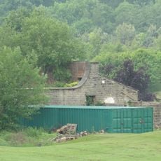
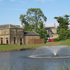
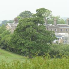
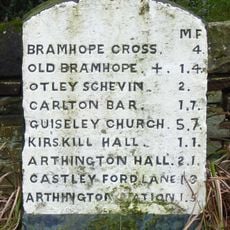
The Leeds Country Way is a 62-mile loop trail around Leeds that passes through farmland, woodlands, small villages, and parks before returning to its starting point at Golden Acre Park. The route follows a mix of footpaths, bridleways, and country lanes, with only brief sections on main roads.

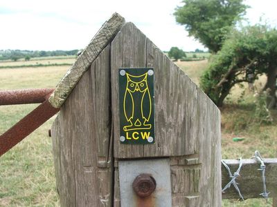
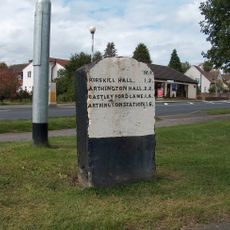
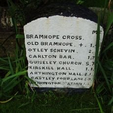
Fred Andrews from the Ramblers Association first conceived the route, which was then developed by West Yorkshire County Council in the early 1980s. After the council was abolished in 1986, Leeds City Council took over management, and in 2006 the path was realigned to sit completely within city boundaries with updated signage.

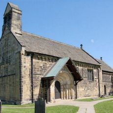
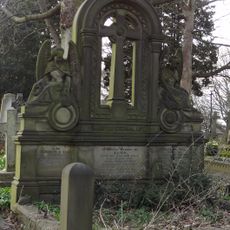
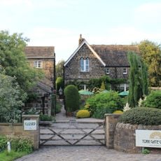
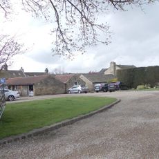
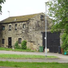
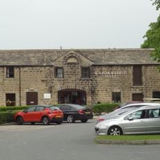
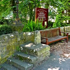
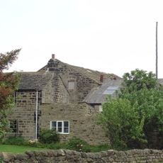
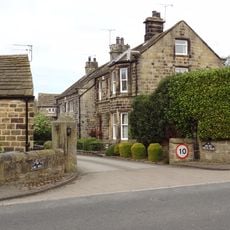
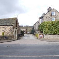
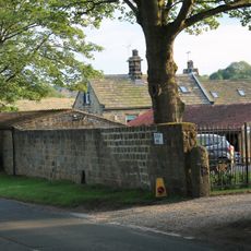
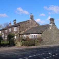
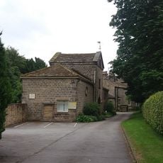
The trail passes through small villages where old buildings and local pubs are part of daily community life. Walkers regularly encounter residents using the paths, creating a sense of connection to how people actually live and move through this rural landscape.

Wear proper walking shoes since paths can be uneven and muddy, especially after rain. Carry water and snacks along with a rain jacket, and plan stops at the many pubs and cafes found along the route for refreshment and rest.

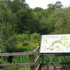
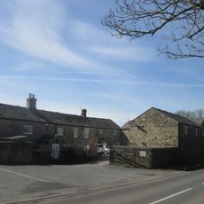
The route passes the Bingley Arms pub, which claims to be England's oldest pub. Along the way, walkers may spot red kites, birds of prey that were reintroduced to the area after disappearing centuries ago.

The community of curious travelers

AroundUs brings together thousands of curated places, local tips, and hidden gems, enriched daily by 60,000 contributors worldwide.

Start exploring
Location
GPS coordinates
53.87110,-1.59313
Latest update
February 7, 2026 11:40
Around this place
Church of St John the Baptist
United Kingdom

Church of St John the Baptist

1.6 km
Breary Marsh
United Kingdom

Breary Marsh

200 m
York Gate Garden
United Kingdom

York Gate Garden

1.7 km
Memorial To Eliza And William Hill Approximately 30 Metres South Of Church Of St John
United Kingdom

Memorial To Eliza And William Hill Approximately 30 Metres South Of Church Of St John

1.6 km
Memorial To Zinai Wormald Approximately 30 Metres North Of Church Of St John The Baptist
United Kingdom

Memorial To Zinai Wormald Approximately 30 Metres North Of Church Of St John The Baptist

1.6 km
York Gate Garden
United Kingdom

York Gate Garden

1.7 km
Audus Hirst Memorial Approximately 30 Metres South Of Church Of St John The Baptist
United Kingdom

Audus Hirst Memorial Approximately 30 Metres South Of Church Of St John The Baptist

1.6 km
Stairfoot Bridge
United Kingdom

Stairfoot Bridge

1.8 km
Milepost On West Corner Of Junction With Creskeld Lane At Se 258 428
United Kingdom

Milepost On West Corner Of Junction With Creskeld Lane At Se 258 428

1.5 km
Milepost On East Corner Of Junction With Breary Lane East, At Se 256 430
United Kingdom

Milepost On East Corner Of Junction With Breary Lane East, At Se 256 430

1.8 km
Adel Mill Farm House
United Kingdom

Adel Mill Farm House

1.1 km
High Farm Public House Outbuilding On East Side Of Yard
United Kingdom

High Farm Public House Outbuilding On East Side Of Yard

1.9 km
East Stable Block North West Of Cookridge Hall
United Kingdom

East Stable Block North West Of Cookridge Hall

1.5 km
Mounting Block By West Gate Of St Johns Churchyard
United Kingdom

Mounting Block By West Gate Of St Johns Churchyard

1.6 km
Lane End Farmhouse
United Kingdom

Lane End Farmhouse

1.7 km
King Lane Farmhouse
United Kingdom

King Lane Farmhouse

1.8 km
Kitchen Garden Wall On East Side Of Cookridge Hall
United Kingdom

Kitchen Garden Wall On East Side Of Cookridge Hall

1.5 km
West Stable Block To North West Of Cookridge Hall
United Kingdom

West Stable Block To North West Of Cookridge Hall

1.6 km
Cookridge Hall
United Kingdom

Cookridge Hall

1.5 km
The Tudors and Victoria House, Adel Mill
United Kingdom

The Tudors and Victoria House, Adel Mill

1.2 km
Walls And Gate Piers To Adel Mill Housing Complex
United Kingdom

Walls And Gate Piers To Adel Mill Housing Complex

1.2 km
Guidestone, Five Lane Ends, Eccup, jct  Eccup Lane/King Lane
United Kingdom

Guidestone, Five Lane Ends, Eccup, jct Eccup Lane/King Lane

1.1 km
Milestone, Otley Road, jct with Church Lane at SE26973985
United Kingdom

Milestone, Otley Road, jct with Church Lane at SE26973985

1.9 km
Cart Shed Immediately North Of Adel Mill Farmhouse
United Kingdom

Cart Shed Immediately North Of Adel Mill Farmhouse

1.2 km
Smithy Hall
United Kingdom

Smithy Hall

1.8 km
Parish Hall
United Kingdom

Parish Hall

1.7 km
Milepost At Se 264 421
United Kingdom

Milepost At Se 264 421

583 m
Milepost On East Corner Of Junction With Breary Lane At Se 255 430
United Kingdom

Milepost On East Corner Of Junction With Breary Lane At Se 255 430

1.8 km
Show the full map
Reviews
Share your experience

No review yet

Discussions
Start a discussion...

No discussion yet

« Leeds Country Way - long-distance footpath in West Yorkshire, United Kingdom » is provided by Around Us (aroundus.com). Images and texts are derived from Wikimedia project under a Creative Commons license. You are allowed to copy, distribute, and modify copies of this page, under the conditions set by the license, as long as this note is clearly visible.

Discover hidden gems everywhere you go!

From secret cafés to breathtaking viewpoints, skip the crowded tourist spots and find places that match your style. Our app makes it easy with voice search, smart filtering, route optimization, and insider tips from travelers worldwide. Download now for the complete mobile experience.

Around Us App Screenshot

A unique approach to discovering new places

Le Figaro

All the places worth exploring

France Info

A tailor-made excursion in just a few clicks

20 Minutes

Around Us
Travel Guide & Maps
Download

Send to your phone

QR Code
1

Open the camera app on your mobile.

2

Point at the QR code with your camera. A notification will appear.

3

Tap the notification to open the link.