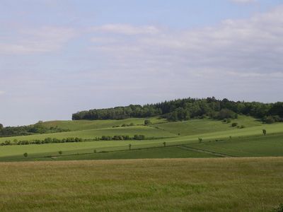
Knoll Camp, Iron Age hill fort and summit in Rockbourne, England
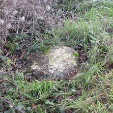
Knoll Camp is a circular earthwork in Rockbourne, England, spanning four acres with a single ditch, inner ramparts, and traces of a counter scarp bank. The structure displays typical defensive engineering of Iron Age settlements.
This fort was built during the Iron Age to serve as a strategic defense for settlements in the region. It reflects the military building techniques that Iron Age peoples used to protect their communities.
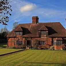
This site connects to a network of burial mounds and fortifications across Hampshire that once held significance for Iron Age communities. The landscape reflects how these groups organized their sacred and defensive spaces.
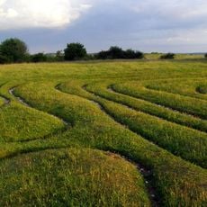
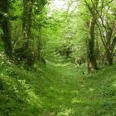
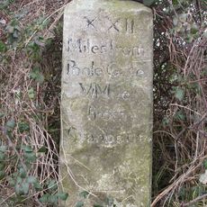
Visitors can reach this site via a footpath that runs southeast along the ridge through the center of the fort. Sturdy footwear is recommended due to the terrain and vegetation.
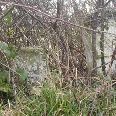
The interior is filled with dense woodland and brambles that partially conceal the archaeological features of this protected site. This natural growth makes exploration both adventurous and physically demanding.
Location: Rockbourne
GPS coordinates: 50.96610,-1.86103
Latest update: December 14, 2025 18:12
Mizmaze
4.6 km
Breamore House
5.4 km
Rockbourne Roman Villa
2.6 km
Whitsbury Castle
3.2 km
St Aldhelm's Chapel
5.4 km
Church of St George
2.9 km
Church of All Saints
3 km
Church of St Andrew
1.7 km
Church of St Leonard
3.1 km
Baptist Chapel
1.7 km
Rose And Thistle Public House
1.4 km
Fryern Court
5 km
Damerham War Memorial
2.5 km
Large Barn 50 Metres North East Of Manor House
1.7 km
Milestone 200 Metres South West Of Grimsdyke Granaries
4.7 km
Estate Office
5.1 km
Milestone 200 Metres North East Of Martin Drove End
5.2 km
Mizmaze on Breamore Down
4.6 km
Manor Farm And Wall Running North East
1.7 km
Milestone About 100 Metres South Of Drive To Little Toyd Farm
3 km
Court Farm House
2.7 km
Barn Formerly Chapel 20 Metres East of Manor House
1.7 km
Milestone
4.3 km
Milestone Opposite Junction With Track To Kites Nest Farm
3.1 km
Milestone About 1 Kilometre North East Of Swayne's Firs
4.7 km
Milestone, Blackheath Down; 10m N of crossroads with major bridleway - Stony Lane.
3.1 km
Milestone, Tidpit, opp. Keeper's Cottage
2.3 km
Milestone, Toyd Down; 1km N of Knap Barrow Farm
2 kmVisited this place? Tap the stars to rate it and share your experience / photos with the community! Try now! You can cancel it anytime.
Discover hidden gems everywhere you go!
From secret cafés to breathtaking viewpoints, skip the crowded tourist spots and find places that match your style. Our app makes it easy with voice search, smart filtering, route optimization, and insider tips from travelers worldwide. Download now for the complete mobile experience.
A unique approach to discovering new places❞
— Le Figaro
All the places worth exploring❞
— France Info
A tailor-made excursion in just a few clicks❞
— 20 Minutes