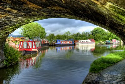
Lancaster Canal, Navigation canal in North West England.
Description
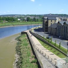
The Lancaster Canal is a navigation waterway in North West England that runs from Preston to Carnforth through open farmland. The route stretches about 42 kilometers across the landscape between the Pennine Hills to the east and Morecambe Bay to the west.
History
The canal was established in 1793 by an Act of Parliament to transport coal from Wigan at lower prices to Preston and North Lancashire. The waterway became a vital link for industrial goods during the region's rapid growth in the 1800s.
Culture
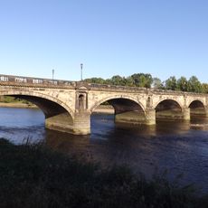
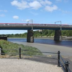
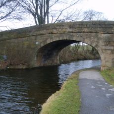
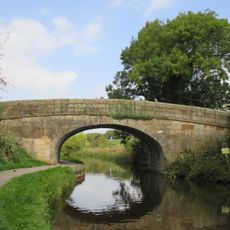
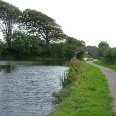
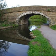
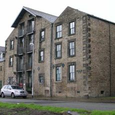
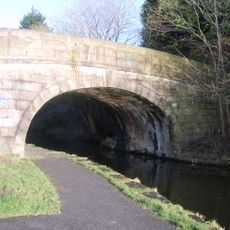
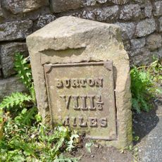
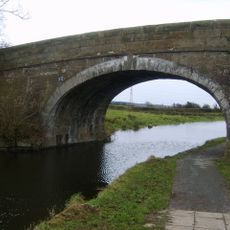
The canal takes its name from Lancaster, a port town that shaped the region's trade history. Visitors can see the classical stone bridges and aqueducts that still define the waterway's character today.
Practical
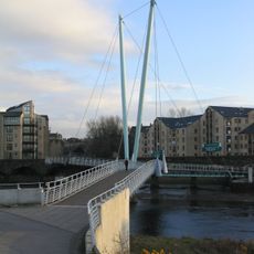
Boats can navigate the canal directly, but access to the wider English canal network requires passage through the Ribble Link system, which involves locks and tidal waters. The waterway is most easily navigated during the warmer months when water conditions are more settled.
Did you know?
The main section operates without any locks for its entire length, making it the longest stretch of lock-free canal in the country. This uncommon feature allows for uninterrupted, relaxed boating that is rare on other English waterways.
AroundUs brings together thousands of curated places, local tips, and hidden gems, enriched daily by 60,000 contributors worldwide. Discover all places nearby (United Kingdom).
Skerton Bridge
1.4 km
Lune Millennium Bridge
1.6 km
Custom House, Lancaster
1.5 km
Carlisle Bridge
1.4 km
Lancaster Carriage and Wagon Works
1 km
St Luke's Church, Skerton
1.1 km
Church of St Joseph
691 m
St Chad's Church
1.1 km
Beaumont Hall Bridge (Number 109)
219 m
Wagon And Horses Public House
1.5 km
Hammerton Hall Bridge (Number 111)
517 m
Lancaster Canal Belmount Bridge
1.4 km
Skerton Liberal Club
1.3 km
George And Dragon Public House
1.5 km
Halton Road Bridge
636 m
23, St Georges Quay
1.5 km
21 And 22, St Georges Quay
1.5 km
Three Warehouses, Now Part Of Number 26, Maritime Museum
1.5 km
Peel House
1.5 km
Victoria Corn Mill
1.6 km
Quay Wall
1.5 km
Ryelands House
1.1 km
Lancaster Canal Dolphinlee Bridge (Number 105)
1 km
Lancaster Canal Folly Bridge (Number 112)
948 m
Milestone 350 Metres North Of Beaumont Gate Farm At Ngr Sd 476 644
787 m
Municipal Baths And Transport Depot With Low Retaining Walls To Sides
1.4 km
Lancaster Canal Williamslands Bridge (Number 113)
1.3 km
38-42, Parliament Street
1.5 kmDiscover hidden gems everywhere you go!
From secret cafés to breathtaking viewpoints, skip the crowded tourist spots and find places that match your style. Our app makes it easy with voice search, smart filtering, route optimization, and insider tips from travelers worldwide. Download now for the complete mobile experience.
A unique approach to discovering new places❞
— Le Figaro
All the places worth exploring❞
— France Info
A tailor-made excursion in just a few clicks❞
— 20 Minutes