Enable Location

We need your location to show you interesting places around you

Discover nearby places

Find interesting locations and hidden gems around you

Precise directions

Get accurate directions and distances to places

Your location is never shared with other users. It's only used when you tap the location button.

Langsett Reservoir

Log in to your account

Start exploring — it's free

Trusted by 62,502 travelers worldwide

Continue with Google
Continue with Apple
or

We will send you a code to connect

By continuing, you accept our Terms and Conditions and our Privacy Policy

Check your inbox

We've sent a pincode in your inbox. Please enter the code below.

Langsett Reservoir

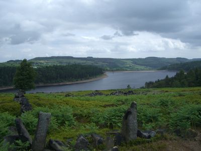
Langsett Reservoir, lake in the United Kingdom

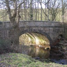
Langsett Reservoir is a large body of water in South Yorkshire, built from the late 1800s into the early 1900s, stretching about one mile across the landscape. Well-maintained paths loop around it through forests, fields and open moorlands, while the water supply serves towns like Sheffield and Barnsley.

The reservoir was built from the late 1800s onward to store and supply water to growing towns in the region. Its construction was part of broader efforts to secure water supply for industrial and domestic use across South Yorkshire.

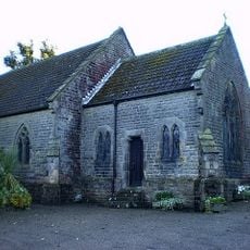
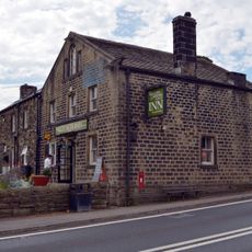
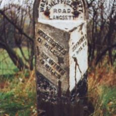
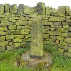
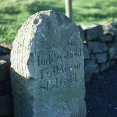
The name Langsett traces back to at least the 13th century, rooted in the old settlement that still stands quietly near the water. Today the village and reservoir form a single identity where rural traditions and outdoor life remain central to how locals and visitors experience this corner of the Peak District.

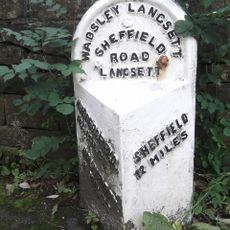
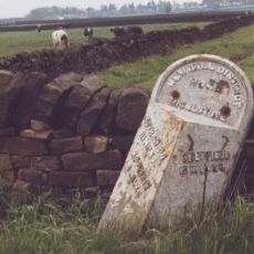
The walk loops roughly four miles and takes about two hours on marked paths with steps, stiles and gates that are easy to follow throughout. Free parking with public toilets sits at Langsett Barn, and when full, an additional free lay-by is available nearby; waterproof boots help in wet conditions and carrying a map or compass is wise, especially if weather turns foggy.

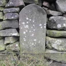
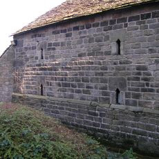
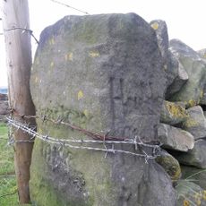
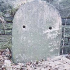
Along the route you can spot ruins of North America Farm, which served as a target range during the Second World War and still bears the marks of shell impacts on its stones. Nearby Thickwoods Lane, a small path, was built up with rubble from bombed houses in Sheffield, weaving wartime history directly into the landscape you walk through today.

The community of curious travelers

AroundUs brings together thousands of curated places, local tips, and hidden gems, enriched daily by 60,000 contributors worldwide.

Start exploring
Location
Elevation above the sea
245 m
GPS coordinates
53.49639,-1.68611
Latest update
February 7, 2026 11:01
Around this place
Hartcliff Folly
United Kingdom

Hartcliff Folly

2.4 km
St James' Church, Midhopestones
United Kingdom

St James' Church, Midhopestones

2.6 km
Church of St Saviour
United Kingdom

Church of St Saviour

3.8 km
Church of St Anne
United Kingdom

Church of St Anne

4.5 km
Wagon And Horses Public House
United Kingdom

Wagon And Horses Public House

557 m
Milestone Approximately 5 Metres East Of Junction With Mortimer Road
United Kingdom

Milestone Approximately 5 Metres East Of Junction With Mortimer Road

2.8 km
Milestone Approximately 300 Metres North Of Flouch Inn
United Kingdom

Milestone Approximately 300 Metres North Of Flouch Inn

2.2 km
Unsliven Bridge, Stocksbridge
United Kingdom

Unsliven Bridge, Stocksbridge

4.5 km
Milestone
United Kingdom

Milestone

1.4 km
Catshaw Cross
United Kingdom

Catshaw Cross

3.5 km
Wayside cross south of Hartcliff Road
United Kingdom

Wayside cross south of Hartcliff Road

3.2 km
Milestone Approximately 400 Metres West Of Junction With Underbank Lane
United Kingdom

Milestone Approximately 400 Metres West Of Junction With Underbank Lane

4.3 km
Milestone Approximately 200 Metres West Of Flouch Inn
United Kingdom

Milestone Approximately 200 Metres West Of Flouch Inn

2 km
Greyhound Stone Approximately 300 Metres East Of Junction With Hartcliff Hill Road
United Kingdom

Greyhound Stone Approximately 300 Metres East Of Junction With Hartcliff Hill Road

2.4 km
Milestone Set In Wall Opposite Junction To Paw Hill Farm At Se 213016
United Kingdom

Milestone Set In Wall Opposite Junction To Paw Hill Farm At Se 213016

1.6 km
Old Milestone Approximately 300 Metres North Of Junction With Bents Road
United Kingdom

Old Milestone Approximately 300 Metres North Of Junction With Bents Road

4.2 km
Guide Pillar At Road Junction South Of Langley Brook On North West Side Of Junction
United Kingdom

Guide Pillar At Road Junction South Of Langley Brook On North West Side Of Junction

4.2 km
Milestone Opposite Junction With Towngate
United Kingdom

Milestone Opposite Junction With Towngate

4.2 km
Milestone Approximately 150 Metres East Of Dog And Partridge Public House
United Kingdom

Milestone Approximately 150 Metres East Of Dog And Partridge Public House

3.1 km
Milestone Set In South Side Of Southern Wall Enclosing Ring Wood
United Kingdom

Milestone Set In South Side Of Southern Wall Enclosing Ring Wood

2.4 km
Milestone Approximately 100 Metres South Of Junction With Bents Road
United Kingdom

Milestone Approximately 100 Metres South Of Junction With Bents Road

3.7 km
Barn At Langsett House
United Kingdom

Barn At Langsett House

485 m
Milestone Opposite Number 351
United Kingdom

Milestone Opposite Number 351

3.2 km
Milestone Approximately 200 Metres South Of Junction With Royal Moor Road At Se 216040
United Kingdom

Milestone Approximately 200 Metres South Of Junction With Royal Moor Road At Se 216040

4.1 km
Milestone Approximately 150 Metres North Of Junction With Hartcliff Road
United Kingdom

Milestone Approximately 150 Metres North Of Junction With Hartcliff Road

1.7 km
Take Off Stone Approximately 250 Metres South Of Junction With Mossley Road
United Kingdom

Take Off Stone Approximately 250 Metres South Of Junction With Mossley Road

3.7 km
Milestone, Mossley Road
United Kingdom

Milestone, Mossley Road

3.5 km
Milestone, Langsett Village
United Kingdom

Milestone, Langsett Village

510 m
Show the full map
« Langsett Reservoir - lake in the United Kingdom » is provided by Around Us (aroundus.com). Images and texts are derived from Wikimedia project under a Creative Commons license. You are allowed to copy, distribute, and modify copies of this page, under the conditions set by the license, as long as this note is clearly visible.

Discover hidden gems everywhere you go!

From secret cafés to breathtaking viewpoints, skip the crowded tourist spots and find places that match your style. Our app makes it easy with voice search, smart filtering, route optimization, and insider tips from travelers worldwide. Download now for the complete mobile experience.

Around Us App Screenshot

A unique approach to discovering new places

Le Figaro

All the places worth exploring

France Info

A tailor-made excursion in just a few clicks

20 Minutes

Around Us
Travel Guide & Maps
Download

Send to your phone

QR Code
1

Open the camera app on your mobile.

2

Point at the QR code with your camera. A notification will appear.

3

Tap the notification to open the link.