Maesbury Castle, Iron Age hill fort in Croscombe, England
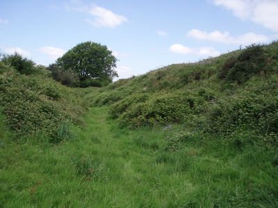
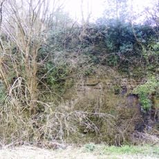
Maesbury Castle is a hillfort situated on the Mendip Hills at around 292 meters elevation overlooking the surrounding countryside. It features a single rampart rising to about 6 meters with an outer ditch, with the fortified area spanning approximately 2.5 hectares.
Built during the Iron Age, the fort later became a strategic boundary marker between Romano-British Celtic lands and advancing West Saxon territories in the 6th and 7th centuries. This period shaped its role as a control point in a shifting political landscape.
The name blends a Welsh word meaning field with Old English meaning fort, showing how different peoples shared and shaped the landscape. You can see this linguistic layering reflected in place names throughout the region.
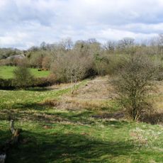
The site is accessible via a footpath from the south, though visitors should expect a steep climb up through a grassy field to reach the main fortification. Wear sturdy shoes and allow time to navigate the uneven terrain.
Local tradition speaks of a lamb that appears to glow in the morning sunlight on Easter Sunday atop the ancient fortification. This tale connects the old site with seasonal celebrations woven into the landscape's folklore.
Location: Croscombe
GPS coordinates: 51.22240,-2.55983
Latest update: December 14, 2025 11:01
Anglo-Bavarian Brewery
3.5 km
The Old Hall
3.3 km
Windsor Hill Quarry
2.1 km
Hobbs Quarry SSSI, Shepton Mallet
2.8 km
Church of St Mary the Virgin, Croscombe
3.4 km
Viaduct Quarry
3.1 km
Church of St James, Ashwick
3 km
Ashwick Court
3 km
Windsor Hill Marsh
2 km
Former Church of St John Evangelist
2.9 km
Church of the Holy Trinity
2.4 km
Milepost At Ngr St 6300 4654
2.1 km
Bowlish House
3.2 km
Old Bowlish House
3.2 km
Wall Enclosing Garden Of Old Ham Manor
3.2 km
Milepost At Ngr St6222 4787
1.4 km
Village Cross adjacent to the Bull Terrier
3.4 km
The Old Manor
3.3 km
Bowlish Villa And Flanking Garden Walls
3.1 km
Milepost At Ngr St 6241 4510
2.5 km
Milepost On B3139 At Ngr St 6063 5046
3.3 km
Milepost On Roadside At Ngr St 5868 4810
2.5 km
Mendip Lodge
2.4 km
Oakhill Methodist Church And Adjacent Gate Piers And Gate Of Forecourt Walls
2.6 km
Bowlish Grange
3.1 km
Boundary Stone At St6389946560
3 km
Milestone, near radio mast and Warren Farm
1.1 km
Milepost, W of Darshill, nr sewage works
3.3 kmVisited this place? Tap the stars to rate it and share your experience / photos with the community! Try now! You can cancel it anytime.
Discover hidden gems everywhere you go!
From secret cafés to breathtaking viewpoints, skip the crowded tourist spots and find places that match your style. Our app makes it easy with voice search, smart filtering, route optimization, and insider tips from travelers worldwide. Download now for the complete mobile experience.
A unique approach to discovering new places❞
— Le Figaro
All the places worth exploring❞
— France Info
A tailor-made excursion in just a few clicks❞
— 20 Minutes