Longridge Fell, Mountain summit in Forest of Bowland, England.
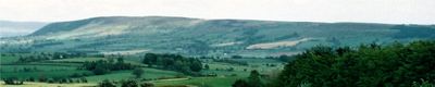
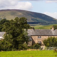
Longridge Fell is a hill in the Forest of Bowland area of Lancashire, reaching about 350 meters at its highest point and running roughly northeast for several kilometers. The northern side drops away steeply while the southern slopes are much gentler and open out gradually.
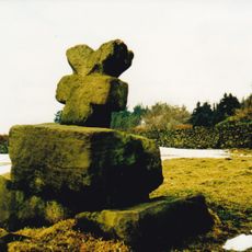
The fell was once used for stone quarrying, with the area around Tootle Heights being the main site of extraction over many decades. A water-filled pit near the Tan Yard bridlepath is the only visible trace of that activity today.
Longridge Fell draws walkers from nearby towns throughout the year, and the summit offers a wide view over the Ribble Valley that stretches toward the coast on clear days. The open moorland at the top gives a strong sense of being above the surrounding landscape.
Footpaths run up the western side of the hill for a direct route, while forest tracks from the south offer a longer and more gradual approach to the summit area. The steep northern slopes are best avoided when planning an ascent, as the southern side is far more accessible.
Despite belonging to an area called Forest of Bowland, the fell itself has very little tree cover and is mostly open moorland with heather. The name refers to an old meaning of the word forest as a hunting ground rather than a wooded area.
The community of curious travelers
AroundUs brings together thousands of curated places, local tips, and hidden gems, enriched daily by 60,000 contributors worldwide.