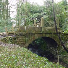
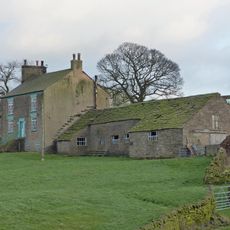
Mellor hill fort, Multiple enclosure hillfort in Stockport, England
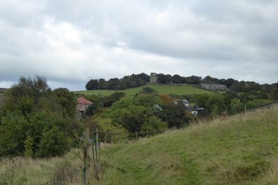
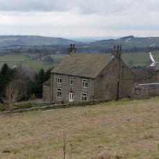
Mellor is an Iron Age settlement on a hilltop near Stockport, featuring two concentric defensive ditch systems for protection. The elevated position provides views across the Cheshire Plain and toward the western Peak District landscape.
The settlement was founded around 800 BC during the Iron Age and remained occupied until the 4th century AD. It spans the transition from Celtic to Romano-British periods, showing continuous use over many centuries.
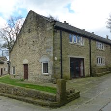
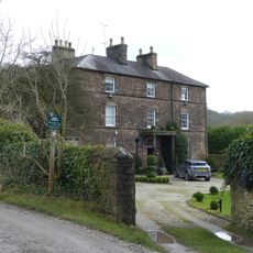
The name of this place reflects the ancient settlement that once stood on this elevated location. Visitors walking the site today can observe the shape of the defensive works and understand how important this position was to the Iron Age community living here.
The site is best explored on foot, and sturdy footwear is recommended due to the sloping terrain. It is helpful to check access details and special opening dates in advance to ensure a smooth visit.
Excavations reveal human activity dating back 10,000 years, with over 200 stone tools from hunter-gatherer communities. These discoveries show the hill was an important living space long before the Iron Age settlement took shape.
Location: Stockport
Inception: 1 Millenium BCE
GPS coordinates: 53.39720,-2.02840
Latest update: December 13, 2025 11:41
Mellor Hall
525 m
St. Thomas' Church, Mellor
39 m
Roman Lakes Leisure Park
1.7 km
Shaw Cairn
1.7 km
Goytcliffe Viaduct
1.9 km
Pear Tree Farmhouse
774 m
Marple Bridge
1.8 km
Bridge over mill stream immediately east of Bottoms Bridge
1.6 km
Bottoms Bridge
1.7 km
Stocks in graveyard of Church of St Thomas the Apostle
45 m
Mellor War Memorial
1.1 km
Marple Bridge United Reformed Church War Memorial
1.7 km
Culvert 10 metres to north of Bottoms Hall
1.5 km
Barn at Pear Tree Farm
785 m
Remains of Saxon cross in graveyard of Church of St Thomas the Apostle
36 m
Norfolk Arms And National Westminster Bank, Marple Bridge Branch
1.7 km
Sundial At Mellor Hall
455 m
Cross Base
1.8 km
Oldstones
733 m
Longshaw Clough Farmhouse and adjoining farm building
1.1 km
Outbuilding to west of Mellor Hall and north of barn
500 m
Outbuildings immediately south east of Old Hall Farmhouse
1.4 km
Tarden
871 m
Barn to south west of Mellor Hall
484 m
30 and 32, Mill Brow
717 m
Old Hall/Old Hall Farmhouse
1.5 km
Townscliffe Cottage, Townscliffe Farmhouse
662 m
Cobden Farmhouse
1.2 kmVisited this place? Tap the stars to rate it and share your experience / photos with the community! Try now! You can cancel it anytime.
Discover hidden gems everywhere you go!
From secret cafés to breathtaking viewpoints, skip the crowded tourist spots and find places that match your style. Our app makes it easy with voice search, smart filtering, route optimization, and insider tips from travelers worldwide. Download now for the complete mobile experience.
A unique approach to discovering new places❞
— Le Figaro
All the places worth exploring❞
— France Info
A tailor-made excursion in just a few clicks❞
— 20 Minutes