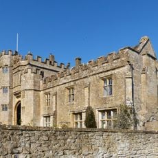
Montacute Castle, Medieval motte-and-bailey castle in Montacute, Somerset, England
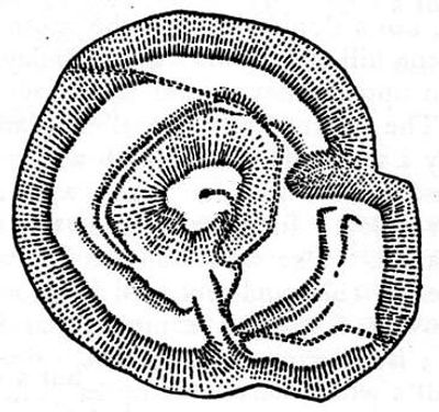
Montacute Castle is a Norman motte-and-bailey castle located on St Michael's Hill in Somerset, featuring an oval-shaped motte with inner and outer baileys. The remaining earthworks and defensive structures clearly display the medieval military design of the fortification.
Robert of Mortain built the castle after the Norman Conquest of 1066, establishing it as one of only two Somerset castles mentioned in the Domesday Book. The site's importance shifted when it took on religious purposes in the following century.
The site connects to Anglo-Saxon religious traditions through the discovery of a sacred cross that predates the Norman Conquest of England. This link to early spiritual history continues to shape how visitors understand the place today.
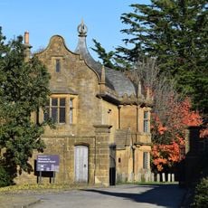
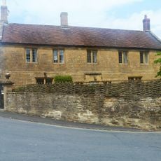
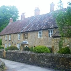
The castle grounds are accessible via marked pathways and offer clear views of the earthworks spread across the hilltop. Visitors should wear appropriate clothing for the weather, as the exposed location is subject to changing conditions.
In 1102 William of Mortain transferred the castle to the Cluniac order, marking an unusual shift from military stronghold to religious property. This transformation demonstrates how the site's purpose and use underwent complete change across the centuries.
Location: Montacute
GPS coordinates: 50.94990,-2.72233
Latest update: December 8, 2025 21:03
Church of St Catherine, Montacute
317 m
Abbey Farmhouse, Montacute
270 m
The Kings Arms Inn
284 m
House On Corner Of The Borough The Tudor Rose Tea Room
427 m
Post Office and K6 telephone call box adjoining
454 m
Abbey Gate
273 m
The Lodge, about 165 metres south-south-west of Montacute House
465 m
South West Gateway To Montacute House
462 m
23 And 24, The Borough
431 m
Priory Dovecote, About 90 Metres East South East Of Abbey Farmhouse
361 m
6, The Borough
480 m
10A, Middle Street
406 m
Monks House
398 m
10, Middle Street
401 m
The Old Bakery
477 m
11A, Middle Street
416 m
13, Middle Street
440 m
The Two Houses Immediately West Of, And Attached To No 27 The Borough
414 m
22, The Borough
432 m
Drinking Fountain
448 m
No 21 And Linking Wall To South
431 m
No 50, With Front Boundary Railings And North Wing Wall
284 m
3 And 4, The Borough
476 m
The Old Vicarage And Adjacent Gateway And Boundary Wall
321 m
Baytree Farmhouse
378 m
Tower On St Michaels Hill
12 m
29 And 30, Bishopston
307 m
Milestone, Montacute Road, beside allotment gardens, N of St Michael's Hill
414 mVisited this place? Tap the stars to rate it and share your experience / photos with the community! Try now! You can cancel it anytime.
Discover hidden gems everywhere you go!
From secret cafés to breathtaking viewpoints, skip the crowded tourist spots and find places that match your style. Our app makes it easy with voice search, smart filtering, route optimization, and insider tips from travelers worldwide. Download now for the complete mobile experience.
A unique approach to discovering new places❞
— Le Figaro
All the places worth exploring❞
— France Info
A tailor-made excursion in just a few clicks❞
— 20 Minutes