Montgomery Canal

Log in to your account

AroundUs is a community-driven map of interesting places, built by curious explorers like you. It grows with every review, story, and photo you share.
Connect to save your favorite spots, contribute locations, and create personalized routes.
Continue with Google
Continue with Apple
Continue with X
Continue with Facebook
Continue with email
By continuing, you accept our Terms and Conditions and our Privacy Policy
Create an account

Montgomery Canal

Add to collection
Map
Suggest a change
Share

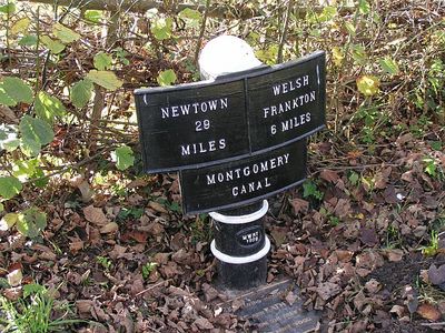
Montgomery Canal, Historic waterway in eastern Powys, Wales

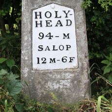
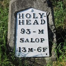
The Montgomery Canal is a waterway that extends across a considerable distance through the region, connecting several settlements and border areas. The route from Frankton Junction to Newtown passes through Llanymynech and Welshpool, with different sections in various states of restoration.

The canal received parliamentary approval in 1794 and took about 25 years to complete, designed to carry limestone and coal across the landscape. Traffic declined over time, and the lock closed in 1944, leaving the waterway unused for decades until restoration efforts began.

The waterway once moved goods that built the region's economy, with limestone and coal traveling its length to fuel growth. Today, local people work to restore it as a way to reconnect with their heritage and bring the landscape back to life.

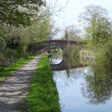
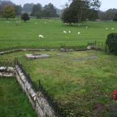
The open sections allow walks along the water's edge and wildlife watching in a quiet setting. Wear proper footwear since the paths can be slippery during wet months.

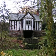
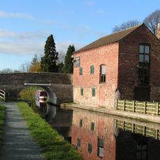
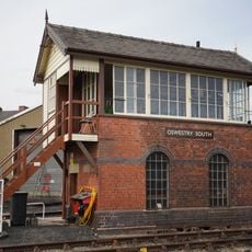
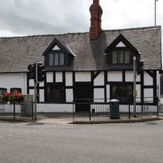
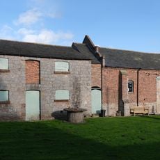
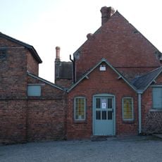
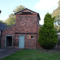
More than 100 structures line the canal, including a notable aqueduct crossing and a historic kiln that still displays its original chimney. These features show the engineering skill of the period and serve as important witnesses to industrial heritage.

Location: Powys

GPS coordinates: 52.82100,-3.00000

Latest update: December 10, 2025 15:53

Photos
Around this place
Cambrian Heritage Railways
United Kingdom

Cambrian Heritage Railways

4.5 km
Woodhouse
United Kingdom

Woodhouse

5.1 km
Knockin telescope
United Kingdom

Knockin telescope

3.5 km
Church of St Michael
United Kingdom

Church of St Michael

1.4 km
Church of Holy Trinity
United Kingdom

Church of Holy Trinity

5.4 km
Church of St Mary
United Kingdom

Church of St Mary

3 km
Pradoe Church
United Kingdom

Pradoe Church

3.7 km
Church of St Mary
United Kingdom

Church of St Mary

4.5 km
St Winifred's Well
United Kingdom

St Winifred's Well

987 m
Shropshire Union Canal Bridge Number 79
United Kingdom

Shropshire Union Canal Bridge Number 79

1.4 km
Bennion/Lewis Memorial Abutting East End Of Vestry Of Church Of St Oswald
United Kingdom

Bennion/Lewis Memorial Abutting East End Of Vestry Of Church Of St Oswald

5.6 km
St Chad
United Kingdom

St Chad

4.8 km
Knockin War Memorial
United Kingdom

Knockin War Memorial

3.1 km
Spiggots Bridge
United Kingdom

Spiggots Bridge

1.7 km
St John the Baptist
United Kingdom

St John the Baptist

1.8 km
Bridge And Watering Place For Cattle Approximately 50 Metres South Of Church Of St Mary
United Kingdom

Bridge And Watering Place For Cattle Approximately 50 Metres South Of Church Of St Mary

3.1 km
Oswestry South Signal Box
United Kingdom

Oswestry South Signal Box

5.5 km
Milestone At Ngr Sj 3525 2350
United Kingdom

Milestone At Ngr Sj 3525 2350

3.1 km
Maesbury War Memorial
United Kingdom

Maesbury War Memorial

1.8 km
2, Lower Brook Street
United Kingdom

2, Lower Brook Street

5.5 km
Ha-Ha To South And West Of Sweeney Hall Incorporating Non Conformist Cemetery At South West Corner
United Kingdom

Ha-Ha To South And West Of Sweeney Hall Incorporating Non Conformist Cemetery At South West Corner

3.6 km
Milestone At Ngr Sj 3487 2503
United Kingdom

Milestone At Ngr Sj 3487 2503

2.2 km
Barn Approximately 40 Metres East Of Sweeney Hall
United Kingdom

Barn Approximately 40 Metres East Of Sweeney Hall

3.6 km
Old House
United Kingdom

Old House

3.1 km
Milestone At Ngr Sj 3417 2643
United Kingdom

Milestone At Ngr Sj 3417 2643

1.8 km
Outbuilding And Attached Brick Wall In Courtyard To Rear Of Sweeney Hall
United Kingdom

Outbuilding And Attached Brick Wall In Courtyard To Rear Of Sweeney Hall

3.6 km
Milestone At Ngr Sj 3154 2792
United Kingdom

Milestone At Ngr Sj 3154 2792

2.9 km
Fowl House/Dovecote Attached To North East Corner Of Sweeney Hall
United Kingdom

Fowl House/Dovecote Attached To North East Corner Of Sweeney Hall

3.6 km
Show the full map
Reviews

Visited this place? Tap the stars to rate it and share your experience / photos with the community! Try now! You can cancel it anytime.

« Montgomery Canal - Historic waterway in eastern Powys, Wales » is provided by Around Us (aroundus.com). Images and texts are derived from Wikimedia project under a Creative Commons license. You are allowed to copy, distribute, and modify copies of this page, under the conditions set by the license, as long as this note is clearly visible.

Discover hidden gems everywhere you go!

From secret cafés to breathtaking viewpoints, skip the crowded tourist spots and find places that match your style. Our app makes it easy with voice search, smart filtering, route optimization, and insider tips from travelers worldwide. Download now for the complete mobile experience.

Around Us App Screenshot

A unique approach to discovering new places

Le Figaro

All the places worth exploring

France Info

A tailor-made excursion in just a few clicks

20 Minutes