Mulgrave Castle, Grade I listed medieval castle in Lythe, United Kingdom.
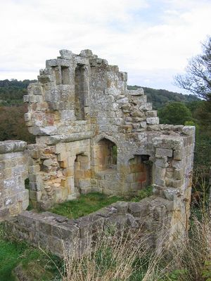
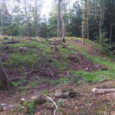
Mulgrave Castle is a medieval fortification located west of Whitby, with stone walls spreading across a ridge and two guard towers marking its entrance. Defensive ditches and reinforced walls shape the layout of the site and remain its most visible features.
Parliament ordered its destruction in 1647 during the English Civil War, using explosives to dismantle the stone structure. This marked the end of the fortress as a functioning defensive site.
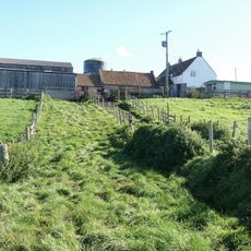
The estate reflects the work of Humphry Repton, a landscape designer who shaped its grounds in 1792 with principles meant to harmonize nature and architecture. You can see today how the surrounding land was deliberately arranged to frame the ruins.
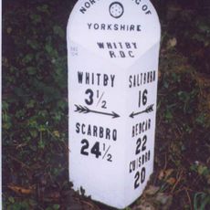
The site sits roughly 6 kilometers west of Whitby with multiple access points, including a main entrance near Lythe village. The terrain includes slopes and uneven ground, so sturdy footwear is advisable for exploring the ruins.
Local legend credits the original fortress to Wada, a 6th-century ruler from Hälsingland who supposedly built numerous fortifications across Yorkshire. This story shows how the place remained rooted in regional memory across the centuries.
Location: Whitby
GPS coordinates: 54.49350,-0.70560
Latest update: December 7, 2025 19:30
Church of St Oswald, Lythe
1.8 km
Church of St Margaret
3.6 km
Lythe War Memorial
1.8 km
The Fox and Hounds Public House
2.9 km
Milestone, Lythe Bank, N of Sandsend
2.1 km
Aislaby War Memorial
3.5 km
Rose Cottage
1.5 km
Raw Pastures Farmhouse
3 km
Middle Farmhouse
1.5 km
Low Farmhouse
1.6 km
Milestone, High Street East Barnby, jct with Ashton Lane and Maltby Lane
1.9 km
Abingdon House and house adjoining to west
1.5 km
Foss Castle
743 m
Barnby Tofts Farmhouse
2.9 km
Oakdene
1.6 km
Raven Hill Farmhouse And Barn Adjoining
2.6 km
Greystone Farmhouse
3.2 km
Overdale Farmhouse
2.6 km
Standing stone on Brockrigg known as Wade's Stone, 420m south east of Brockrigg Farm
2.9 km
High Farmhouse
1.5 km
Milestone, nr Bends sign
2.9 km
Swarth Howe Cross
3 km
Milestone, Guisborough Road opp track to farm
3 km
Fairfax Farm House
1.8 km
High Farmhouse and barn adjoining
3 km
Woodbine Cottage and Rose Cottage
3.1 km
Cobbler Cottage and outbuilding attached on right
1.5 km
Holly Cottage
1.6 kmVisited this place? Tap the stars to rate it and share your experience / photos with the community! Try now! You can cancel it anytime.
Discover hidden gems everywhere you go!
From secret cafés to breathtaking viewpoints, skip the crowded tourist spots and find places that match your style. Our app makes it easy with voice search, smart filtering, route optimization, and insider tips from travelers worldwide. Download now for the complete mobile experience.
A unique approach to discovering new places❞
— Le Figaro
All the places worth exploring❞
— France Info
A tailor-made excursion in just a few clicks❞
— 20 Minutes