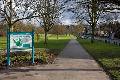
Oak Hill Park, Public park in East Barnet, England
Oak Hill Park is a public green space in East Barnet with tennis courts, sports fields, an outdoor fitness area, and multiple play areas. The different sections connect through walking paths that allow visitors to explore the full range of recreational facilities.
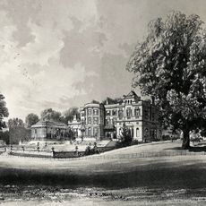
The land was owned by St Albans Abbey until 1536, when church properties were sold following a major shift in land ownership. Prominent families subsequently managed and shaped the estate before it eventually became a public park for the community.
The park serves as a gathering place where neighbors come together for weekly running clubs and local sports activities. People use the open areas to exercise, socialize, and participate in community life throughout the week.
The park can be entered from several points including Church Hill Road, Parkside Gardens, Daneland, and Vernon Crescent with bus stops nearby. Visitors will find it easy to locate an entrance close to where they are and can use public transport to arrive at the site.
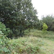
The site contains descendants of oak trees that were originally used during medieval construction of St Albans Abbey. These old trees provide a living link to the location's long history, though many visitors pass by without noticing them.
Location: London Borough of Barnet
Operator: Barnet Council
GPS coordinates: 51.63780,-0.15490
Latest update: December 12, 2025 14:26
Barnet House, London
1.7 km
St Mary the Virgin, East Barnet
290 m
Christ Church, Cockfosters
1.6 km
Oakleigh Park Rail Cutting
725 m
East Barnet War Memorial
765 m
Christ the King, Cockfosters
1.4 km
Little Grove
797 m
Holy Trinity Lyonsdown
1.8 km
All Saints' Church
1.2 km
St Mary Magdalen Catholic Church, Whetstone
1.5 km
Barnet Synagogue
1.6 km
Christ Church at Whetstone
1.4 km
St Andrew's Church
1.6 km
Barfield Allotments Nature Park
1.2 km
East Barnet Library
872 m
Memorial To German First World War Internees, New Southgate Cemetery
1.6 km
Osidge Library
919 m
Clarke Family Monument In St Marys Churchyard
257 m
1264, High Road N20
1.6 km
De Bohun School
1.2 km
St James's Primary School
1.7 km
The Whetstone Outside The Griffin Public House Number 1262
1.6 km
The Abbey Church of Christ the King
1.5 km
1270, High Road N20
1.6 km
The Limes
1.6 km
Group Of 6 Tombstones To The Grove Family In St Marys Churchyard
268 m
Longmore Avenue railway bridge
1.2 km
1266 And 1268, High Road N20
1.6 kmVisited this place? Tap the stars to rate it and share your experience / photos with the community! Try now! You can cancel it anytime.
Discover hidden gems everywhere you go!
From secret cafés to breathtaking viewpoints, skip the crowded tourist spots and find places that match your style. Our app makes it easy with voice search, smart filtering, route optimization, and insider tips from travelers worldwide. Download now for the complete mobile experience.
A unique approach to discovering new places❞
— Le Figaro
All the places worth exploring❞
— France Info
A tailor-made excursion in just a few clicks❞
— 20 Minutes