Otmoor RSPB reserve, Nature reserve in Fencott and Murcott, England
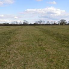
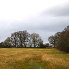
Otmoor RSPB reserve is a 400-hectare expanse of wetland and grassland featuring interconnected water channels and open meadows. This habitat supports diverse bird populations that shift seasonally, making it a dynamic environment throughout the year.
The land underwent major changes in the early 1800s following the Enclosure Act of 1815, which prompted drainage projects across the area. These interventions sparked considerable resistance from local farming communities.
The reserve's distinct geometric field patterns influenced Lewis Carroll during the creation of Through the Looking Glass chess sequences.
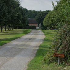
The reserve features multiple observation points and walking paths that can be accessed from parking areas near the entrance. Visitors should wear sturdy footwear and bring weather-appropriate clothing since the ground is often wet and muddy.
An active Ministry of Defence rifle range sits directly adjacent to the reserve, creating an uncommon pairing of military operations and nature conservation. This unusual arrangement demonstrates how different land uses can coexist in the same area.
Location: Fencott and Murcott
Location: Noke
GPS coordinates: 51.82640,-1.18250
Latest update: December 14, 2025 11:22
Beckley Park
2.8 km
Woodperry House
4.2 km
Studley Priory, Oxfordshire
4 km
St Nicholas' Church, Islip
3.8 km
The Manor Country House Hotel
5 km
Wendlebury Meads and Mansmoor Closes
3 km
Woodsides Meadow
3.3 km
Church of St Barnabas
3.5 km
Church of the Holy Rood, Woodeaton
3.9 km
Church of St Giles
2.4 km
Church of St Andrew
1.2 km
Church of St Swithin
3.6 km
Church of the Assumption of the Blessed Virgin Mary
3.3 km
Church of St Mary the Virgin
1.3 km
Murcott Mission Room
2.5 km
The Nut Tree Public House
2.5 km
Islip (Oxfordshire) War Memorial
3.8 km
The Abingdon Arms Public House
3.3 km
Old Arngrove Farm
4.6 km
Northfield Farmhouse
5 km
Woodeaton Cross
3.9 km
Manor House, Water Tower, Workshops And Attached Walls Approximately 70 Metres To South East
3.9 km
Manor House
4 km
Merton Grounds Farmhouse
4.8 km
Church of St Swithun, Churchyard Cross Approximately 25 Metres to South East
3.5 km
Studley Almshouses
4 km
Churchyard Cross Approximately 5 Metres South West Of Church Of St Mary The Virgin
1.3 km
Milestone, S end of village 30m E of sharp bend, by village Hall
4.9 kmVisited this place? Tap the stars to rate it and share your experience / photos with the community! Try now! You can cancel it anytime.
Discover hidden gems everywhere you go!
From secret cafés to breathtaking viewpoints, skip the crowded tourist spots and find places that match your style. Our app makes it easy with voice search, smart filtering, route optimization, and insider tips from travelers worldwide. Download now for the complete mobile experience.
A unique approach to discovering new places❞
— Le Figaro
All the places worth exploring❞
— France Info
A tailor-made excursion in just a few clicks❞
— 20 Minutes