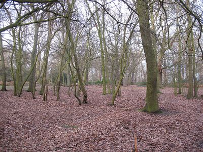
Oxleas Wood, Ancient woodland in Royal Borough of Greenwich, United Kingdom.
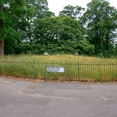
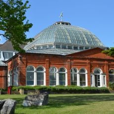
Oxleas Wood is an ancient woodland spanning 77 hectares in Royal Borough of Greenwich, featuring oak, birch, hornbeam, and hazel trees throughout the site. Walking paths, outdoor fitness equipment, sports areas, and a cafe at the hilltop meadow are available to visitors.
The woodland formed after the last ice age roughly 8,000 years ago and came under Shaw family management beginning in 1679. This family stewardship lasted more than a century until 1811.
The site serves as a gathering place where local residents walk, run, and rest among the trees throughout the seasons. People use the meadows and woodlands as part of their everyday connection to nature.
The site is easy to navigate with marked trails for various fitness levels and interests. Public restrooms at the cafe and plenty of space for different group sizes make visits straightforward.
Underground water reservoirs beneath Oxleas Meadow supply water to local communities, revealing the woodland's critical role for the region. The Wogebourne stream and other waterways originate within this forest.
Location: Royal Borough of Greenwich
GPS coordinates: 51.46700,0.06600
Latest update: December 8, 2025 19:51
Severndroog Castle
425 m
Woolwich Common
1.4 km
The Tudor Barn
1.6 km
The History of the Old Kent Road
1.8 km
Plumstead Common Windmill
2.1 km
85-91 Genesta Road
1.4 km
Shrewsbury Barrow
909 m
The Green
2.3 km
Eltham Library
1.9 km
Church of St Luke
881 m
Ypres Memorial Milestone
517 m
Major Little Memorial, Woolwich
1.7 km
The Bull Public House
259 m
Christ Church
505 m
8th London Howitzer Brigade War Memorial
1.8 km
Main Building, Royal Military Academy
1.1 km
Water Tower At East Side Of Junction With Cleanthus Road
280 m
Mounting Block, Shooter's Hill
238 m
Shrewsbury House, Including Boundary Walls And Gates, Pergola, Terrace Walling, Steps And Gazebo
847 m
Avery Hill Training College (Entrance Gate And Adjoining Lodge)
1.8 km
Slade Centre Library
1.9 km
K2 Telephone Kiosk Outside Water Board Reservoir
1.8 km
Christ Church War Memorial
652 m
Avery Hill Training College (Conservatory)
2 km
Conduit Head, Eltham
2 km
Fire Station, With Flats For Fire Officers Above
821 m
Milestone Opposite And To The East Of Entrance To Gravel Pit Lane
1.7 km
Milestone, Shooters Hill, by No. 57, Prospect Cottage
519 mVisited this place? Tap the stars to rate it and share your experience / photos with the community! Try now! You can cancel it anytime.
Discover hidden gems everywhere you go!
From secret cafés to breathtaking viewpoints, skip the crowded tourist spots and find places that match your style. Our app makes it easy with voice search, smart filtering, route optimization, and insider tips from travelers worldwide. Download now for the complete mobile experience.
A unique approach to discovering new places❞
— Le Figaro
All the places worth exploring❞
— France Info
A tailor-made excursion in just a few clicks❞
— 20 Minutes