Enable Location

We need your location to show you interesting places around you

Discover nearby places

Find interesting locations and hidden gems around you

Precise directions

Get accurate directions and distances to places

Your location is never shared with other users. It's only used when you tap the location button.

The Tudor Barn

Log in to your account

Start exploring — it's free

Trusted by 62,474 travelers worldwide

Continue with Google
Continue with Apple
or

We will send you a code to connect

By continuing, you accept our Terms and Conditions and our Privacy Policy

Check your inbox

We've sent a pincode in your inbox. Please enter the code below.

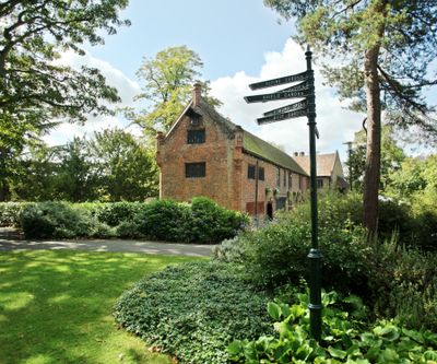
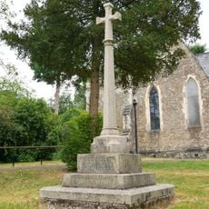
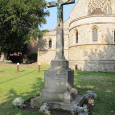
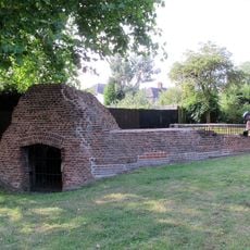
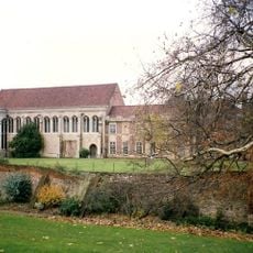
The Tudor Barn, Grade II* listed barn in Eltham, Royal Borough of Greenwich, England.

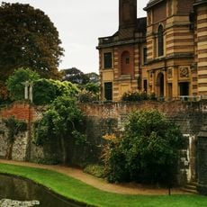
The Tudor Barn is a timber-framed structure with brick walls located in Well Hall Pleasaunce park, originally built to store agricultural goods. Today it contains multiple floors with various rooms that include dining and event spaces for different gatherings.

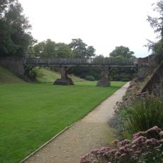
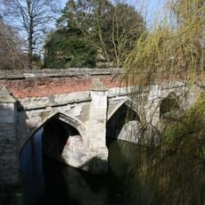
Built in 1525 by William Roper, who married Thomas More's daughter Margaret, the barn was part of a larger estate surrounded by a protective moat. This connection to the More family gave it importance beyond its agricultural function.

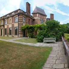
The space serves as a venue for weddings, concerts, and exhibitions, drawing people together for important celebrations and events. Its role as a gathering place shows how the structure has evolved to remain part of the local community's life.

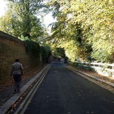
The barn is easily accessible within Well Hall Pleasaunce park and accommodates visitors across multiple floors for various types of events and visits. Being situated within the park grounds makes it convenient to reach and explore.

Children's author Edith Nesbit, who wrote The Railway Children, lived on the grounds from 1899 to 1921 and created some of her best-known works during her time there. This literary connection adds a cultural layer to the visitor experience.

The community of curious travelers

AroundUs brings together thousands of curated places, local tips, and hidden gems, enriched daily by 60,000 contributors worldwide.

Start exploring
GPS coordinates
51.45700,0.04902
Latest update
December 14, 2025 09:45
Around this place
Eltham Palace
United Kingdom

Eltham Palace

1.1 km
Ferrier Estate
United Kingdom

Ferrier Estate

1.6 km
Severndroog Castle
United Kingdom

Severndroog Castle

1.3 km
Bob Hope Theatre
United Kingdom

Bob Hope Theatre

851 m
Sutcliffe Park
United Kingdom

Sutcliffe Park

1.4 km
Church of Holy Trinity
United Kingdom

Church of Holy Trinity

1.4 km
Birdbrook Road Nature Reserve
United Kingdom

Birdbrook Road Nature Reserve

1.2 km
Eltham Palace
United Kingdom

Eltham Palace

1.1 km
Church of St John the Baptist
United Kingdom

Church of St John the Baptist

673 m
Eltham Library
United Kingdom

Eltham Library

907 m
Church of St Saviour
United Kingdom

Church of St Saviour

1.3 km
Church of St Luke
United Kingdom

Church of St Luke

769 m
Cliefden House
United Kingdom

Cliefden House

763 m
Corelli College (formerly Kidbrooke Comprehensive School for Girls)
United Kingdom

Corelli College (formerly Kidbrooke Comprehensive School for Girls)

1.4 km
Eltham Court (Eltham Palace)
United Kingdom

Eltham Court (Eltham Palace)

1.1 km
Eltham War Memorial
United Kingdom

Eltham War Memorial

689 m
Convent Of St Mary
United Kingdom

Convent Of St Mary

905 m
K2 Telephone Kiosk Outside Water Board Reservoir
United Kingdom

K2 Telephone Kiosk Outside Water Board Reservoir

1.1 km
Remains Of South Bridge Across Eltham Palace Moat
United Kingdom

Remains Of South Bridge Across Eltham Palace Moat

1.2 km
Old Wall Along South And East Sides Of Churchyard, Church Of St John The Baptist
United Kingdom

Old Wall Along South And East Sides Of Churchyard, Church Of St John The Baptist

702 m
Christ Church War Memorial
United Kingdom

Christ Church War Memorial

1 km
Holy Trinity Church War Memorial
United Kingdom

Holy Trinity Church War Memorial

1.4 km
Milestone Fixed To The Wall Of The Chequers Public House (Number 34)
United Kingdom

Milestone Fixed To The Wall Of The Chequers Public House (Number 34)

665 m
Conduit Head, Eltham
United Kingdom

Conduit Head, Eltham

1.5 km
North Bridge Across Eltham Palace Moat
United Kingdom

North Bridge Across Eltham Palace Moat

1.1 km
Walls Of Inner Courtyard To Eltham Palace, With Chambers Adjoining
United Kingdom

Walls Of Inner Courtyard To Eltham Palace, With Chambers Adjoining

1 km
North Boundary Wall, Entrance Gateway And Spur Wall With Gateway In Grounds To North Of House Called The Tilt Yard
United Kingdom

North Boundary Wall, Entrance Gateway And Spur Wall With Gateway In Grounds To North Of House Called The Tilt Yard

1 km
Milestone, Eltham Road, Eof Kidbrooke Park Road, S of Sutcliffe Park (stadium)
United Kingdom

Milestone, Eltham Road, Eof Kidbrooke Park Road, S of Sutcliffe Park (stadium)

1.6 km
Show the full map
« The Tudor Barn - Grade II* listed barn in Eltham, Royal Borough of Greenwich, England » is provided by Around Us (aroundus.com). Images and texts are derived from Wikimedia project under a Creative Commons license. You are allowed to copy, distribute, and modify copies of this page, under the conditions set by the license, as long as this note is clearly visible.

Discover hidden gems everywhere you go!

From secret cafés to breathtaking viewpoints, skip the crowded tourist spots and find places that match your style. Our app makes it easy with voice search, smart filtering, route optimization, and insider tips from travelers worldwide. Download now for the complete mobile experience.

Around Us App Screenshot

A unique approach to discovering new places

Le Figaro

All the places worth exploring

France Info

A tailor-made excursion in just a few clicks

20 Minutes

Around Us
Travel Guide & Maps
Download

Send to your phone

QR Code
1

Open the camera app on your mobile.

2

Point at the QR code with your camera. A notification will appear.

3

Tap the notification to open the link.