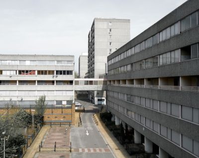
Ferrier Estate, Post-war housing estate in Kidbrooke, London, United Kingdom
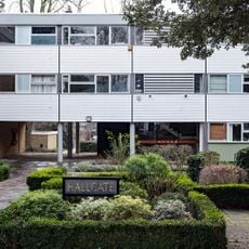
The Ferrier Estate was a residential settlement in Kidbrooke made up of 74 building blocks containing low-rise houses and tall towers. These structures spread across open green areas and shaped the southern London landscape for decades.
The settlement arose between 1968 and 1972 through the London council authority on the grounds of a former RAF base. Rapid construction was achieved through prefabricated concrete sections that served as an innovative building method of the post-war period.
The estate housed numerous refugee families and represented a significant example of post-war social housing design focused on community-centered living.
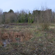
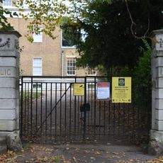
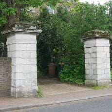
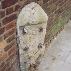
The location no longer exists today as demolition began in 2009 and the site was redeveloped. Visitors can still find individual structural remnants or historical records to learn more about the former settlement layout.
The settlement contained eleven 12-story towers split across two separate building sites, with each group having its own central heating facilities. This unusual division shows how planners tried to break large complexes into manageable units.
GPS coordinates: 51.46000,0.02700
Latest update: December 7, 2025 20:46
Morden College
1.2 km
Manor House Gardens
1.5 km
Sutcliffe Park
574 m
Blackheath Halls
1.3 km
Church of St Michael and All Angels
1.1 km
The Tudor Barn
1.6 km
The Clarendon Hotel
1.5 km
Blackheath Quaker Meeting House with cobbled area of forecourt
1.5 km
All Saints' Parish Hall
1.6 km
Birdbrook Road Nature Reserve
460 m
Church of St Saviour
1.5 km
Manor House Library
1.6 km
Church of St James
1.1 km
Roman Catholic Church of St Mary
1.3 km
3 And 4, Cresswell Park Se3
1.3 km
Museum of Neoliberalism
1.1 km
Corelli College (formerly Kidbrooke Comprehensive School for Girls)
1.5 km
Christ's College Preparatory School
1.6 km
Colonnade House
1.5 km
Paragon House
1.5 km
Men of St Peter's War Memorial, Lee
475 m
23-27, Tranquil Vale Se3
1.5 km
3-14, South Row
1.5 km
Hallgate
962 m
Gate Piers At Lee Public Library
1.6 km
Gate Piers To North Of Colonnade House
1.5 km
Milestone, Lee High Road, W of jct with Lenham Road
1.4 km
Milestone, Eltham Road, Eof Kidbrooke Park Road, S of Sutcliffe Park (stadium)
748 mReviews
Visited this place? Tap the stars to rate it and share your experience / photos with the community! Try now! You can cancel it anytime.
Discover hidden gems everywhere you go!
From secret cafés to breathtaking viewpoints, skip the crowded tourist spots and find places that match your style. Our app makes it easy with voice search, smart filtering, route optimization, and insider tips from travelers worldwide. Download now for the complete mobile experience.
A unique approach to discovering new places❞
— Le Figaro
All the places worth exploring❞
— France Info
A tailor-made excursion in just a few clicks❞
— 20 Minutes