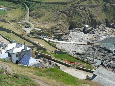
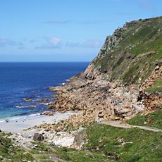
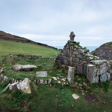
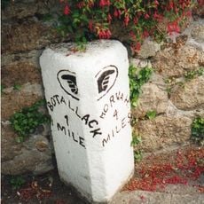
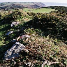
Priest Cove, Rocky cove near St Just, England
Priest Cove is a rocky cove near St Just featuring a granite coastline with a man-made saltwater swimming pool carved into the rocks beside Cape Cornwall Headland. This natural basin provides a sheltered bathing spot within the dramatic coastal landscape.
In the 1830s, the cove was used for attempts to establish a pilchard fishery with cellars carved into the rocks. The exposed coastal location ultimately prevented the venture from succeeding commercially.
The cove hosts an annual swimming event to the Brisons, two small islands offshore, which draws together local residents and visitors. This gathering reflects the community's deep connection to the sea and has become part of local tradition.
The National Trust car park situated behind the beach provides access to the cove with a cafe, toilets, and shop. These facilities make a visit straightforward and comfortable for families and all visitors.
The granite formations exposed in the rocks contain minerals such as quartz, feldspar, and tourmaline that visitors can observe in the cliff walls. This geological feature makes the site interesting for those curious about the Earth's natural structures.
Location: St Just
GPS coordinates: 50.12500,-5.70600
Latest update: December 14, 2025 13:03
Porth Nanven
959 m
St Just in Penwith Parish Church
1.9 km
Ballowall Barrow
447 m
The Wellington Hotel
1.9 km
4, Church Street
1.9 km
The Star Inn
1.9 km
The Queen's Arms Inn
2 km
The Kings Arms Inn
1.9 km
Commercial Hotel
1.9 km
Porthledden House
490 m
Cot Mill
1.8 km
War Memorial Clock Tower
1.8 km
Mining Chimney
315 m
Cargodna Pumping House
1.7 km
Cape Cornwall Chimney
317 m
Carrallack House
1.6 km
Medieval chapel called St Helen's Chapel with a dwelling and enclosure at Cape Cornwall
290 m
1 and 2, Market Street
1.8 km
K6 Telephone Kiosk
1.9 km
Churchyard cross in St Just's churchyard, 10m west of the church
1.9 km
Milestone Approximately 28M S Of No. 1 Trenhare
1.9 km
Round cairn on Carn Polpry
1.8 km
Cross slab at parish church
1.9 km
Churchyard Wall
1.9 km
Tin mine calciner at Botallack Mine
2 km
6, Market Square
1.9 km
The Ballowall Barrow incorporating entrance grave, cairn, ritual pits and cists 420m WSW of Bollowal Farm
444 m
Methodist Church (former Wesleyan Chapel) And Attached Vestry
1.7 kmVisited this place? Tap the stars to rate it and share your experience / photos with the community! Try now! You can cancel it anytime.
Discover hidden gems everywhere you go!
From secret cafés to breathtaking viewpoints, skip the crowded tourist spots and find places that match your style. Our app makes it easy with voice search, smart filtering, route optimization, and insider tips from travelers worldwide. Download now for the complete mobile experience.
A unique approach to discovering new places❞
— Le Figaro
All the places worth exploring❞
— France Info
A tailor-made excursion in just a few clicks❞
— 20 Minutes