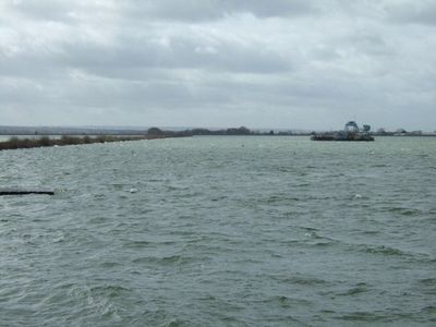
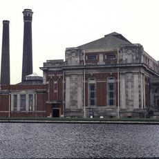
Queen Mary Reservoir, lake in the United Kingdom
Queen Mary Reservoir is a large water storage facility in Spelthorne surrounded by pathways where visitors can view the water from various points along its shore. The site functions both as a water supply source for the region and as a space for recreational pursuits and water sports like sailing.
The reservoir was constructed in the mid-20th century to secure water supply for the region and support the growth of surrounding communities. Over time it evolved from a purely functional water storage facility into a place where the community also gathers for leisure and water sports.
The site has parking areas and changing facilities with equipment storage that simplify and make visiting comfortable. The flat landscape and well-maintained paths allow most visitors to easily explore and enjoy the area without difficulty.
A sailing club based at the reservoir offers courses and boat rentals for both beginners and experienced enthusiasts, making the water easily accessible. The club has become the hub of the local water sports community and regularly hosts competitions and training sessions.
The community of curious travelers
AroundUs brings together thousands of curated places, local tips, and hidden gems, enriched daily by 60,000 contributors worldwide.