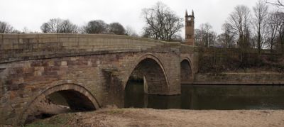
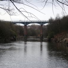
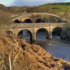
Ringley Old Bridge, Stone footbridge in Kearsley, England
Ringley Old Bridge is a stone footbridge that crosses the River Irwell between Ringley and Stoneclough in Greater Manchester, featuring three arches including two large semi-circular spans and a smaller western arch originally built for the tow path. The bridge carries pedestrians across the river and links these two communities on either bank.
The bridge was built in 1677 to replace a wooden structure that had been destroyed by flooding four years earlier, representing an important infrastructure upgrade for the area. This stone construction proved far more durable than its wooden predecessor against the river's seasonal challenges.
The bridge stands near historical village stocks, creating a preserved area that represents the traditional methods of local justice and community governance.
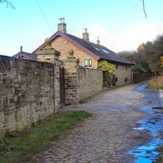
The bridge is easily accessible on foot from both Ringley and Stoneclough, with no special equipment or preparation needed for a crossing. A leisurely walk across and around the bridge allows you to take in the structure and surrounding riverside setting at your own pace.
The bridge features triangular cut waters between its main arches that serve as refuge spaces within the simple parapet, showing skilled engineering from the 17th century. These thoughtful details allowed workers and pedestrians to find shelter during high water events.
The community of curious travelers
AroundUs brings together thousands of curated places, local tips, and hidden gems, enriched daily by 60,000 contributors worldwide.