Chest opened
+${chestReward.xp} XP
Explorer
NOUVEAU ×${chestReward.collectible.quantity}
tapez pour fermer
Chest locked

Open chests in the app

Around Us is built for your phone — chests unlock when you walk, explore and capture nearby places.

Enable Location

We need your location to show you interesting places around you

Discover nearby places

Find interesting locations and hidden gems around you

Precise directions

Get accurate directions and distances to places

Your location is never shared with other users. It's only used when you tap the location button.

Log in to your account

Start exploring — it's free

Trusted by 72,891 travelers worldwide

Continue with Google
Continue with Apple
or

We will send you a code to connect

By continuing, you accept our Terms and Conditions and our Privacy Policy

Check your inbox

We've sent a pincode in your inbox. Please enter the code below.

River Croco
Discussion Reviews Photo
3.4k Popularity

River Croco, Brook in Cheshire West and Chester, England

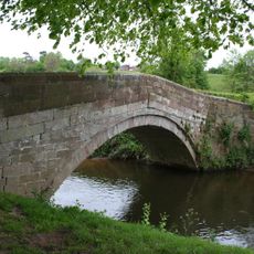
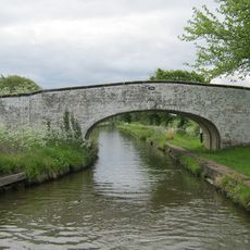
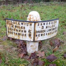
River Croco is a brook that winds through the Cheshire landscape, originating west of Congleton and joining the River Dane at Middlewich. Along its course, the waterway passes under the London Road and the M6 motorway, with several spots where visitors can observe nature or walk nearby.

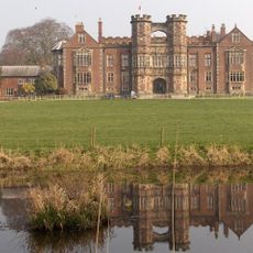
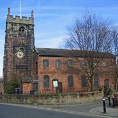
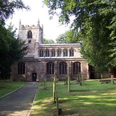
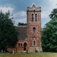
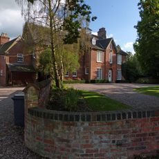
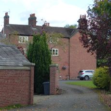
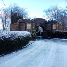
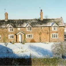
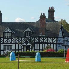
The brook has been documented since at least the 16th century, flowing past significant local landmarks such as Brereton Church and its associated hall. These early records show the waterway shaped the local area over a long period.

The name of River Croco holds potential Celtic linguistic roots, reflecting the historical nomenclature patterns of British waterways.

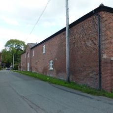
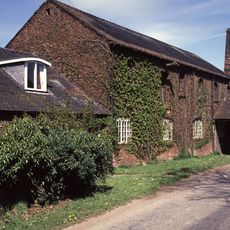
The water is easily accessible from several points where you can observe it or take walks. Its proximity to roads and the motorway makes it easy to reach, even if you want to explore the surrounding area.

Near Brereton Hall, the river includes a weir system that created Brereton Pool, demonstrating historical water management techniques.

The community of curious travelers

AroundUs brings together thousands of curated places, local tips, and hidden gems, enriched daily by 60,000 contributors worldwide.

Start exploring
GPS coordinates
53.19546,-2.37148
Latest update
December 12, 2025 07:58
Around this place
Brereton Hall
United Kingdom

Brereton Hall

3.3 km
Cranage Hall
United Kingdom

Cranage Hall

1.8 km
St Luke's Church, Holmes Chapel
United Kingdom

St Luke's Church, Holmes Chapel

1.2 km
St Oswald's Church, Brereton
United Kingdom

St Oswald's Church, Brereton

3.4 km
St John the Evangelist's Church, Byley
United Kingdom

St John the Evangelist's Church, Byley

4.1 km
Twemlow Viaduct
United Kingdom

Twemlow Viaduct

2.2 km
The Bear's Head Hotel
United Kingdom

The Bear's Head Hotel

3.2 km
Hermitage Bridge
United Kingdom

Hermitage Bridge

1.8 km
Trent and Mersey Canal Bridge Number 164
United Kingdom

Trent and Mersey Canal Bridge Number 164

4.1 km
Holmes Chapel Library
United Kingdom

Holmes Chapel Library

1.2 km
The Red Lion
United Kingdom

The Red Lion

1.2 km
Pillared haybarn 80 metres north west of Park House Farmhouse
United Kingdom

Pillared haybarn 80 metres north west of Park House Farmhouse

2.2 km
Old Rectory
United Kingdom

Old Rectory

3.2 km
Sundial 10 metres south of east bay of nave of Church of St. Oswald
United Kingdom

Sundial 10 metres south of east bay of nave of Church of St. Oswald

3.4 km
Farm building comprising barn, shippon, stables and cartshed 40 metres west of Park House Farmhouse
United Kingdom

Farm building comprising barn, shippon, stables and cartshed 40 metres west of Park House Farmhouse

2.2 km
Milepost at 7678 6587
United Kingdom

Milepost at 7678 6587

1.6 km
Park House Farmhouse
United Kingdom

Park House Farmhouse

2.2 km
South Lodge to Brereton Hall School
United Kingdom

South Lodge to Brereton Hall School

3.3 km
Canal Milepost South Of Bridge No 164 At Sj 7255 6348
United Kingdom

Canal Milepost South Of Bridge No 164 At Sj 7255 6348

4.1 km
Milepost at 7744 6456
United Kingdom

Milepost at 7744 6456

3 km
Milepost 200 metres south east of Tetton Lane junction
United Kingdom

Milepost 200 metres south east of Tetton Lane junction

4.1 km
Bridge Farmhouse
United Kingdom

Bridge Farmhouse

1.9 km
Hollins Farmhouse
United Kingdom

Hollins Farmhouse

2.1 km
Park Mill And Park Cottage
United Kingdom

Park Mill And Park Cottage

2.2 km
Mile post 5 metres south of Byley Lane junction
United Kingdom

Mile post 5 metres south of Byley Lane junction

2 km
Milepost, W of Holmes Chapel
United Kingdom

Milepost, W of Holmes Chapel

755 m
Milepost, roadside at SJ769673
United Kingdom

Milepost, roadside at SJ769673

1.8 km
Milepost, SW of Twemlow Green
United Kingdom

Milepost, SW of Twemlow Green

3.1 km
Show the full map
Reviews
Share your experience

No review yet

Discussions
Start a discussion...

No discussion yet

« River Croco - Brook in Cheshire West and Chester, England » is provided by Around Us (aroundus.com). Images and texts are derived from Wikimedia project under a Creative Commons license. You are allowed to copy, distribute, and modify copies of this page, under the conditions set by the license, as long as this note is clearly visible.

Discover hidden gems everywhere you go!

From secret cafés to breathtaking viewpoints, skip the crowded tourist spots and find places that match your style. Our app makes it easy with voice search, smart filtering, route optimization, and insider tips from travelers worldwide. Download now for the complete mobile experience.

Around Us App Screenshot

A unique approach to discovering new places

Le Figaro

All the places worth exploring

France Info

A tailor-made excursion in just a few clicks

20 Minutes

Around Us
Travel Guide & Maps
Download

Send to your phone

QR Code
1

Open the camera app on your mobile.

2

Point at the QR code with your camera. A notification will appear.

3

Tap the notification to open the link.