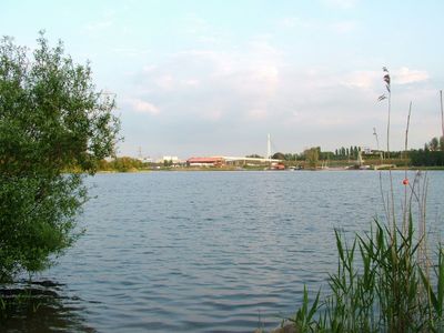
Sale Water Park, Public park in Greater Manchester, England
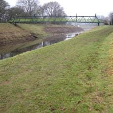
Sale Water Park is a recreational site featuring a central lake, walking paths, and open green spaces positioned alongside the River Mersey. The grounds include dedicated areas for cycling, fishing, and observing water birds throughout the park.
The park was created in 1979 when a former industrial site was transformed into a public recreational space for the Manchester area. This project was part of a broader effort to repurpose abandoned factory and industrial land across the region.
Locals use the park to walk, jog, and spend time with family throughout the week and weekends. You will see people stopping at benches by the water, cycling on the paths, and children playing near open grassy areas.
The site is readily accessible by public transportation and has parking areas with clear signage throughout the grounds. The paths are flat and walkable for most visitors, though some sections may become muddy after rain.
The park features dedicated bird-watching platforms and marked fishing spots around the lake that set it apart from other green spaces in the region. These zones were established to encourage visitors to observe the local wildlife and natural features of the site.
The community of curious travelers
AroundUs brings together thousands of curated places, local tips, and hidden gems, enriched daily by 60,000 contributors worldwide.