Chest opened
+${chestReward.xp} XP
Explorer
NOUVEAU ×${chestReward.collectible.quantity}
tapez pour fermer
Chest locked

Open chests in the app

Around Us is built for your phone — chests unlock when you walk, explore and capture nearby places.

Enable Location

We need your location to show you interesting places around you

Discover nearby places

Find interesting locations and hidden gems around you

Precise directions

Get accurate directions and distances to places

Your location is never shared with other users. It's only used when you tap the location button.

Log in to your account

Start exploring — it's free

Trusted by 72,920 travelers worldwide

Continue with Google
Continue with Apple
or

We will send you a code to connect

By continuing, you accept our Terms and Conditions and our Privacy Policy

Check your inbox

We've sent a pincode in your inbox. Please enter the code below.

Staincliffe Wapentake
Discussion Reviews Photo
1.7k Popularity

Staincliffe Wapentake, Medieval administrative division in West Riding of Yorkshire, England

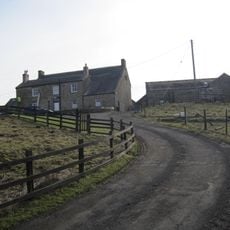
Staincliffe Wapentake was a medieval administrative division in West Yorkshire that covered a large territory spanning numerous parishes. The region was split into two main sections, each comprising different settlements and local communities within the Yorkshire landscape.

This administrative division emerged as part of Yorkshire's medieval governance system and developed over centuries. In the 12th century, the assembly meetings relocated from their original location to the settlement of Flasby.

The region incorporated numerous townships within its boundaries, each maintaining distinct local governance systems and community structures throughout medieval times.

The original administrative center changed location during medieval times, moving to Flasby. Today's visitors can explore the historic landscape to understand how this medieval division shaped the Yorkshire region.

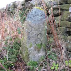
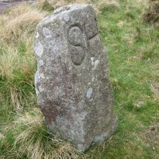
The name Staincliffe comes from a lost settlement at Bank Newton, which is often confused with a similarly named place near Dewsbury. This distinction matters when researching the area's local heritage.

The community of curious travelers

AroundUs brings together thousands of curated places, local tips, and hidden gems, enriched daily by 60,000 contributors worldwide.

Start exploring
GPS coordinates
54.92200,-2.04200
Latest update
December 14, 2025 13:06
Around this place
Dilston Castle
United Kingdom

Dilston Castle

4.7 km
Church of St John
United Kingdom

Church of St John

4 km
Church of St Mary
United Kingdom

Church of St Mary

838 m
Church of St James
United Kingdom

Church of St James

5.2 km
Wellington Inn
United Kingdom

Wellington Inn

5.3 km
Dilston Chapel
United Kingdom

Dilston Chapel

4.7 km
Corbridge War Memorial
United Kingdom

Corbridge War Memorial

5.4 km
Earls Bridge Over Devils Water, 150 Metres North-West Of Dilston Hall
United Kingdom

Earls Bridge Over Devils Water, 150 Metres North-West Of Dilston Hall

4.7 km
East Portal Of Farnley Scar Tunnel
United Kingdom

East Portal Of Farnley Scar Tunnel

5.3 km
Boundary Stone At Ngr Ny 97255421
United Kingdom

Boundary Stone At Ngr Ny 97255421

4.4 km
Footbridge at Riding Mill railway station
United Kingdom

Footbridge at Riding Mill railway station

5.4 km
Mile Post On East Side Of Road At Ngr Ny 94615988
United Kingdom

Mile Post On East Side Of Road At Ngr Ny 94615988

3.1 km
Boundary Stone At Ngr Ny 93945483, Outside Fence Corner
United Kingdom

Boundary Stone At Ngr Ny 93945483, Outside Fence Corner

5.1 km
Boundary Stone At Ngr Ny 94045475
United Kingdom

Boundary Stone At Ngr Ny 94045475

5.1 km
Dotland Park Farmhouse
United Kingdom

Dotland Park Farmhouse

4.6 km
The Manor House And Wall Attached To Rear
United Kingdom

The Manor House And Wall Attached To Rear

5.1 km
Boundary Stone At Ngr Ny 98635454
United Kingdom

Boundary Stone At Ngr Ny 98635454

4.2 km
Boundary Stone On South Side Of Road At Ngr Ny 99315478
United Kingdom

Boundary Stone On South Side Of Road At Ngr Ny 99315478

4.2 km
West Portal Of Farnley Scar Tunnel
United Kingdom

West Portal Of Farnley Scar Tunnel

5.3 km
Boundary Stone At Ngr Ny 97305443
United Kingdom

Boundary Stone At Ngr Ny 97305443

4.2 km
Boundary Stone At Ngr Ny 94125463, On West Of Fence
United Kingdom

Boundary Stone At Ngr Ny 94125463, On West Of Fence

5.1 km
The Hare Stone
United Kingdom

The Hare Stone

3.9 km
Boundary Stone At Ngr Ny 94165455, On West Of Fence
United Kingdom

Boundary Stone At Ngr Ny 94165455, On West Of Fence

5.2 km
Boundary Stone At Ngr Ny 94305430
United Kingdom

Boundary Stone At Ngr Ny 94305430

5.3 km
Boundary Stone At Ngr Ny 97365466
United Kingdom

Boundary Stone At Ngr Ny 97365466

3.9 km
Donald's Grave, On South Side Of Road 10 Metres East Of Track To Slaley Hall
United Kingdom

Donald's Grave, On South Side Of Road 10 Metres East Of Track To Slaley Hall

4.5 km
Old Mill 30 Metres South West Of Linnels Bridge
United Kingdom

Old Mill 30 Metres South West Of Linnels Bridge

3.6 km
Boundary Stone At Ngr Ny 94005482
United Kingdom

Boundary Stone At Ngr Ny 94005482

5.1 km
Show the full map
Reviews
Share your experience

No review yet

Discussions
Start a discussion...

No discussion yet

« Staincliffe Wapentake - Medieval administrative division in West Riding of Yorkshire, England » is provided by Around Us (aroundus.com). Images and texts are derived from Wikimedia project under a Creative Commons license. You are allowed to copy, distribute, and modify copies of this page, under the conditions set by the license, as long as this note is clearly visible.

Discover hidden gems everywhere you go!

From secret cafés to breathtaking viewpoints, skip the crowded tourist spots and find places that match your style. Our app makes it easy with voice search, smart filtering, route optimization, and insider tips from travelers worldwide. Download now for the complete mobile experience.

Around Us App Screenshot

A unique approach to discovering new places

Le Figaro

All the places worth exploring

France Info

A tailor-made excursion in just a few clicks

20 Minutes

Around Us
Travel Guide & Maps
Download

Send to your phone

QR Code
1

Open the camera app on your mobile.

2

Point at the QR code with your camera. A notification will appear.

3

Tap the notification to open the link.