Stockers Lake, Nature reserve in Rickmansworth, United Kingdom.
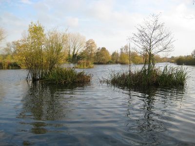
Stockers Lake is a nature reserve in Rickmansworth featuring several islands formed by gravel ridges. These islands provide protected spaces for local and migratory birds throughout the year.
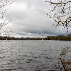
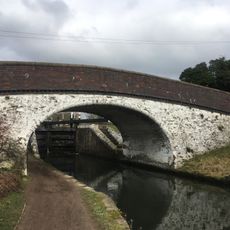
The lake formed during the 1920s and 1930s from gravel extraction, with material used in building Wembley Stadium. This industrial past transformed into an important habitat for wildlife.
Local conservation groups actively manage the site and regularly involve visitors in wildlife monitoring activities. The community plays an important role in protecting this bird habitat for both local and visiting species.
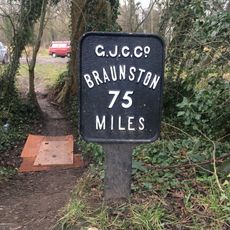
Access the site through unpaved paths starting from the Aquadrome car park, where three bird observation hides and a heron viewpoint await. Wear appropriate footwear as paths can be muddy or uneven depending on weather.
The site hosts Hertfordshire's largest heronry, with up to 20 nests in trees on the water islands where breeding herons and little egrets nest. This concentration of nesting birds is remarkable for the region.
GPS coordinates: 51.63000,-0.48800
Latest update: December 14, 2025 17:44
Rickmansworth Aquadrome
742 m
Church of St Peter
828 m
Church of St Mary, Rickmansworth
1.6 km
25 and 27, Church Street
1.6 km
99, Church Street
1.6 km
29 and 31, Church Street
1.6 km
The Fox And Hounds Public House
1.4 km
Wilson Monument Immediately North Of Chancel Of Church Of St Mary
1.6 km
The Feathers Public House
1.6 km
London Coal Duty Marker On Towing Path About 10 Metres South East Of Stocker's House
446 m
London Coal Duty Marker On Footpath On County Boundary About 880 Metres North West Of Wellington Grove (Not Listed)
761 m
Mile Post On Towing Path About 600 Metres North East Of Stocker's Lock
1 km
London Coal Duty Marker On County Boundary On Towing Path About 620 Metres South West Of Stocker's Lock (Q.V.)
232 m
Bridge Number 175 At Stocker's Lock
455 m
The Priory
1.6 km
The Chequers Restaurant
1.6 km
The Old Vicarage
1.6 km
Stockers Lock House
462 m
Stockers House
435 m
The Whip And Collar Public House
557 m
Pair Of Chest Tombs With Fluted Corner Piers About 10 Metres North Of Church Of St Mary
1.6 km
Barn And Cart Shed About 35 Metres North North West Of Stocker's Farm House
453 m
72, 72A And 72B, High Street
1.6 km
21 And 25, Harefield Road
1.4 km
Barn About 25 Metres North West Of Stocker's Farm House
443 m
142 And 144, High Street
1.5 km
The Bury
1.5 km
Stockers Lock Number 82
470 mVisited this place? Tap the stars to rate it and share your experience / photos with the community! Try now! You can cancel it anytime.
Discover hidden gems everywhere you go!
From secret cafés to breathtaking viewpoints, skip the crowded tourist spots and find places that match your style. Our app makes it easy with voice search, smart filtering, route optimization, and insider tips from travelers worldwide. Download now for the complete mobile experience.
A unique approach to discovering new places❞
— Le Figaro
All the places worth exploring❞
— France Info
A tailor-made excursion in just a few clicks❞
— 20 Minutes