Enable Location

We need your location to show you interesting places around you

Discover nearby places

Find interesting locations and hidden gems around you

Precise directions

Get accurate directions and distances to places

Your location is never shared with other users. It's only used when you tap the location button.

Sunny Hill Park

Log in to your account

Start exploring — it's free

Trusted by 63,013 travelers worldwide

Continue with Google
Continue with Apple
or

We will send you a code to connect

By continuing, you accept our Terms and Conditions and our Privacy Policy

Check your inbox

We've sent a pincode in your inbox. Please enter the code below.

Sunny Hill Park
Discussion Reviews 1 Photos
3.7k Popularity

Sunny Hill Park, Public park in Hendon, London Borough of Barnet, England

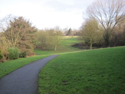
Sunny Hill Park is a public park covering 22 hectares in Hendon, with rolling hills offering views north and west across the London metropolitan area. The grounds include tennis courts, basketball facilities, football pitches, three age-specific playgrounds, and a cafe.

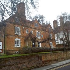
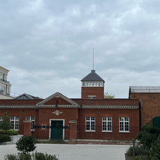
The land was originally known as Sunnyhill Fields and belonged to Church Farmhouse until Hendon Council purchased it in 1921. The council acquired 16 acres to establish what is now the park.

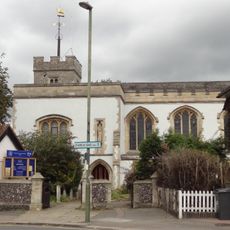
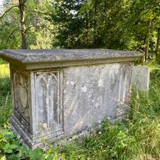
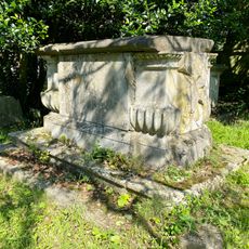
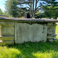
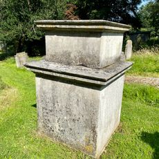
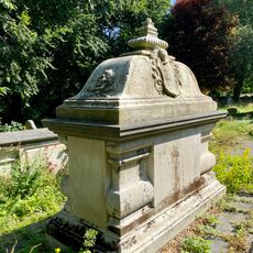
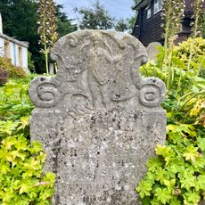
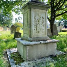
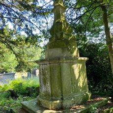
A section of St Mary's Churchyard sits within the grounds, containing archaeological remains from Roman and Anglo-Saxon times in the southeastern corner. These remnants tell the story of settlements that once existed here.

The park spreads across a large area, so it helps to explore the different zones ahead of time to plan your visit. The hills involve some walking effort, but reward you with good views from the higher points.

Original hedgerows marking where historical field boundaries once ran can still be found threading through the park. Together with mature trees, these features preserve the site's agricultural past.

The community of curious travelers

AroundUs brings together thousands of curated places, local tips, and hidden gems, enriched daily by 60,000 contributors worldwide.

Start exploring
GPS coordinates
51.59700,-0.23000
Latest update
December 11, 2025 18:11
Around this place
RAF Museum London
United Kingdom

RAF Museum London

631 m
St Mary's Church, Hendon
United Kingdom

St Mary's Church, Hendon

674 m
Hendon Town Hall
United Kingdom

Hendon Town Hall

974 m
Church Farmhouse Museum
United Kingdom

Church Farmhouse Museum

647 m
Hendon Library
United Kingdom

Hendon Library

935 m
Milestone (London 7) On Wall Of Number 161 Brent Street Between Church Road And Lodge Road
United Kingdom

Milestone (London 7) On Wall Of Number 161 Brent Street Between Church Road And Lodge Road

1 km
Mausoleum Of Philip Rundell In St Marys Churchyard
United Kingdom

Mausoleum Of Philip Rundell In St Marys Churchyard

624 m
Hendon Fire Station
United Kingdom

Hendon Fire Station

908 m
Burroughs House
United Kingdom

Burroughs House

1.2 km
Ivey House
United Kingdom

Ivey House

1.2 km
Daniel Almshouses
United Kingdom

Daniel Almshouses

830 m
Tomb Of Sir Joseph Ayloffe In St Marys Churchyard
United Kingdom

Tomb Of Sir Joseph Ayloffe In St Marys Churchyard

605 m
Unidentified Chest Tomb 15 Metres South East Of Church In St Marys Churchyard
United Kingdom

Unidentified Chest Tomb 15 Metres South East Of Church In St Marys Churchyard

652 m
44-52, The Burroughs Nw4
United Kingdom

44-52, The Burroughs Nw4

1.1 km
9 And 11, The Burroughs Nw4
United Kingdom

9 And 11, The Burroughs Nw4

1.2 km
Model Farm, The Milking Parlour
United Kingdom

Model Farm, The Milking Parlour

677 m
Montfort House
United Kingdom

Montfort House

871 m
Tomb Of Conquest Jones In St Marys Churchyard
United Kingdom

Tomb Of Conquest Jones In St Marys Churchyard

614 m
White House
United Kingdom

White House

604 m
Tomb Of Henry Joynes In St Marys Churchyard
United Kingdom

Tomb Of Henry Joynes In St Marys Churchyard

620 m
15, The Burroughs Nw4
United Kingdom

15, The Burroughs Nw4

1.2 km
Former Control Tower, Watch Office, Aircraft Factory And Factory Office Block At Hendon Aerodrome
United Kingdom

Former Control Tower, Watch Office, Aircraft Factory And Factory Office Block At Hendon Aerodrome

594 m
Tomb Of Susannah Frye In St Marys Churchyard
United Kingdom

Tomb Of Susannah Frye In St Marys Churchyard

611 m
Headstone Of Thomas Thatcher In St Marys Churchyard
United Kingdom

Headstone Of Thomas Thatcher In St Marys Churchyard

649 m
Tomb Of John Jones In St Marys Churchyard
United Kingdom

Tomb Of John Jones In St Marys Churchyard

610 m
Tomb Of John Haley In St Marys Churchyard
United Kingdom

Tomb Of John Haley In St Marys Churchyard

644 m
47 And 55, The Burroughs Nw4
United Kingdom

47 And 55, The Burroughs Nw4

1.1 km
Police Box In Cottenham Drive, Peel Centre
United Kingdom

Police Box In Cottenham Drive, Peel Centre

1.1 km
Show the full map
Reviews
Share your experience

No review yet

Discussions
Start a discussion...

No discussion yet

« Sunny Hill Park - Public park in Hendon, London Borough of Barnet, England » is provided by Around Us (aroundus.com). Images and texts are derived from Wikimedia project under a Creative Commons license. You are allowed to copy, distribute, and modify copies of this page, under the conditions set by the license, as long as this note is clearly visible.

Discover hidden gems everywhere you go!

From secret cafés to breathtaking viewpoints, skip the crowded tourist spots and find places that match your style. Our app makes it easy with voice search, smart filtering, route optimization, and insider tips from travelers worldwide. Download now for the complete mobile experience.

Around Us App Screenshot

A unique approach to discovering new places

Le Figaro

All the places worth exploring

France Info

A tailor-made excursion in just a few clicks

20 Minutes

Around Us
Travel Guide & Maps
Download

Send to your phone

QR Code
1

Open the camera app on your mobile.

2

Point at the QR code with your camera. A notification will appear.

3

Tap the notification to open the link.