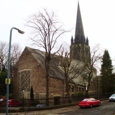
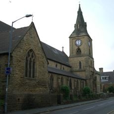
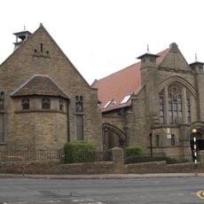
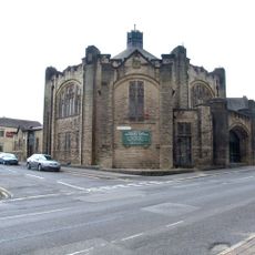
St. Thomas' Church, Crookes, Anglican church in Crookes, Sheffield, England
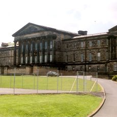
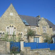
St. Thomas' Church is an Anglican church building in Crookes featuring Gothic revival architecture with a square tower and ornate pointed arch windows. The structure includes a spire at its south-western corner and connects to adjacent extensions that serve community functions.
Construction began in 1852 under architects Flockton & Son and the building received consecration in 1854. The structure later served different purposes across the decades before becoming a shared religious space for multiple denominations.
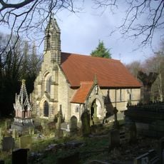
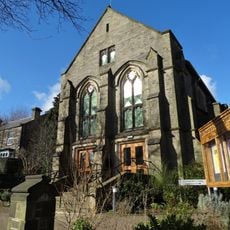
The church represents an ecumenical community where Anglican and Baptist traditions have shared the same space and congregation since 1982. Visitors can sense how this partnership shapes the worship and activities held within its walls today.
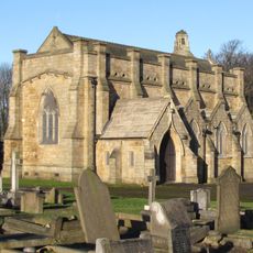
The building is actively used and features various spaces for visitors to explore, with several areas adapted for different community functions. It is advisable to check ahead about access to specific areas, as they may be in use during your visit.
The building underwent significant restoration in 1995 and was repurposed as a training center, extending its role beyond traditional worship. This transformation demonstrates how historic structures adapt to serve evolving community needs.
Location: Sheffield
GPS coordinates: 53.38257,-1.50748
Latest update: December 14, 2025 09:47
Weston Park
1.1 km
Thornbury Hospital
1.1 km
Tapton Hall
899 m
Weston Park Museum
1 km
The Mount, Sheffield
859 m
York and Lancaster Regiment War Memorial
1.1 km
Church of St Mark, Broomhill, Sheffield
986 m
Mappin Art Gallery
1 km
Church of St Mary
1.1 km
St Michaels Cemetery Chapel
1.2 km
Statue of Ebenezer Elliott
1.2 km
Cemetery Chapel At Crookes Cemetery
712 m
King Edward VII Upper School
1.1 km
Memorial To Godfrey Sykes 80 Metres North East Of Mappin Art Gallery
1.1 km
Walsh Monument And Railing At Rivelin Glen Cemetery
1.2 km
Caretakers House And Boundary Wall Crookesmoor Vestry Hall
1.2 km
Hale Court And Attached Wall And Railings
676 m
St Timothy's Church
669 m
61-67, Clarkehouse Road
1.2 km
Bandstand 60 Metres North East Of Mappin Art Gallery
1.1 km
Wesley Hall
63 m
Sewer Gas Lamp Opposite Junction With Glebe Road
285 m
York And Lancaster Regiment Boer War Memorial
1.1 km
Sewer Gas Lamp At Junction Of Ashdell And Westbourne Road
917 m
Sewer Gas Lamp At Junction Wuith Stannington View Road
483 m
Numbers 4-20 And 20A And Steps Walls And Railings
1.2 km
Boundary Wall And Gate To Number 8
1.1 km
Milestone, Manchester Road, opp Crosspool Tavern
867 mVisited this place? Tap the stars to rate it and share your experience / photos with the community! Try now! You can cancel it anytime.
Discover hidden gems everywhere you go!
From secret cafés to breathtaking viewpoints, skip the crowded tourist spots and find places that match your style. Our app makes it easy with voice search, smart filtering, route optimization, and insider tips from travelers worldwide. Download now for the complete mobile experience.
A unique approach to discovering new places❞
— Le Figaro
All the places worth exploring❞
— France Info
A tailor-made excursion in just a few clicks❞
— 20 Minutes