Thornbury Hospital, Private healthcare facility in Sheffield, England
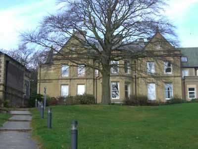
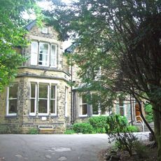
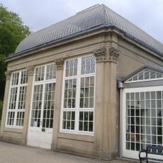
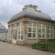
Thornbury Hospital is a private medical facility housed in a stone building featuring curved bay windows and Classical architectural details, with a steep pitched roof crowned by tall chimneys and gables. The center provides 77 private patient rooms with ensuite bathrooms, 21 consulting spaces, and four operating theaters designed to accommodate various surgical procedures.
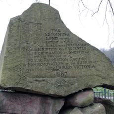
The building originated in 1865 as a private residence built for Frederick Mappin, a Sheffield cutlery magnate. Following the end of World War II, the property was converted into a National Health Service facility in 1947.
The facility holds an important place within Sheffield's network of specialist care providers and is known throughout the medical community for its focused approach to patient treatment. Local physicians often refer their patients here for specific procedures and services.
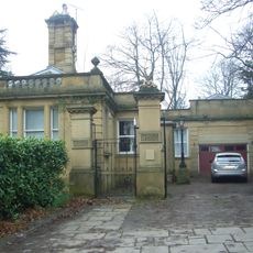
The site is accessed through a sweeping driveway from Fulwood Road and sits within grounds spanning approximately six acres of landscaped grounds. Visitors should keep in mind that this is an active medical facility with specific access policies and operational hours.
The expansive grounds were designed by Robert Marnock, a notable landscape architect, giving the medical complex a park-like character that many visitors overlook. This historical landscaping provides a calming backdrop rarely mentioned in descriptions of the facility.
Location: Sheffield
Inception: 1947
Website: https://bmihealthcare.co.uk/hospitals/bmi-thornbury-hospital
GPS coordinates: 53.37430,-1.51741
Latest update: December 11, 2025 18:08
Endcliffe Hall
374 m
Sandygate Road
946 m
Endcliffe Park
885 m
Shepherd Wheel
1.2 km
Tapton Hall
233 m
Riverdale House
565 m
The Mount, Sheffield
1.3 km
St John's Church, Ranmoor
324 m
St. Thomas' Church, Crookes
1.1 km
The Towers
1.2 km
Statue of Queen Victoria
1.2 km
Jubilee Monument And Railing In Centre Of Endcliffe Park
1.1 km
Cemetery Chapel At Crookes Cemetery
935 m
Storth Oaks And Adjoining Stable Range And Gateway
923 m
Pavilion And Lodge At East Entrance To Park
1.2 km
The Lodge to Towers
1.1 km
Bear Pit Near South Side Of Botanical Gardens
1.2 km
Jubilee Obelisk At South West End Of Park
892 m
Lodge To Riverdale House
485 m
Sewer Gas Lamp At Junction Of Ashdell And Westbourne Road
1.1 km
Left Hand Glasshouse On North West Side Of Botanical Gardens
1.2 km
Wesley Hall
1.2 km
Central Glasshouse On North West Side Of Botanical Gardens
1.2 km
Hunters Bar Toll Gate
1.3 km
Gateway To Botanical Gardens With Lodges Screen Wall And Railings
1.3 km
Right hand glasshouse on north-west side of Botanical Gardens
1.3 km
Sewer Gas Lamp At Junction Wuith Stannington View Road
1.1 km
Milestone, Manchester Road, opp Crosspool Tavern
629 mVisited this place? Tap the stars to rate it and share your experience / photos with the community! Try now! You can cancel it anytime.
Discover hidden gems everywhere you go!
From secret cafés to breathtaking viewpoints, skip the crowded tourist spots and find places that match your style. Our app makes it easy with voice search, smart filtering, route optimization, and insider tips from travelers worldwide. Download now for the complete mobile experience.
A unique approach to discovering new places❞
— Le Figaro
All the places worth exploring❞
— France Info
A tailor-made excursion in just a few clicks❞
— 20 Minutes