Enable Location

We need your location to show you interesting places around you

Discover nearby places

Find interesting locations and hidden gems around you

Precise directions

Get accurate directions and distances to places

Your location is never shared with other users. It's only used when you tap the location button.

Endcliffe Park

Log in to your account

Start exploring — it's free

Trusted by 61,908 travelers worldwide

Continue with Google
Continue with Apple
or

We will send you a code to connect

By continuing, you accept our Terms and Conditions and our Privacy Policy

Check your inbox

We've sent a pincode in your inbox. Please enter the code below.

Endcliffe Park

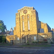
Endcliffe Park, Public park in Sheffield, United Kingdom

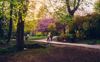
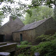
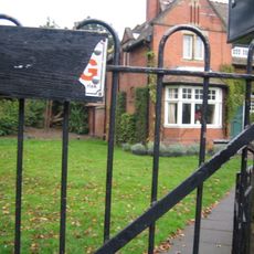
Endcliffe Park is a public green space in Sheffield that combines open grassland with wooded sections running alongside the Porter Brook. The grounds feature riverside walking paths, small water areas with waterfowl, and clearings where people can sit or move freely.

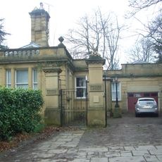
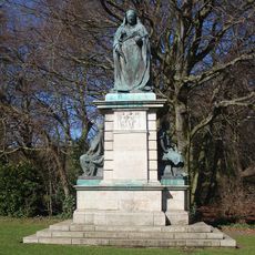
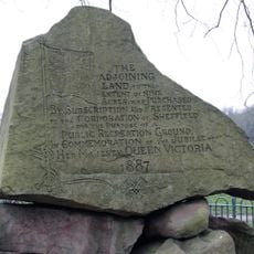
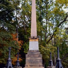
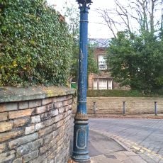
The site gained two Victorian monuments that were moved here from Sheffield city center, dating back to the 1800s. These stone structures now stand within the park as reminders of the city's past.

A memorial garden here marks where an American military aircraft crashed in 1944, with ten crew members commemorated in this dedicated space. Visitors can reflect on this shared history and see how the community honors those who lost their lives.

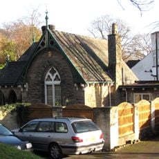
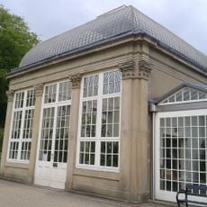
The grounds offer a children's play area, sports fields, and a cafe for refreshment spread throughout different sections. Visitors can move between wooded trails and open spaces depending on what they want to do.

This location marks the starting point of a chain of connected green spaces that extends from Sheffield toward the Peak District National Park. The system links the city with natural areas and hills further south in an unbroken line of open land.

The community of curious travelers

AroundUs brings together thousands of curated places, local tips, and hidden gems, enriched daily by 60,000 contributors worldwide.

Start exploring
Location
Operator
Sheffield City Council
GPS coordinates
53.36838,-1.50851
Latest update
December 8, 2025 19:57
Around this place
Endcliffe Hall
United Kingdom

Endcliffe Hall

513 m
Sheffield Botanical Gardens
United Kingdom

Sheffield Botanical Gardens

803 m
Sheffield Botanical Gardens
United Kingdom

Sheffield Botanical Gardens

863 m
Thornbury Hospital
United Kingdom

Thornbury Hospital

885 m
Shepherd Wheel
United Kingdom

Shepherd Wheel

1.1 km
Tapton Hall
United Kingdom

Tapton Hall

959 m
Riverdale House
United Kingdom

Riverdale House

801 m
Banner Cross Hall
United Kingdom

Banner Cross Hall

1.2 km
The Mount, Sheffield
United Kingdom

The Mount, Sheffield

1.1 km
St John's Church, Ranmoor
United Kingdom

St John's Church, Ranmoor

948 m
Sharrow Mills
United Kingdom

Sharrow Mills

1 km
Wilson Road Synagogue
United Kingdom

Wilson Road Synagogue

659 m
Banner Cross Methodist Church
United Kingdom

Banner Cross Methodist Church

911 m
Statue of Queen Victoria
United Kingdom

Statue of Queen Victoria

344 m
Jubilee Monument And Railing In Centre Of Endcliffe Park
United Kingdom

Jubilee Monument And Railing In Centre Of Endcliffe Park

205 m
Bear Pit Near South Side Of Botanical Gardens
United Kingdom

Bear Pit Near South Side Of Botanical Gardens

704 m
Pavilion And Lodge At East Entrance To Park
United Kingdom

Pavilion And Lodge At East Entrance To Park

358 m
Lodge To Riverdale House
United Kingdom

Lodge To Riverdale House

724 m
Jubilee Obelisk At South West End Of Park
United Kingdom

Jubilee Obelisk At South West End Of Park

105 m
Gateway To Botanical Gardens With Lodges Screen Wall And Railings
United Kingdom

Gateway To Botanical Gardens With Lodges Screen Wall And Railings

874 m
Sewer Gas Lamp At Junction Of Ashdell And Westbourne Road
United Kingdom

Sewer Gas Lamp At Junction Of Ashdell And Westbourne Road

878 m
Left Hand Glasshouse On North West Side Of Botanical Gardens
United Kingdom

Left Hand Glasshouse On North West Side Of Botanical Gardens

758 m
Hunters Bar Toll Gate
United Kingdom

Hunters Bar Toll Gate

428 m
61-67, Clarkehouse Road
United Kingdom

61-67, Clarkehouse Road

1.1 km
Sewer Gas Destructor Lamp
United Kingdom

Sewer Gas Destructor Lamp

761 m
Right hand glasshouse on north-west side of Botanical Gardens
United Kingdom

Right hand glasshouse on north-west side of Botanical Gardens

837 m
Central Glasshouse On North West Side Of Botanical Gardens
United Kingdom

Central Glasshouse On North West Side Of Botanical Gardens

794 m
Boundary Wall And Gate To Number 8
United Kingdom

Boundary Wall And Gate To Number 8

991 m
Show the full map
« Endcliffe Park - Public park in Sheffield, United Kingdom » is provided by Around Us (aroundus.com). Images and texts are derived from Wikimedia project under a Creative Commons license. You are allowed to copy, distribute, and modify copies of this page, under the conditions set by the license, as long as this note is clearly visible.

Discover hidden gems everywhere you go!

From secret cafés to breathtaking viewpoints, skip the crowded tourist spots and find places that match your style. Our app makes it easy with voice search, smart filtering, route optimization, and insider tips from travelers worldwide. Download now for the complete mobile experience.

Around Us App Screenshot

A unique approach to discovering new places

Le Figaro

All the places worth exploring

France Info

A tailor-made excursion in just a few clicks

20 Minutes

Around Us
Travel Guide & Maps
Download

Send to your phone

QR Code
1

Open the camera app on your mobile.

2

Point at the QR code with your camera. A notification will appear.

3

Tap the notification to open the link.