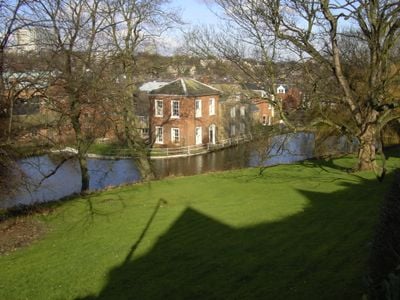
Sharrow Mills, Historic mill building in Sharrow Vale, Sheffield, England
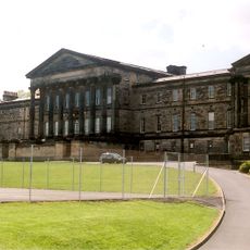
Sharrow Mills is an industrial complex featuring seven listed structures arranged around a central courtyard with a prominent brick manager's house at its center. The layout demonstrates how different production areas were organized around this shared space to support the facility's operations.
The site began in 1581 as a cutlers wheel owned by the Duke of Norfolk, serving blade makers for over 150 years. In 1737, Thomas Wilson started renting the mill and initiated the family's long involvement with the operation.
The mill reflects Sheffield's shift from blade shear production to snuff manufacturing under the Wilson family's direction. Visitors can see the spaces where this change in production took place.
The complex remains partially operational with some areas open to visitors while others continue active production. It is best to wear sturdy footwear as the floors can be uneven and some spaces remain in active use.
A devastating fire in 1757 led to a nationwide fundraising campaign to rebuild the mill, reflecting its economic importance at the time. This reconstruction effort shows how crucial the site was to the nation's industrial economy.
Location: Sheffield
GPS coordinates: 53.36850,-1.49287
Latest update: December 14, 2025 11:05
Sheffield General Cemetery
383 m
Sheffield Botanical Gardens
515 m
Sheffield Botanical Gardens
541 m
Broom Hall
762 m
Wilson Road Synagogue
412 m
Statue of Queen Victoria
706 m
Monument To Mark Firth 60 Metres East Of New Chapel At General Cemetery
349 m
Jubilee Monument And Railing In Centre Of Endcliffe Park
840 m
20, Broomhall Road
617 m
Old Chapel at General Cemetery
302 m
King Edward VII Upper School
880 m
James Nicholson Memorial In General Cemetery
343 m
Monument To William Parker 40 Metres South West Of Old Chapel At General Cemetery
252 m
Pavilion And Lodge At East Entrance To Park
709 m
Bear Pit Near South Side Of Botanical Gardens
555 m
Gateway To Botanical Gardens With Lodges Screen Wall And Railings
630 m
Hunters Bar Toll Gate
632 m
61-67, Clarkehouse Road
720 m
Sewer Gas Lamp at Junction with Frog Walk
293 m
Sewer Gas Destructor Lamp
409 m
New Chapel At General Cemetery
437 m
Left Hand Glasshouse On North West Side Of Botanical Gardens
595 m
Central Glasshouse On North West Side Of Botanical Gardens
606 m
Right hand glasshouse on north-west side of Botanical Gardens
619 m
Sewer Gas Lamp 25 Metres South East Of Junction With Antrim Avenue
814 m
Boundary Wall And Gate To Number 8
759 m
Main Gateway And Lodges To General Cemetery
183 m
Gateway To General Cemetery With Screen And Flanking Walls
381 mVisited this place? Tap the stars to rate it and share your experience / photos with the community! Try now! You can cancel it anytime.
Discover hidden gems everywhere you go!
From secret cafés to breathtaking viewpoints, skip the crowded tourist spots and find places that match your style. Our app makes it easy with voice search, smart filtering, route optimization, and insider tips from travelers worldwide. Download now for the complete mobile experience.
A unique approach to discovering new places❞
— Le Figaro
All the places worth exploring❞
— France Info
A tailor-made excursion in just a few clicks❞
— 20 Minutes