Sheffield General Cemetery, Victorian cemetery in Sharrow, England
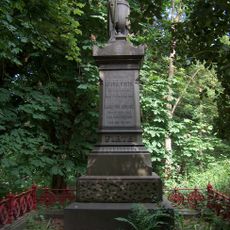
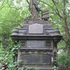
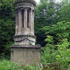
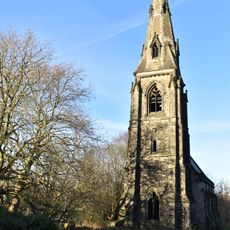
Sheffield General Cemetery is a six-hectare burial ground featuring classical monuments, elaborate tombstones, and tree-lined pathways alongside the Porter Brook. The grounds hold a diverse collection of memorials representing different architectural styles and periods.
The cemetery was established in 1836 to meet burial needs during the Industrial Revolution when Sheffield's population was growing rapidly. It served this purpose until 1978, when new burial practices changed how the city managed its dead.
The grounds contain separate sections for Anglican and Nonconformist burials, each reflecting distinct beliefs through their layout and design choices. Walking through these areas, you notice how the burial grounds mirror the religious divisions that mattered to people of that era.
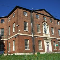
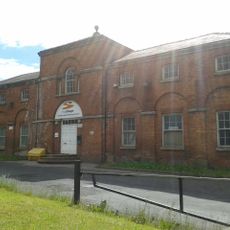
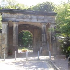
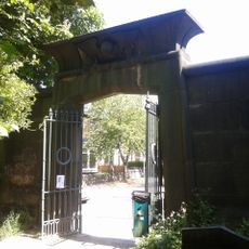
The main entrance through the Gatehouse on Cemetery Avenue provides access to the restored pathways, with additional entry points at Montague Street and Cemetery Road. The grounds are best explored on foot, allowing time to wander through the different sections.
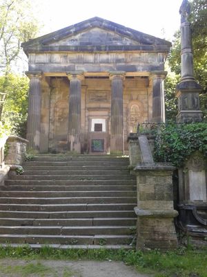
The Samuel Worth Chapel and catacombs display different architectural styles and offer insight into burial practices of the 1800s. The Gatehouse was built directly over Porter Brook, creating a symbolic reference to the mythological river Styx as a passage between worlds.
Location: Sheffield
GPS coordinates: 53.36920,-1.48722
Latest update: December 8, 2025 20:03
Sheffield Botanical Gardens
775 m
Sheffield Botanical Gardens
780 m
Broom Hall
628 m
Velocity Tower
826 m
Moore Street electricity substation
841 m
Mount Pleasant
705 m
Sharrow Mills
383 m
Wilson Road Synagogue
770 m
Church of St Silas
774 m
Monument To Mark Firth 60 Metres East Of New Chapel At General Cemetery
36 m
20, Broomhall Road
541 m
Old Chapel at General Cemetery
99 m
James Nicholson Memorial In General Cemetery
44 m
Monument To William Parker 40 Metres South West Of Old Chapel At General Cemetery
140 m
Bear Pit Near South Side Of Botanical Gardens
852 m
Sewer Gas Lamp at Junction with Frog Walk
235 m
Gateway To Botanical Gardens With Lodges Screen Wall And Railings
851 m
61-67, Clarkehouse Road
841 m
Sewer Gas Lamp at Junction with London Road
740 m
Sewer Gas Destructor Lamp
770 m
New Chapel At General Cemetery
72 m
Former Stables And Coach House At Number 3 Mount Pleasant Community Centre
672 m
Central Glasshouse On North West Side Of Botanical Gardens
861 m
Right hand glasshouse on north-west side of Botanical Gardens
857 m
Sewer Gas Lamp 25 Metres South East Of Junction With Antrim Avenue
813 m
Trustee Savings Bank
799 m
Main Gateway And Lodges To General Cemetery
206 m
Gateway To General Cemetery With Screen And Flanking Walls
100 mVisited this place? Tap the stars to rate it and share your experience / photos with the community! Try now! You can cancel it anytime.
Discover hidden gems everywhere you go!
From secret cafés to breathtaking viewpoints, skip the crowded tourist spots and find places that match your style. Our app makes it easy with voice search, smart filtering, route optimization, and insider tips from travelers worldwide. Download now for the complete mobile experience.
A unique approach to discovering new places❞
— Le Figaro
All the places worth exploring❞
— France Info
A tailor-made excursion in just a few clicks❞
— 20 Minutes