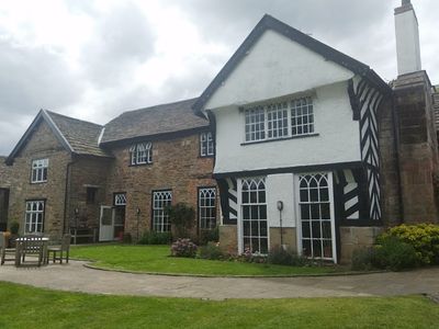
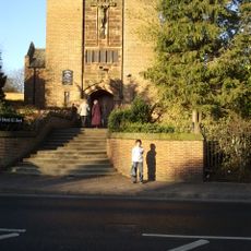
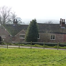
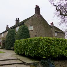
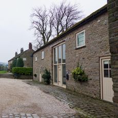
Sutton Hall, Sutton Lane Ends, Grade II listed building and pub in Sutton Lane Ends, England.
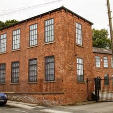
Sutton Hall is an English country house with a U-shaped plan built from stone and timber framing, featuring irregular gables and carved wooden figures on the right wing. The structure combines different architectural styles that developed across several building periods.
The building was constructed in the middle of the 17th century, replacing an earlier manor house on the same site. It belonged to Sir Humphrey Davenport, who served as Chief Baron of the Exchequer, a senior judicial official.
The name 'Sutton' comes from Old English meaning 'southern settlement'. The building contains multiple rooms that visitors move through while exploring how the space has been used and repurposed over time.
The site features seven dining spaces along with gardens and terraces for visitors to explore. Regular events take place here, including live music on certain weekdays and monthly quiz nights organized for guests.
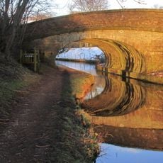
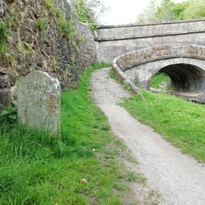
Near the hall stands a Bronze Age burial mound that marks an ancient cremation site. This archaeological feature connects the modern pub with the prehistoric past of the surrounding area.
Location: Sutton
Made from material: wood
Website: https://brunningandprice.co.uk/suttonhall
GPS coordinates: 53.24070,-2.11271
Latest update: December 14, 2025 09:43
St Peter's Church, Macclesfield
1.5 km
St George's Church, Macclesfield
1.6 km
Langley Hall, Cheshire
1.3 km
Macclesfield War Memorial
1.8 km
St Edward The Confessor R C Church
961 m
Park Mill
1.6 km
Canal Bridge No 44 On The Macclesfield Canal
227 m
Gurnett Aqueduct
264 m
Victoria Mills
1.6 km
Lord Byron Public House
1.6 km
Hollins Farm
949 m
Brunswick House
1.6 km
Macclesfield Canal, Bridge Number 43 At Sj 924 719
438 m
Union Mill
1.9 km
Macclesfield Canal, Bridge Number 41 At Richmond Hill
1.3 km
Ridge Hall Farmhouse, Ridge Hill
1.8 km
Barn at Hollins Farm
941 m
Outbuildings at Ridge Hall Farm
1.7 km
Canal Bridge No 45
1 km
Macclesfield Canal, Bridge Number 38
1.7 km
Macclesfield Canal Milestone, South of Bridge Number 43
420 m
Lower Paradise Mill
1.9 km
Albion Mill
1.1 km
Macclesfield Canal, Bridge Number 40 At Windmill Lane
1.3 km
Byrons Mill
1.1 km
Milestone, NW of King's Head, Gurnett
414 m
Milepost, N of Symondley Farm
795 m
Milestone, Moss Lane
877 mVisited this place? Tap the stars to rate it and share your experience / photos with the community! Try now! You can cancel it anytime.
Discover hidden gems everywhere you go!
From secret cafés to breathtaking viewpoints, skip the crowded tourist spots and find places that match your style. Our app makes it easy with voice search, smart filtering, route optimization, and insider tips from travelers worldwide. Download now for the complete mobile experience.
A unique approach to discovering new places❞
— Le Figaro
All the places worth exploring❞
— France Info
A tailor-made excursion in just a few clicks❞
— 20 Minutes