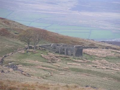
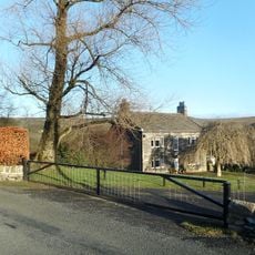
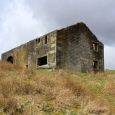
Top Withens, Stone farmhouse ruins in West Yorkshire, England.
Top Withens is a stone farmhouse ruin in the Yorkshire moors, where weathered walls stand against moorland hills in the distance. The remains show the original layout of this building, which sits on an open, exposed plateau high on the moors.
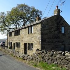
Top Withens dates back to the 17th century and people lived there until the 1920s, when it was abandoned on the Yorkshire moors. The farmhouse reflects centuries of use by farming families before it fell into decay.
Top Withens inspired Emily Brontë when she wrote Wuthering Heights, with the farmhouse shaping how she imagined the Earnshaw family home. The place connects the wild moorland setting to the novel that made it famous.
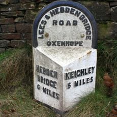
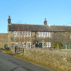
The ruins can be reached by walking about 2.5 miles from Cemetery Road in Haworth, following the marked Bronte Way route. The path climbs through open moorland, so visitors should wear sturdy shoes and dress for changeable weather conditions.
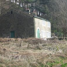
The site sits at a height where powerful winds regularly sweep across the moors, creating distinctive sounds as they move through the stone remains. These wind patterns shaped Brontë's choice of location and give visitors a sense of the raw conditions that inspired her writing.
Location: England
GPS coordinates: 53.81480,-2.02979
Latest update: December 7, 2025 20:20
Brontë Parsonage Museum
5.1 km
Ponden Hall
1.9 km
Brontë Waterfall
1.8 km
Old Silent Inn
2.7 km
Herders Inn
5.1 km
Church of St Mary the Virgin
4.9 km
St Gabriel's Church
3.2 km
Bridge at Blake Dean over Graining Water
4.7 km
Bay Horse Public House
5.1 km
Haworth Library
5.1 km
Long Bridge, Haworth
4.5 km
Lumb Foot Packhorse Bridge
4 km
Hanging Stone or Watersheddles Cross
3.1 km
Bridge at Holme Ends over Alcomden Water
4.1 km
Lumb Bridge
4.1 km
Wheat Ing Bridge
5 km
Bronte Footbridge
1.7 km
High Greenwood House
4.8 km
Widdop Gate
4.5 km
Milestone On West Corner Of Junction With Hill House Edge Lane
4.8 km
Over Wood Farmhouse and attached barn
4.2 km
Holme Ends Farmhouse and attached barn
4.2 km
Wayside cross known as Abel Cross
4.7 km
New High Laithe Farmhouse and attached barn
4.7 km
Milepost Approximately 100 Metres To East Of Junction With Hill House Edge Lane
4.9 km
Milestone, on Harehills Lane, approx ½ mile W of Oldfield Lane jct
4 km
Watersheddles Reservoir
3 km
Keighley Moor Reservoir
4.1 kmVisited this place? Tap the stars to rate it and share your experience / photos with the community! Try now! You can cancel it anytime.
Discover hidden gems everywhere you go!
From secret cafés to breathtaking viewpoints, skip the crowded tourist spots and find places that match your style. Our app makes it easy with voice search, smart filtering, route optimization, and insider tips from travelers worldwide. Download now for the complete mobile experience.
A unique approach to discovering new places❞
— Le Figaro
All the places worth exploring❞
— France Info
A tailor-made excursion in just a few clicks❞
— 20 Minutes