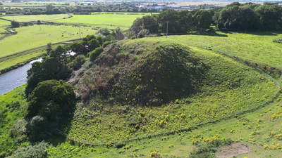
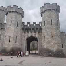
Twthill Castle, Medieval motte-and-bailey castle in Rhuddlan, Wales.
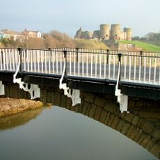
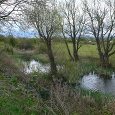
Twthill Castle is a Norman fortress featuring a prominent earthwork mound roughly 12 meters tall and 80 meters across, positioned near the River Clwyd. The site displays the typical motte-and-bailey design with its distinctive raised hill and fortified layout.
Robert of Rhuddlan established this fortress in 1073 under orders from William the Conqueror to secure Norman rule in northern Wales. The site formed part of the systematic invasion and control of Welsh territories by Norman forces.
The site contains remains connected to a Welsh ruler's residence and marks where local authority gave way to incoming conquerors. Walking the grounds reveals how power shifted through the physical layout.
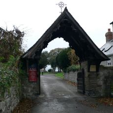
The grounds are accessible year-round and can be reached via a public footpath roughly 400 meters long from Rhuddlan town. The path crosses farmland, so expect uneven surfaces and occasional wet conditions depending on recent weather.
The site once housed a mint that produced coins during the period of the Conqueror. Examples of these early coins are preserved in museum collections today, documenting the economic activity of that era.
Location: Rhuddlan
Website: https://cadw.gov.wales/visit/places-to-visit/twthill-rhuddlan
GPS coordinates: 53.28711,-3.46193
Latest update: December 9, 2025 12:23
Bodelwyddan Castle
3.9 km
Marble Church
3.1 km
St Asaph Cathedral
3.6 km
Bodrhyddan Hall
2.2 km
Dyserth Waterfall
3.4 km
Faenol Fawr
2.9 km
Moel Hiraddug
3.8 km
Our Lady of the Assumption Church, Rhyl
3.9 km
Bodelwyddan Castle and Park
3.9 km
Church Of Saint Mary
650 m
Church of St Bridget, Dyserth
3.4 km
Translators' Memorial
3.6 km
Rhuddlan Bridge
553 m
Pont Dafydd
3.2 km
St Asaph Library
3.3 km
Rhuddlan Chapel
434 m
No 1, (Parliament House), Parliament Street Sw Side
524 m
No 4, (Parliament House) Parliament Street Sw Side
496 m
The Banquet House, Princes Road (Ne Side)
396 m
Clive Engine House, Talargoch Mine
3.8 km
Telephone Call-Box On The Up Platform at Rhyl Railway Station
3.9 km
Bodelwyddan Village Hall (former School)
3.2 km
St Asaph Bridge, High Street
3.6 km
Rhuddlan Nature Reserve
586 m
17, The Village
3.2 km
Lychgate to Churchyard, Church Street (Sw Side)
596 m
Bodelwyddan Vicarage
3.2 km
Tomb Group In St Bridget's Churchyard
3.4 kmVisited this place? Tap the stars to rate it and share your experience / photos with the community! Try now! You can cancel it anytime.
Discover hidden gems everywhere you go!
From secret cafés to breathtaking viewpoints, skip the crowded tourist spots and find places that match your style. Our app makes it easy with voice search, smart filtering, route optimization, and insider tips from travelers worldwide. Download now for the complete mobile experience.
A unique approach to discovering new places❞
— Le Figaro
All the places worth exploring❞
— France Info
A tailor-made excursion in just a few clicks❞
— 20 Minutes